Overview
| DOI | https://doi.org/10.3334/ORNLDAAC/1514 |
|---|---|
| Version | 1 |
| Project | |
| Published | 2017-08-14 |
| Usage | 493 downloads |
Description
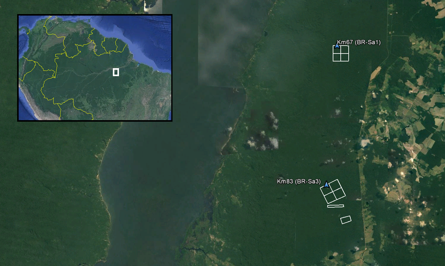
This data set provides LiDAR point clouds and digital terrain models (DTM) from surveys over the Tapajos National Forest in Belterra municipality, Para, Brazil during late June and early July 2008. The surveys encompass the K67 and K83 eddy flux towers and a deforestation chronosequence managed through the Large-Scale Biosphere-Atmosphere Experiment in Amazonia providing long-term flux measurements of carbon dioxide. The LiDAR data was collected to measure forest canopy structure across Amazonian landscapes to monitor the effects of selective logging on forest biomass and carbon balance, and forest recovery over time.
Science Keywords
- LAND SURFACE
- TOPOGRAPHY
- TERRAIN ELEVATION
- DIGITAL ELEVATION/TERRAIN MODEL (DEM)
- SPECTRAL/ENGINEERING
- LIDAR
Data Use and Citation
This dataset is openly shared, without restriction, in accordance with the NASA Earthdata Data Use Guidance.
Data Files
Sign in to download files.
Companion Files
Sign in to download files.
Dataset Companion Files
Dataset has 2 companion files.
- Forested_Areas_Para_Brazil.pdf
- TAP_A_footprints.kmz
Browse Images
Dataset has 1 browse image file.