Get Data
Summary:
This data set provides two data files in text format (.txt). One file contains tri-monthly measurements of above-ground biomass made during the growing season between July 1982 and August 1990 on a dry, cold Eurasian steppe dominated by Stipa grandis at the Tumentsogt Research Station in Mongolia. The second file contains monthly and annual climate data recorded at the study site from 1963 through 1983.
Mongolian steppes occupy a major part of eastern Mongolia and northern China and are characterized climatically by low mean annual rainfall and temperature, with a highly seasonal pattern in both. The beginning of spring rainfall and warming are strongly correlated, and the onset of the growing season rainfall triggers the green-up in the region. Land use is dominated by grazing, historically by nomadic pastoralists and more recently for cooperative livestock production. Privatization of grazing land and cropland conversions have been increasing since 1990. Ecosystem degradation such as deterioration of vegetation (e.g., vegetation removal and replacement) and soil (e.g., erosion) is becoming widespread.
Peak above-ground biomass at Tumentsogt occurs during a short rainy season (June-August). The amount of biomass fluctuates from year-to-year coherently with rainfall variation. Above-ground net primaryp roductivity (ANPP) estimates are relatively low in comparison to other temperate grasslands, ranging from 72 to 160 g/m2/yr.
Revision Notes: Only the documentation for this data set has been modified. The data files have been checked for accuracy and are identical to those originally published in 1996.
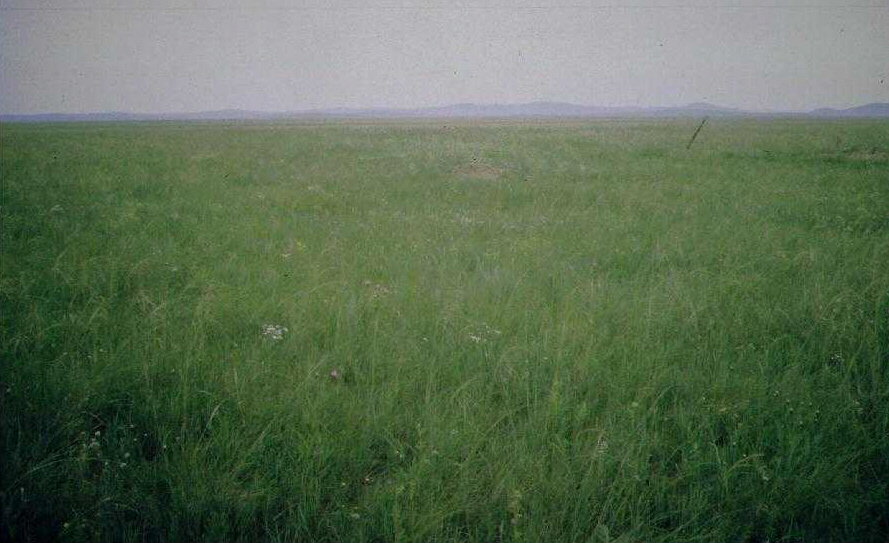
Figure 1. Stipa grandis site at the Tumentsogt Grassland Research Station, Mongolia. Source: Chuluun and Ojima (1999).
Additional Documentation
The Net Primary Productivity (NPP) data collection contains field measurements of biomass, estimated NPP, and climate data for terrestrial grassland, tropical forest, temperate forest, boreal forest, and tundra sites worldwide. Data were compiled from the published literature for intensively studied and well-documented individual field sites and from a number of previously compiled multi-site, multi-biome data sets of georeferenced NPP estimates. The principal compilation effort (Olson et al., 2001) was sponsored by the NASA Terrestrial Ecology Program. For more information, please visit the NPP web site at http://daac.ornl.gov/NPP/npp_home.shtml.
Data Citation:
Cite this data set as follows:
Togtohyn, C., and D. Ojima. 2015. NPP Grassland: Tumentsogt, Mongolia, 1982-1990, R1. Data set. Available on-line [http://daac.ornl.gov] from Oak Ridge National Laboratory Distributed Active Archive Center, Oak Ridge, Tennessee, USA. http://dx.doi.org/10.3334/ORNLDAAC/154
This data set was originally published as:
Togtohyn, C., and D. Ojima. 1996. NPP Grassland: Tumentsogt, Mongolia, 1982-1990. Data set. Available on-line [http://daac.ornl.gov] from Oak Ridge National Laboratory Distributed Active Archive Center, Oak Ridge, Tennessee, U.S.A.
Table of Contents:
- 1 Data Set Overview
- 2 Data Description
- 3 Applications and Derivation
- 4 Quality Assessment
- 5 Acquisition Materials and Methods
- 6 Data Access
- 7 References
1. Data Set Overview:
Project: Net Primary Production (NPP)
The Tumentsogt Research Station study site of the Mongolian Academy of Sciences is located on the Eastern Mongolian Plains (47.4 N 112.5 E) in Sukhbaatar Aimag Province, located 500-km east towards Ulaanbaatar. The Mongolian steppe ecosystem has been described by Dashnyam (1974) and Hilbig (1995), and its soils by Bespalov (1964). The ecology of plants and animals in the Tumentsogt region has been studied by Sheremet'ev and Jargalsaikhan (1990) and Dmitriev et al. (1990).
In Asia, grasslands extend from continental regions west of the Urals to the tropical regions of China and India. One of the most extensive grasslands in the world exists in the Mongolian Plateau steepe region and is a critical resource for meat, milk, leather, wool, and cereal grain production. Historically, nomadic pastoralists in the region utilized this grassland region to graze their mixed herds of sheep, goats, camels, cattle, and horses. Grazing patterns were dictated more by intra- and interannual climate variability than by political or economic factors. However, there have been significant changes in the traditional pastoral systems and in livestock and human population numbers and distribution in the Mongolian Plateau region over the last 50 years. Many aspects of the traditional nomadic culture are being replaced by socialistic practices where herdsmen commonly organize into collectives and are allowed only a small number of animals for private ownership. In addition, human population in the region has risen dramatically during the past several decades. All of these factors has led to increased grazing intensity and rates of cropland conversion and consequently ecosystem degradation such as deterioration of vegetation (e.g., vegetation removal and replacement) and soil (e.g., erosion). Additional obstacles limiting grassland productivity are the dry climate with frequent droughts which suppress the development of grass biomass and possible impacts due to climate change.
Environmental and cultural factors affecting productivity of the Mongolian grasslands have been studied by a few investigators using a combination of field observations, model simulations, and remote sensing (Togtohyn, 1995; Chuluun and Ojima, 1996; 2002; Kogan et al., 2004). Peak above-ground biomass at Tumentsogt occurs during the short rainy season. The seasonal average increases from about 30 g/m2 in May to 140-160 g/m2 in August and declines thereafter (Kogan et al., 2004). The amount of biomass fluctuates from year-to-year coherently with rainfall variation. Estimates of ANPP are relatively low in comparison to other temperate grasslands, ranging from 72 to 160 g/m2/yr. ANPP, below-ground NPP (BNPP), and Total NPP (TNPP) values for Tumentsogt steppe reported by various published data sources.
Table 1. Data Sources
| Source | Units | ANPP | BNPP | TNPP |
|---|---|---|---|---|
| Togtohyn et al. (1995) | g/m2/yr | 160 | na | na |
| Scurlock and Olson (2013) | ||||
| Kogan et al. (2004) | 140 | |||
| Ojima et al. (1998) | gC/m2/yr | 35.3 | ||
| GPPDI Class B Site #1166 (MI 1799) in Olson et al. (2013) | gC/m2/yr | 70 |
Notes: MI = Measurement identification number. na = not available.
2. Data Description:
Spatial Coverage
Site: Tumentsogt, Mongolia
Site Boundaries: (All latitude and longitude given in decimal degrees)
| Site (Region) | Westernmost Longitude | Easternmost Longitude | Northernmost Latitude | Southernmost Latitude | Elevation (m) |
|---|---|---|---|---|---|
| Tumentsogt, Mongolia | 112.5 | 112.5 | 47.4 | 47.4 | 1,100 |
Spatial Resolution
1-ha (2.4 acres) enclosed field with 1-m2 plots (Kogan et al., 2004). Information from other sources not available.
Temporal Coverage
July 1982 to August 1990
Temporal Resolution
Tri-monthly to monthly
Data File Information
Table 2. Data file descriptions
| FILE NAME | TEMPORAL COVERAGE | FILE CONTENTS |
|---|---|---|
| tmn_npp.txt | 1982/07/10-1990/08/30 | Above-ground biomass data for the cold desert steppe at Tumentsogt, Mongolia |
| tmn_cli.txt | 1966/01/01-1983/12/31 | Climate data from a weather station at the Tumentsogt study site |
NPP Data. This data set contains one NPP data file (.txt format). The variable values are delimited by semicolons. The first 18 lines are metadata; data records begin on line 19. There are no missing values. Biomass units are expressed in g/m2 (dry matter weight).
Table 3. Column headings in NPP file.
| COLUMN HEADING | DEFINITION | UNITS |
|---|---|---|
| Site | Site where data were gathered (code refers to site identification) | text |
| Treatmt | Long term management of site (code refers to treatment described in metadata in data file) | |
| Year | Year in which data were collected | yyyy |
| Mn | Month in which data were collected | mm |
| Dy | Day on which data were collected | dd |
| Tyear | Date in decimal year (year plus the Julian date divided by 365) | numeric |
| AGbiomass | Above-ground biomass | g/m2 |
Sample NPP Data Record
| Site;Treatmt;Year;Mn;Dy;Tyear; AGbiomass tmn;lngtrm ;1982;07;30;1982.580; 181.0 tmn;lngtrm ;1982;08;10;1982.610; 151.0 tmn;lngtrm ;1982;08;20;1982.640; 207.0 tmn;lngtrm ;1982;08;30;1982.660; 142.0 ... |
Climate Data. Climate data are provided in one text file (.txt format). The first 18 lines are metadata; data records begin on line 19. The variable values are delimited by semicolons. There are no missing values.
Sample Climate Data Record
| Site;Temp;Parm; Jan; Feb; Mar; Apr; May; Jun; Jul; Aug; Sep; Oct; Nov; Dec; Year tmn;mean;prec; 1.1; 1.2; 2.8; 6.8; 17.6; 50.1; 85.7; 60.2; 27.8; 9.1; 4.0; 2.5; 268.9 tmn;mean;tmax;-11.1; -9.7; 0.5; 10.9; 19.1; 25.3; 27.5; 23.8; 18.0; 9.7; -2.5;-10.1; 27.8 tmn;mean;tmin;-23.5;-22.0;-14.5; -4.1; 3.9; 9.9; 13.1; 10.2; 3.4; -5.5;-14.7;-20.7; -24.4 tmn;numb;prec; 18.0; 18.0; 18.0; 18.0; 18.0; 18.0; 18.0; 18.0; 18.0; 18.0; 18.0; 18.0; 18.0 tmn;numb;tmax; 18.0; 18.0; 18.0; 18.0; 18.0; 18.0; 18.0; 18.0; 18.0; 18.0; 18.0; 18.0; 18.0 tmn;numb;tmin; 18.0; 18.0; 18.0; 18.0; 18.0; 18.0; 18.0; 18.0; 18.0; 18.0; 18.0; 18.0; 18.0 tmn;stdv;prec; 1.0; 0.9; 2.8; 4.4; 11.8; 35.4; 52.5; 36.0; 23.8; 5.7; 4.2; 2.2; 88.7 tmn;stdv;tmax; 3.0; 3.2; 3.6; 1.7; 2.1; 2.0; 2.2; 1.1; 1.2; 3.2; 2.8; 2.7; 2.0 tmn;stdv;tmin; 3.0; 5.9; 3.6; 1.7; 2.1; 2.0; 2.2; 2.6; 1.2; 3.2; 2.8; 2.7; 3.0 tmn;1966;prec; 1.2; 1.3; 3.1; 6.8; 17.6; 74.2; 39.8; 63.0; 2.4; 22.1; 0.6; 2.7; 234.8 tmn;1966;tmax;-11.1; -9.7; 0.5; 10.2; 19.1; 25.3; 27.2; 24.7; 20.1; 12.0; -4.3;-16.4; 27.2 tmn;1966;tmin;-23.5;-23.1;-14.5; -4.8; 3.9; 9.9; 12.8; 11.7; 5.5; -3.2;-16.5;-27.0; -27.0 … Where, Temp (temporal) - specific year or long-term statistic: mean = mean based on all years numb = number of years stdv = standard deviation based on all years Parm (parameter): prec = precipitation for month or year (mm) tmax = mean maximum temperature for month or year (C) tmin = mean minimum temperature for month or year (C) |
3. Data Application and Derivation:
Data on NPP of particular ecosystem types worldwide is in demand from modelers working at a variety of scales from Global Climate Models (GCMs) to regional or national estimates of carbon fluxes between atmosphere, biosphere and soils. Ground-based data are also required for calibration of remote sensing measurements, and parameterization and validation of models based on remote sensing.
Early growing seasonal precipitation is one of the major driving factors for plant productivity in this ecosystem. The sandy soils of the Mongolian steppe contribute to plant productivity, and are more susceptible to soil carbon losses under increased grazing intensity. Over most of their area, Mongolian grasslands are in good condition in terms of soil organic matter content. However, these grassland ecosystems are susceptible to changes in grazing management. Chuluun and Ojima (1996) suggested that land use policies in the Mongolian steppe should incorporate traditional approaches in developing a sustainable grazing system.
Very few field ecological works have focused on the long-term dynamics of primary productivity of the Mongolian Stipa grandis steppe. Information on interannual variation in primary production is essential for determining the domestic herbivore stocking rates of these grasslands and for understanding the response of this grassland ecosystem to C02-induced climate change. Under the CENTURY model simulated climate-elevated C02 perturbations, Tumentsogt displayed small increases in plant production. Tumentsogt appears to be both temperature limited and water stress sensitive, and responds to the increased growing season temperatures and a slight increase in rainfall during the growing season (i.e., April through July) (Ojima et al., 1998).
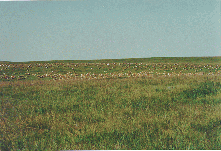
Figure 2. Gazelles grazing on the Mongolian steppe. Source: Chuluun and Ojima (1999).
4. Quality Assessment:
NPP of grasslands is subject to a number of different methods of estimation from biomass data, some of which may be inappropriate for particular biome types. Methodology of estimation/calculation needs to be taken into account, as well as methodology of measurement, when making comparisons between different regions. Errors in biomass measurement may also occur between different study sites. For short time series of data it may be assumed that measurement methodology remains consistent; however, over very long time series changes in staff, tools, etc. may lead to "calibration" errors.
The CENTURY model was validated against observed soil organic carbon and above-ground plant biomass at the Tumentsogt steepe where the Research Station of the Mongolian Academy of Sciences is located (Togtohyn et al., 1995). Simulated above-ground mean peak plant biomass using CENTURY with 1982-1990 observed weather data from Tumentsogt exactly matched with observed field measurements (Chuluun and Ojima, 1999). Comparisons of CENTURY simulated NPP and soil C levels with field data for this site are also very good (Ojima et al., 1998).
Due to the sparseness of seasonal field biomass observations at Mongolian steepes, there are few data to compare with the findings at Tumentsogt. However, similar to other arid areas, above-ground biomass amounts that are above and below the long-term mean at Tumentsogt appear to be are associated with wetter and drier conditions.
Annual mean biomass for Stipa grandis at Tumentsogt (140 g/m2 for 1982–1997 in Kogan et al., 2004 and 160 g/m2 for 1982–1990 in Togtohyn et al., 1995) is similar to the peak live biomass reported for Stipa grandis (144.43 g/m2) in Inner Mongolia's Kilin River basin for 1980-1989 (Xiao et al., 1995).
5. Data Acquisition Materials and Methods:
Site Information
The Tumentsogt Research Station study site represents a dry, cold Eurasian steppe with mean annual precipitation of 269 mm and mean annual maximum/minimum temperatures of 27.6/-24.4 degrees C. Most of the rainfall occurs during a short rainy season between June and August. However, this rainfall is insufficient to provide intensive vegetation growth.
Grasslands at Tumentsogt are dominated by cool season grasses and soil carbon isotopic analysis shows that it has been for a long period of time. Soil organic carbon and nitrogen levels are positively correlated with annual precipitation. Stipa grandis is the dominant vegetation in this middle Eurasian steppe zone where climate is semi-arid (Wu, 1980; Xiao et al., 1995). S. grandis steppe provides good forage for livestock (sheep, goats, camels, cattle, and horses) and is used mainly as natural grazing lands.
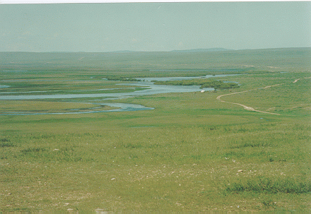
Figure 3. Herlen River adjacent to the Mongolian steppe. Source: Chuluun and Ojima (1999).
Table 4. Site characteristics
| Description | Values |
|---|---|
| mean annual precipitation | 280 mm |
| mean monthly minimum temperature | -23.5 degrees C (Jan) |
| mean monthly maximum temperature | 27.5 degrees C (July) |
| vegetation type | typical steppe |
| dominant species | Stipa grandis (C3) |
| historical long-term management regime | annual grazing |
| max above-ground live biomass (typical month) | 235 g/m2 (July) |
| soil type | dark chestnut mollisol |
| soil pH | Not available |
| soil texture (sand/ silt/ clay) | 0.60 / 0.20 / 0.20 |
| soil carbon content | 4,030 g/m2 (0-20 cm) |
| soil nitrogen content | 7,500 g/m2 (0-20 cm) |
Methods
Measurements were made at a 1-ha (2.4 acres) experimental field typical for the Tumentsogt Research Station location (Kogan et al., 2004). The experimental field was fenced to preserve natural biomass growth. The procedure included cutting and weighing above-ground live biomass on the area of 1-m2 in four corners of the field every 10 days. The average weight from four 1-m2 plots was recalculated for the entire 1-ha area and expressed in tons per hectare. For the following 10 days’ measurements, the four plots were moved to the neighboring locations of the field.
Information from other sources not available.

Figure 4. Nomadic herdsmen housing and transportation on the Mongolian steppe. Source: Chuluun and Ojima (1999).
6. Data Access:
This data set is available through the Oak Ridge National Laboratory (ORNL) Distributed Active Archive Center (DAAC).
Data Archive:
Web Site: http://daac.ornl.gov
Contact for Data Center Access Information:
E-mail: uso@daac.ornl.gov
Telephone: +1 (865) 241-3952
7. References:
Bespalov, N.D. 1964. Soils of Outer Mongolia. Israel Program for Scientific Translations, Jerusalem.
Chuluun, T., and D. Ojima. 1999. Climate and grazing sensitivity of the Mongolian rangeland ecosystem, pp. 877-878. IN: Proceedings of the Sixth International Rangeland Congress on “People and Rangelands: Building the Future”, Townsville, Queensland, Australia, vol. 2.
Chuluun, T., and D. Ojima. 2002. Land use change and carbon cycle in arid and semi-arid lands of East and Central Asia. Science in China Series C Life Sciences-English Edition 45 SUPP: 48-54.
Dashnyam, B. 1974. Flora and Vegetation of the Eastern Mongolian Steppe. Mongolian Academy of Sciences Publ., Ulaanbaatar (in Mongolian).
Dmitriev, P.P., O.I. Khudyakov, and L. Jargalsaikhan. 1990. A succession of dark-chestnut soils and vegetation in Eastern Mongolia in conjunction with rodents life-activity. Bull. Mosk. O-va ispytatelei prirody. Otd. biol. 95: 3-15.
Hilbig, W. 1995. The Vegetation of Mongolia. SPB. Academic Publishing, Amsterdam, Netherlands.
Kogan, F., R. Stark, A. Gitelson, L. Jargalsaikhan, C. Dugrajav, and S. Tsooj. 2004. Derivation of pasture biomass in Mongolia from AVHRR-based vegetation health indices. International Journal of Remote Sensing 25(14): 2889-2896. doi:10.1080/01431160410001697619
Long, S.P., E. Garcia Moya, S.K. Imbamba, A. Kamnalrut, M.T.F. Piedade, J.M.O. Scurlock, Y.K. Shen and D.O. Hall. 1989. Primary productivity of natural grass ecosystems of the tropics: a reappraisal. Plant and Soil 115: 155-166. doi:10.1046/j.1365-2486.2001.00448.x
Ojima, D.S., T. Chuluun, B. Bolortsetseg, C.J. Tucker, and J. Hicke. 2004. Eurasian land use impacts on rangeland productivity. Geophysical Monograph Series 153: 293-301. doi:10.1029/153GM22
Ojima, D.S., X. Xiao, T. Chuluun, and X.S. Zhang. 1998. Asian grassland biogeochemistry: factors affecting past and future dynamics of Asian grasslands. Asian Change in the Context of Global Climate Change 3: 128-144.Sheremet'ev, S.N,. and L. Jargalsaikhan. 1990. Water relations ecology of the steppe plants of Mongolia. USSR Academy of Sciences, Leningrad.
Olson, R.J., K.R. Johnson, D.L. Zheng, and J.M.O. Scurlock. 2001. Global and Regional Ecosystem Modeling: Databases of Model Drivers and Validation Measurements. ORNL Technical Memorandum TM-2001/196. Oak Ridge National Laboratory, Oak Ridge, Tennessee, U.S.A.
Olson, R.J., J.M.O. Scurlock, S.D. Prince, D.L. Zheng, and K.R. Johnson (eds.). 2013. NPP Multi-Biome: Global Primary Production Data Initiative Products, R2. Data set. Available on-line [http://daac.ornl.gov] from the Oak Ridge National Laboratory Distributed Active Archive Center, Oak Ridge, Tennessee, USA. doi:10.3334/ORNLDAAC/617
Scurlock, J.M.O., and R.J. Olson. 2013. NPP Multi-Biome: Grassland, Boreal Forest, and Tropical Forest Sites, 1939-1996, R1. Data set. Available on-line [http://daac.ornl.gov] from Oak Ridge National Laboratory Distributed Active Archive Center, Oak Ridge, Tennessee, USA. doi:10.3334/ORNLDAAC/653
Togtohyn, C., T. Chuluun, D.S. Ojima, J. Luvsandorjiin, J. Dodd, and S. Williams. 1995. Simulation studies of grazing in the Mongolian steppe, pp. 23-28. IN: Proceedings of the Fifth International Rangeland Congress, Vol. 1. Society of Range Management, Denver, CO, USA.
Xiao X., Y. Wang, S. Jiang, D.S. Ojim,a and C.D. Bonham. 1995. Interannual variation in the climate and aboveground biomass of Leymus chinense steppe and Stipa grandis steppe in the Xilin river basin, Inner Mongolia, China. Journal of Arid Environments 31: 283-299. doi:10.1016/S0140-1963(05)80033-3
Wu, Z.Y. 1980. Vegetation of China, pp. 519-533. Science Press, Beijing.
Additional Sources of Information:
Shu, J., Q. Qiuhui, and K. Dezhen. 1985. A comparative study on production of Aneurolepidium chinense and Stipa grandis steppe communities at Baiyinxile Livestock Farm in Inner Mongolia Region. IN: Inner Mongolia Grassland Ecosystem Research Station, Academia Sinica (ed.). Research on Grassland Ecosystem 1: 12-23.
Xiao, X., S. Jiang, Y. Wang, D.S. Ojima and C.D. Bonham. 1996. Temporal variation in aboveground biomass of Leymus chinense steppe from species to community levels in the Xilin River Basin, Inner Mongolia, China. Vegetatio 123: 1-12. doi:10.1007/BF00044884
Zhao, X., Y. Yao, and R. Yang. 1988. Ecological geographic characteristics and outlook of natural grasslands resources in Xilin river basin. In: Inner Mongolia Grassland Ecosystem Research Station (ed.). Research on Grassland Ecosystem 3: 184-226. Science Press, Beijing. (in Chinese with English abstract). 275 pp.