Get Data
Summary:
This data set contains a single text file which reports properties of fallen course woody debris in an old-growth upland forest at the Pará Western (Santarém) - km 67, Primary Forest Tower Site. This site is in the Tapajos National Forest located in north central Brazil. Measurements extend from April 2001 through July 2001.
Standing and Fallen coarse woody debris (CWD), or necromass were measured in a series of ecological plots at the km 67 eddy flux tower site in the Tapajos National Forest (Figure 2). The data set includes different size classes of debris measured in different plot sizes. Size classes were: 2-10cm (in 64 m2 subplots) , 10-30cm (in 1600 m2 subplots), 30cm (in 38400 m2 subplots), standing (in entire 50m by 1000m transects).
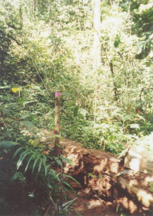
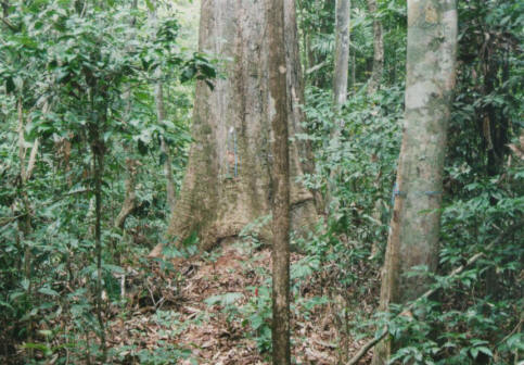
Figure 1. Typical forest conditions surrounding the tower site.

Figure 2. Map of transects and CWD plots for kilometer 67 site in the Tapajo´s National Forest, Brazil. More information on methods of data collection is available in Rice et al. 2004.
Data Citation:
Cite this data set as follows:
Wofsy, S. C., A. H. Rice, S. R. Saleska, E. H. Pyle, and L. R. Hutyra. 2008. LBA-ECO CD-10 Coarse Woody Debris Data at km 67 Tower Site, Tapajos National Forest. Data set. Available on-line [http://daac.ornl.gov] from Oak Ridge National Laboratory Distributed Active Archive Center, Oak Ridge, Tennessee, U.S.A. doi:10.3334/ORNLDAAC/858
Implementation of the LBA Data and Publication Policy by Data Users:
The LBA Data and Publication Policy [http://daac.ornl.gov/LBA/lba_data_policy.html] is in effect for a period of five (5) years from the date of archiving and should be followed by data users who have obtained LBA data sets from the ORNL DAAC. Users who download LBA data in the five years after data have been archived must contact the investigators who collected the data, per provisions 6 and 7 in the Policy.
This data set was archived in May of 2008. Users who download the data between May 2008 and April 2013 must comply with the LBA Data and Publication Policy.
Data users should use the Investigator contact information in this document to communicate with the data provider. Alternatively, the LBA Web Site [http://lba.inpa.gov.br/lba/] in Brazil will have current contact information.
Data users should use the Data Set Citation and other applicable references provided in this document to acknowledge use of the data.
Table of Contents:
- 1 Data Set Overview
- 2 Data Characteristics
- 3 Applications and Derivation
- 4 Quality Assessment
- 5 Acquisition Materials and Methods
- 6 Data Access
- 7 References
1. Data Set Overview:
Project:LBA (Large-Scale Biosphere-Atmosphere Experiment in the Amazon)
Activity: LBA-ECO
LBA Science Component: Carbon Dynamics
Team ID: CD-10 (Wofsy / Kirchhoff / Camargo)
The investigators were Saleska, Scott, R.; Hutyra, Lucy ; Pyle, Elizabeth Hammond and Wofsy, Steven C. . You may contact Hutyra, Lucy (lrhutyra@u.washington.edu) and Pyle, Elizabeth Hammond (ehp@io.harvard)
LBA Data Set Inventory ID:CD10_CWD_Tapajos
Data from plot-based measurements of CWD (Coarse woody debris) made at the KM 67 eddy-flux tower site, Tapajos National Forest, Brazil. Data set includes different size classes of debris measured in different plot sizes. Size classes were: 2-10cm (in 64 m2 subplots) , 10-30cm (in 1600 m2 subplots), 30cm (in 38400 m2 subplots), standing (in entire 50m by 1000m transects).
These data may be updated or reprocessed from time to time, and it is the user's responsibility to insure that you have the most recent version of the data. For the latest version, please see the following web site: Harvard University, LBA Web Page (http://www-as.harvard.edu/data/lbadata.html)
Related Data Sets:
LBA-ECO CD-10 Ground-based Biometry Data at km 67 Tower Site, Tapajos National Forest
LBA-ECO CD-10 Forest Litter Data for km 67 Tower Site, Tapajos National Forest
2. Data Characteristics:
The debris data are reported in one comma separated ASCII text file,km67_CWD_survey_2001.txt.
| Columns include: row.names = unique row identifier T = transect Tag = if the piece was tagged, it appears here. Only the largest pieces were tagged. volume.cm3 = volume calculated from measured dimensions. decay = estimated decay class, based on Harmon & Sexton (1996): • Decay class 1 = solid wood, recently fallen, bark and twigs present.v • Decay class 2 = solid wood, significant weathering, branches present. • Decay class 3 = wood not solid, may be sloughing but nail still must be pounded into tree. • Decay class 4 = wood sloughing and/or friable, nails may be forcibly pushed into log. • Decay class 5 = wood friable, barely holding shape; nails may be easily pushed into log. size = plot size biomass.keller.g = estimated biomass in Mg C/ha (dry mass) using locally measured densities, as described in Rice et al. 2004. Missing Value Code is "NA" Values are Comma Separated |
Sample Data Record:
row.names,T,Tag,volume.cm3,decay,size,biomass.keller.g 1,1,NA,154.17352925,3,64,87.8789116725 2,1,NA,57.3601974166667,5,64,14.9136513283333 3,1,NA,2389.20013893333,4.5,64,621.192036122667 4,1,NA,79.5345868333333,4,64,37.3812558116667 5,1,NA,408.559067115,5,64,106.2253574499 ... 1365,1,67,2614398.29430932,2,197500,1856222.78895961 1366,1,49,74952.7169684244,2,197500,53216.4290475813 1367,1,513,128266.375254132,2,197500,91069.1264304335 1368,1,109,110657.36409693,4,197500,52008.9611255569 1369,1,65,513494.012481363,3,197500,292691.587114377 |
Site boundaries: (All latitude and longitude given in degrees and fractions)
| Site (Region) | Westernmost Longitude | Easternmost Longitude | Northernmost Latitude | Southernmost Latitude | Geodetic Datum |
|---|---|---|---|---|---|
| Para Western (Santarem)- km 67 Primary Forest Tower Site (Para Western(Santarem)) | -54.959 | -54.959 | -2.857 | -2.857 | World Geodetic System, 1984(WGS-84) |
Time period:
- The data set covers the period 2001/04/15 to 2001/07/15.
- Temporal Resolution: One measurement in 2001.
Platform/Sensor/Parameters measured include:
- FIELD INVESTIGATION / HUMAN OBSERVER / BIOMASS
3. Data Application and Derivation:
Top, middle and bottom diameters and total length were measured for fallen CWD with either a large tree caliper or a small electronic caliper and dimensional measurements converted to volumes using Newton's formula for a cylinder (Harmon and Sexton 1996). To calculate the volume of the standing CWD, the following taper function from Chambers et al. (2000) was used to calculate a top diameter from a DBH and an estimated height. Top Diameter = 1.59 * DBH(cm) * (Height(m)*100(cm/m))- .091. The calculated top diameter and DBH were averaged to obtain a middle diameter and these three values were again converted to disk areas and entered into Newton's formula to calculate a volume (substituting height for length). Volumes were converted to biomass with site-specific densities.
4. Quality Assessment:
Data have been well proofed for transcription errors.
5. Data Acquisition Materials and Methods:
Individual pieces of CWD were measured in ground-based plots. All pieces about 10 cm in diameter and 1 m in length were tagged. Top, middle and bottom diameters and total length were measured for fallen CWD with either a large tree caliper or a small electronic caliper and dimensional measurements converted to volumes using Newton's formula for a cylinder (Harmon and Sexton 1996).
Data from plot-based measurements of CWD (Coarse woody debris) made at the KM 67 eddy-flux tower site, Tapajos National Forest, Brazil.
Data set includes different size classes of debris measured in different plot sizes. Size classes were: 2-10cm (in 64 m2 subplots) , 10-30cm (in 1600 m2 subplots), 30cm (in 38400 m2 subplots), standing (in entire 50m by 1000m transects).
More information on methods of data collection is available in Rice et al. 2004.
Sensors used include:
- HUMAN OBSERVER
6. Data Access:
This data is available through the Oak Ridge National Laboratory (ORNL) Distributed Active Archive Center (DAAC) or the EOS Data Gateway.
Data Archive Center:
Contact for Data Center Access Information:
E-mail: uso@daac.ornl.gov
Telephone: +1 (865) 241-3952
7. References:
Chambers, J. Q., N. Higuchi, J. P. Schimel, L. V. Ferreira, and J. M. Melack. 2000. Decomposition and carbon cycling of dead trees in tropical forests of the central Amazon. Oecologia 122:380–388.
Harmon, M. E. and J. Sexton. 1996. Guidelines for measurements of woody detritus in forest ecosystems. Publication no. 20. U.S. Long-term Ecological Research (LTER) Network Office, University of Washington, Seattle, Washington, USA.
Rice, A.H., E.H. Pyle, S.R. Saleska, L. Hutyra, M. Palace, M. Keller, P.B. de Camargo, K. Portilho, D.F. Marques, and S.C. WOFSY. 2004. Carbon balance and vegetation dynamics in an old-growth Amazonian forest. Ecological Applications, Vol. 14, No. 4, pp. S55.
Related Publications
- Rice, A.H., E.H. Pyle, S.R. Saleska, L. Hutyra, M. Palace, M. Keller, P.B. de Camargo, K. Portilho, D.F. Marques, and S.C. WOFSY. (2004) Carbon balance and vegetation dynamics in an old-growth Amazonian forest. Ecological Applications, Vol. 14, No. 4, pp. S55.
- Saleska, S.R., S.D. Miller, D.M. Matross, M.L. Goulden, S.C. Wofsy, H.R. da Rocha, P.B. de Camargo, P. Crill, B.C. Daube, H.C. de Freitas, L. Hutyra, M. Keller, V. Kirchhoff, M. Menton, J.W. Munger, E.H. Pyle, A.H. Rice, and H. Silva. (2003) Carbon in amazon forests: Unexpected seasonal fluxes and disturbance-induced losses. Science 302(5650):1554-1557.