Documentation Revision Date: 2026-05-01
Dataset Version: 1
Summary
There are five data files in ICARTT V1.1 (.ict) format in this dataset.
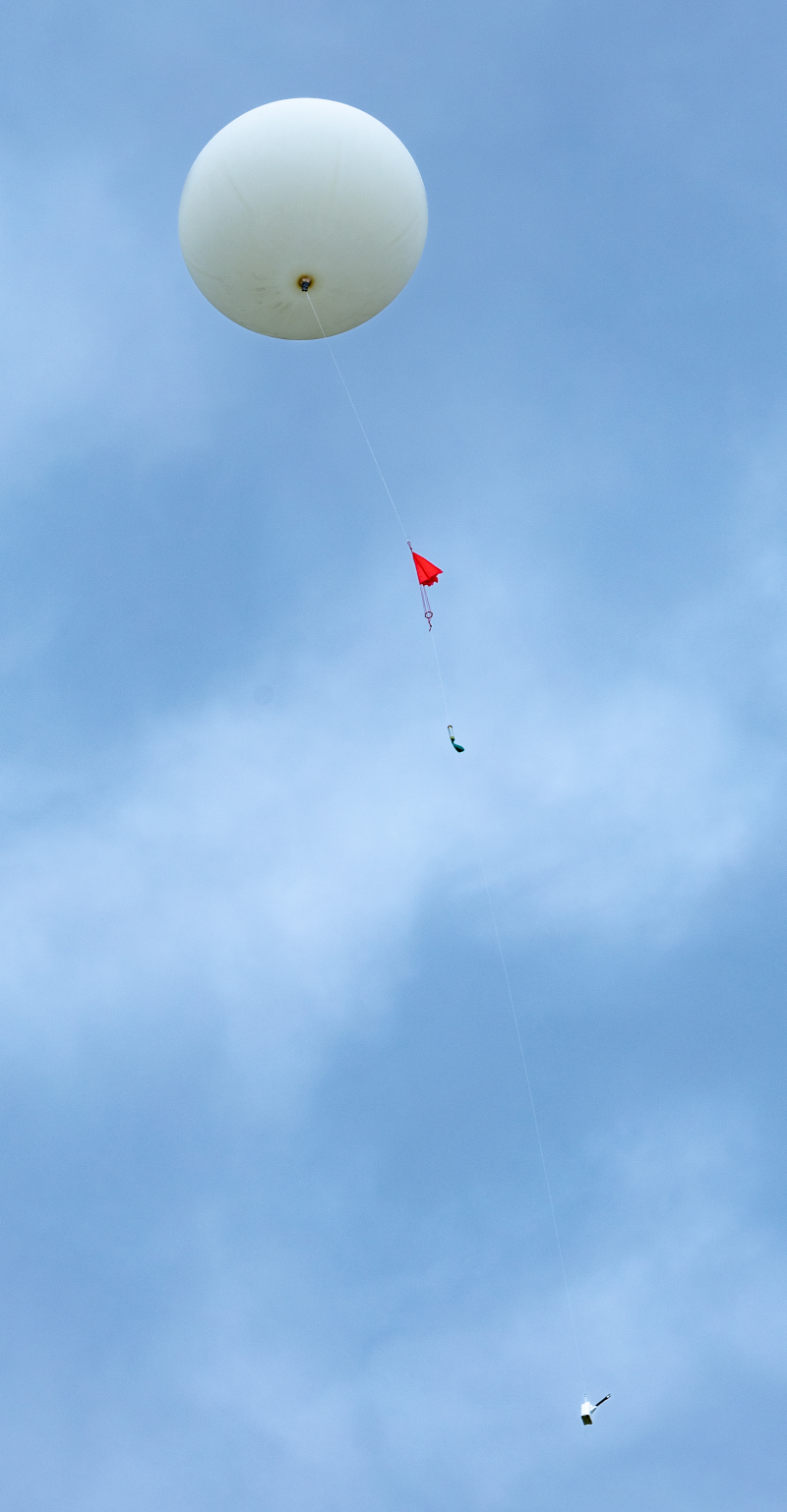
Figure 1. A weather balloon launched in Missoula, Montana, August 29, 2024, flying a radiosonde.
Citation
Pangle, P., and J. Fowler. 2026. FireSense: Balloon Vertical Profile Measurements, Missoula, MT, USA, 2024. ORNL DAAC, Oak Ridge, Tennessee, USA. https://doi.org/10.3334/ORNLDAAC/2499
Table of Contents
- Dataset Overview
- Data Characteristics
- Application and Derivation
- Quality Assessment
- Data Acquisition, Materials, and Methods
- Data Access
- References
Dataset Overview
This dataset contains five vertical atmospheric profiles collected from balloon-based radiosondes in Missoula, Montana, on August 28-29, 2024. The data includes air pressure, air temperature, relative humidity, MSL altitude, dew point temperature, virtual temperature, wind speed and direction, latitude and longitude, and data related to the balloon and instrument. The data were acquired by Graw balloon-based DFM-17 radiosondes under the Idaho Space Grant Consortium, Montana Space Grant Consortium and FireSense project. The measurements were made between the surface and approximately 29 km MSL. These high-resolution observations of atmospheric state variables are critical for initialization and validation of wildfire smoke transport models and as training data for fire weather artificial intelligence (AI) models.
Project: FireSense
The FireSense project aims to improve U.S. wildland fire management by working with operational agencies to refine and deliver NASA’s unique Earth science and technological capabilities. FireSense focuses on four types of assessments to support decisions before, during, and after wildland fires: pre-fire fuel conditions, active fire dynamics, post-fire impacts and threats, and air quality forecasting. Each type of assessment is co-developed with wildland fire management stakeholders. Through co-development of technology and data-informed tools, FireSense is intended to enable a transition from reactive to proactive fire response by facilitating increased preparedness for and co-existence with fire. To accomplish this, the FireSense team collaborates with resource managers, policymakers, and stakeholders at all levels. Since the fall of 2023, FireSense has run an annual airborne and field component where the project team tests and develops improved capabilities and technologies for transfer to stakeholders. FireSense leverages multiple airborne instruments, including the MODIS/ASTER Airborne Simulator (MASTER), the Uninhabited Aerial Vehicle Synthetic Aperture Radar (UAVSAR), the Airborne Visible/Infrared Imaging Spectrometer 3 (AVIRIS-3), the Scanning L-band Active Passive (SLAP), and the San Jose State University Wildfire Imaging System (SWIS).
Related Dataset
Pangle, P., and J. Fowler. 2026. FireSense: Balloon Vertical Profile Measurements, Albany, NY, USA, 2024. ORNL DAAC, Oak Ridge, Tennessee, USA. https://doi.org/10.3334/ORNLDAAC/2497
Acknowledgements
This work was supported by the National Space Grant College and Fellowship Project and NASA FireSense Project. The Idaho Space Grant Consortium and Montana Space Grant Consortium supported balloon operations, and the University of Montana Autonomous Aerial Systems Office provided range access and airspace deconfliction.
Data Characteristics
Spatial Coverage: Missoula, Montana, US
Spatial Resolution: Irregular from the surface to <29 km
Temporal Coverage: 2024-08-28 to 2024-08-29
Temporal Resolution: 1 s
Study Area: Latitude and longitude are given in decimal degrees.
| Region | Westernmost Longitude | Easternmost Longitude | Northernmost Latitude | Southernmost Latitude |
|---|---|---|---|---|
| Missoula, Montana, US | -113.9959 | -113.0296 | 46.8556 | 46.2264 |
Data File Information
There are five files in ICARTT (.ict) V1.1 format (Aknan et al., 2013) in this dataset.
The no-data value is -9999
The file naming convention is FireSense-Missoula-Balloon_ PROFILE_ <YYYYMMDDhhmm>_<RX>.ict, where
- <YYYYMMDDhhmm> is the sampling start date-time in Coordinated Universal Time (UTC) (e.g., "20240408120014")
- <RX> is the data revision number (e.g., "R0")
Example file name: FireSense-Missoula-Balloon_PROFILE_202408281500_R0.ict
Table 1. Variables in the data files
| Variable Name | Units | Description |
|---|---|---|
| Lat | degrees north | Latitude of radiosonde location |
| Long | degrees east | Longitude of radiosonde location |
| P | hPa | Air Pressure |
| T | degrees C | Air Temperature |
| Hu | percent | Relative Humidity over water |
| Ws | m s-1 | Wind Speed |
| Wd | degrees | Wind Direction |
| Alt | m | MSL Altitude |
| Geopot | m | Geopotential height |
| MRI | none | Instrument/intermediate Variable |
| RI | none | Instrument/intermediate Variable |
| Dewp | degrees C | Dew point temperature |
| VirtTemp | degrees C | Virtual Temperature |
| Rs | m s-1 | Instrument/intermediate Variable: Sonde vertical speed |
| Elevation | degrees | Instrument/intermediate Variable: Sonde elevation angle |
| Azimuth | degrees | Instrument/intermediate Variable: Sonde azimuth angle |
| Range | m | Instrument/intermediate Variable: Sonde range |
| D | kg m-3 | Instrument/intermediate Variable Density |
Application and Derivation
High-temporal-resolution vertical profiles acquired during multiple wildfires offer valuable insight, for characterizing atmospheric transport and mixing dynamics.
Quality Assessment
FireSense team chose Graw balloon borne radiosondes as the profile reference measurement in the field based on The Global Climate Observing System (GCOS) Reference Upper-Air Network’s (GRUAN) assessment of radiosonde intercomparisons. Currently GRUAN integrates high-quality Graw radiosondes into a 30-40 site global network to provide precise, traceable vertical profiles of essential climate variables (temperature, humidity, pressure) from the surface to the stratosphere. These measurements are used to calibrate satellite data and monitor long-term climate trends. The uncertainty values cited below are based on manufacturer specifications for the Graw Radiosonde DFM-17:
- Temperature Accuracy: <0.2 degrees C
- Pressure Uncertainty: <1 hPa
- Relative Humidity Uncertainty: <3%
- Wind Speed Uncertainty: <0.1 m s-1
- Wind Direction Uncertainty <1 degree
Data Acquisition, Materials, and Methods
Data were collected in a wildfire smoke-impacted airshed in Missoula, Montana, on August 28-29, 2024. The vertical profiles of the atmospheric state variables were measured by balloon-based DFM-17 radiosondes between the surface and approximately 29 km MSL. The instrument on the balloon was the Graw Radiosonde DFM-17 responsible for pressure, temperature, and relative humidity measurements.
Data Access
These data are available through the Oak Ridge National Laboratory (ORNL) Distributed Active Archive Center (DAAC).
FireSense: Balloon Vertical Profile Measurements, Missoula, MT, USA, 2024
Contact for Data Center Access Information:
- E-mail: uso@daac.ornl.gov
- Telephone: +1 (865) 241-3952
References
Aknan, A., Chen, G., Crawford, J., and E. Williams. 2013. ICARTT File Format Standards V1.1. NASA Earth Science Data and Information Systems Standards Coordination Office. https://www.earthdata.nasa.gov/s3fs-public/imported/ESDS-RFC-019-v1.1_0.pdf
Fowler, J., P. Pangle, J. Shuman, R. McSwain, H. Rain. M. Falkowski, T. Kauffman, B. Lefer, M. Martin, C. Mataya, and H. Riris. 2024. UAS Measurement Platform to Fill a Critical Knowledge Gap on Wildland Fires. Poster presented at 2024 AGU Meeting, Washington, DC, 8-13 December 2024.
Graw Radiosonde DFM-17: https://www.graw.de/products/radiosondes/radiosonde-dfm-17
Pangle, P., and J. Fowler. 2026. FireSense: Balloon Vertical Profile Measurements, Albany, NY, USA, 2024. ORNL DAAC, Oak Ridge, Tennessee, USA. https://doi.org/10.3334/ORNLDAAC/2497