Get Data
Revision Date: January 06, 2009
Pre-LBA Smoke, Clouds, and Radiation - Brazil (SCAR-B) Data
Summary
This data set contains meteorological data, reanalysis data, remote sensing images, and data on atmospheric composition collected during the Smoke, Clouds, and Radiation - Brazil (SCAR-B) experiment. The SCAR-B examined the effects of biomass burning on atmospheric processes with four primary goals: (1) improving techniques for remote sensing of these process from space, (2) obtain measurements of the rates of emissions of trace gases and particles from biomass burning, (3) observe the influence of atmospheric processes on the emission products was to obtain measurements of the rates of emissions of trace gases and particles from biomass burning, and to observe the influence of atmospheric processes on these emission products, and (4) characterize the physical and radiative properties of smoke particles from biomass burning. SCAR-B was conducted during biomass burning in the cerrado ( dry savannah) and Amazonia rainforest to understand the influence of land cover type on smoke, clouds, and radiation.
Selected archived data and images from SCAR-B are described in the Data Description section table. Extensive background information on SCAR-B is provided following the Data Description.
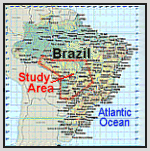
SCAR-B Study Area
The processed, quality controlled and integrated data in the documented Pre-LBA Data sets were originally published as a set of three CD-ROMS (Marengo and Victoria, 1998) but are now archived individually.
Pre-LBA Data Set Collection Initiative
The Pre-LBA data set collection was dedicated to providing information to the LBA research community about existing data that have been collected in Amazonia during the 20 years prior to 1998. The main goal of this activity was to compile and document existing data sets in a consistent manner and make them available prior to the beginning of the LBA experiment.
The data set compilation efforts included satellite imagery, micrometeorological observations, near surface and upper-air atmospheric conditions, surface biophysical and hydrological measurements obtained from 1970s-1990s in a number of field experiments. Data were collected for several intensive field campaigns, during the rainy and dry seasons, and other periods that vary from short intensive field campaigns to several years worth of observations, measured sometimes with a time resolution of 5 minutes and 1 hour.
Citation:
Cite this data set as follows:
Kirchhoff, V.W.J.H. and C.A. Nobre. 2009. Pre-LBA Smoke, Clouds, and Radiation - Brazil (SCAR-B) Data. Data set. Available on-line [http://daac.ornl.gov] from Oak Ridge National Laboratory Distributed Active Archive Center, Oak Ridge, Tennessee, U.S.A. doi:10.3334/ORNLDAAC/916.
The original CD-ROM citation is as follows:
Marengo, J.A., and R. L. Victoria. 1998. Pre-LBA Data Sets Initiative, 3 vols. [Pre-Large-Scale Biosphere-Atmosphere Experiment in Amazonia Data Sets Initiative, 3 vols.]. CD-ROM. Centro de Previsao de Tempo e Estudios Climaticos, Instituto Nacional de Pesquisas Espaciais (CPTEC/INPE) [Center for Weather Forecasting and Climate Study, National Institute for Space Research], Sao Paulo, Brazil.
Pre-LBA Data Set Collection Metadata Campaign: SCAR-B > Smoke, Clouds and Radiation - Brazil Keywords CLOUDS FIRE AIRCRAFT SMOKE RADIATION OPTICAL PARAMETERS TRAJECTORIE RADIATION BUDGET Investigators Last_name: Kirchhoff First_name: Volker Middle_name: W.J.H. Email: kir@spd.inpe.br Phone: +55-12-325.6037 FAX: +55-12-322.9887 Address: INPE Av. dos Astronautas, 1758C.P.515 Zip code: 12201-970 City: Sao Jose dos Campos State_or_Province: Sao Paulo Country: Brazil Last_name: Alvala First_name: Plinio Middle_name: Carlos Email: plinio@dge.inpe.br Phone: +55-12-325.6801 FAX:+55-12-325.6810 Address: INPEAv. dos Astronautas, 1758 C.P.515 Zip code: 12201-970 City: Sao Jose dos Campos State_or_Province: Sao Paulo Country: Brazil Last_name: Barreira First_name: Romulo Middle_name: Alves Phone: +55-12-341.6108 FAX: +55-12-341.6108 Address: INPER.Francisco F.Oliveira,82 City: Taubate State_or_Province: Sao Paulo Country: Brazil Last_name: Casiccia First_name: Claudio Middle_name: A.R. Email: casiccia@dge.inpe.br Phone: +55-12-325.6803 Address: INPEAv. dos Astronautas, 1758 C.P.515 Zip code: 12201-970 City: Sao Jose dos Campos State_or_Province: Sao Paulo Country: Brazil Last_name: Pereira First_name: Enio Middle_name: Bueno Email: enio@das.inpe.br Phone: +55-12-321.3029 Phone: +55-12-321.6969 Address: INPEAv. dos Astronautas, 1758 C.P.515 Zip code: 12201-970 City: Sao Jose dos Campos State_or_Province: Sao Paulo Country: Brazil Last_name: Tarasova First_name: Tatiana Email: tatiana@cptec.inpe.br Phone: +55-12-361.2822 Address: CPTEC-INPERua Gen.Goes Monteiro, 1066 City: Lorena State_or_Province: Sao Paulo Country: Brasil Last_name: Paulo First_name: Artaxo Email: artaxo@if.usp.br Phone: +55-011-818.7016 ax: +55-011-818.6925 Address: Instituto de Fisica-USPC.P.66318 - zip code 05389-970 City: Sao Paulo State_or_Province: Sao Paulo Country: Brasil Last_name: Trosnikov First_name: Igor Email: igor@cptec.inpe.br Phone: +55-12-561-2822 Address: CPTEC-INPERua Gen.Goes Monteiro, 1066 City: Lorena State_or_Province: Sao Paulo Country: Brasil Last_name: Alvala First_name: Regina Middle_name: C.S. Email: regina@met.inpe.br Phone: +55-12-325-6644 FAX: +55-12-325-6666 Address: INPEAv. dos Astronautas, 1758 C.P.515 Zip code: 12201-970 City: Sao Jose dos Campos State_or_Province: Sao Paulo Country: Brazil |
Last_name: Leite First_name: Patricia Middle_name: Marciano Phone: +55-12-325.6038 Phone: +55-12-325.9887 Address: INPEAv. dos Astronautas,1758 C.P.515 - Zip code: 12201-970 City: Sao Jose dos Campos Country: Brazil Last_name: Sahai First_name: Yogeshwar Email: sahai@dge.inpe.br Phone: +55-12-325.6802 Phone: +55-12-325.6810 Address: INPEC.P.515 Zip code:12201-970 City: Sao Jose dos Campos State_or_Province: Sao Paulo Country: Brasil Last_name: Zamorano First_name: Felix Email: Famorano@dge.inpe.br Phone: +55-12-325.6806 Fax: +55-12-325.6810 Address: INPEAv. dos Astronautas, 1758 C.P.515 - zip code : 2201-970 City: Sao Jose dos Campos State_or_Province: Sao Paulo Country: Brazil Last_name: Motta First_name: Adauto Middle_name: G. Email: motta@jerimum.crn.inpe.br Phone: +55-12-231.4733 Phone: +55-12-231.4941 Address: INPEC. P. 130 Zip code:59001-970 City: Natal State_or_Province: Rio Grande do Norte Country: Brazil Technical_Contact Last_name: Kirchhoff First_name: Volker Middle_name: W.J.H. Email: kir@spd.inpe.br Phone: +55-12-325.6037 FAX: +55-12-322.9887Address: INPEAv. dos Astronautas, 1758 C.P.515 Zip code: 12201-970 City: Sao Jose dos Campos State_or_Province: Sao Paulo Country: Brazil Start_Date:1995-08-15 Stop_Date: 1995-09-22 Coverage: Southernmost_latitude: 60SNorthernmost_latitude: 15N Westernmost_longitude: 100W Easternmost_longitude: 10W Minimum_altitude:Surface Maximum_altitude:200hPa Maximum_altitude:200hPa Minimum_depth: 1500X1500 Location: South America Author Last_name: Nobre First_name: Carlos Middle_name: A. Email: nobre@cptec.inpe.br Phone: +55 12 561 2822 FAX: +55 12 561 2835 ; Address: CPTEC-INPERodovia Presidente Dutra, Km 40 C. P.01 - Zip code 12630-000 City: Cachoeira Paulista State_or_Province: Sao Paulo Country: Brazil Data_Center Data_Center_Name: INPE, AEB, NASA Data_Center_URL: http://www.cptec.inpe.br/lba/prelba/prelba.html data set_ID: SCAR-B Data_Center_Contact Last_name: Kirchhoff First_name: Volker Middle_name: W.J.H. Email: plinio@dge.inpe.br Phone: +55-12-325.6037 FAX: +55-12-322.9887 Address: INPEAv. dos Astronautas, 1758 C.P.515 Zip code: 12201-970 City: Sao Jose dos Campos State_or_Province: Sao Paulo Country: Brazil Originating_Center: INPE, AEB, NASA Revision_Date: 1997-02-05 Constraints Access: Data may not be used for commercial applications.Use: Data may not be used for commercial applications. |
Data Set Description
Data Files
| Data Type | Data File Name | Data File Descriptions | Companion File Name |
|---|---|---|---|
| Conventional Meteorological Data | ALTA_FLORESTA.zip | The Alta Floresta data files contain upper-air information that were collected with radiosondes during the SCAR-B
period of August 17 to 30, 1995 over the Alta Floresta site. The site is located at 9.5 degrees S latitude and 56 degrees W longitude. The data cover pressure levels from the surface to approximately 100 hPa. The data are organized into two set of files. The first set are named with the DDMMHH.sub format and the second set are named with the ZvdHHMM.dat format. The DDMMHH.sub files are named for the day (DD), month (MM),and the UTC hour (HH) when the launch started. The data is organized in tables, where the variables are organized as: TEMPO(m) - Time from launching (minutes) P(hPa) - Pressure level ALT.(m) - Altitude T(oC) - Air (dry bulb) temperature TD(oC) - Dew point temperature UR(%) - Relative humidity TH(oK) - Wet bulb temperature R(g/Kg) - Mixing ratio DIR(gr)- Wind direction V(m/s) - Wind speed uu - Zonal component of the wind vv(m/s) - Meridional component of the wind |
N/A |
| METAR.zip SYNOP.zip TEMP.zip AIREP.zip |
On the code messages contained in the METAR, SYNOP, TEMP and AIREP directories: The data sets included in the four files: METAR, SYNOP, TEMP and AIREP contain observations taken during the SCAR-B period. These observations are coded accordingly to the WMO codification. These are ASCII text files. For more information on how to decode the messages contained in the four files above, please refer to this publication: WMO, 1988: Manual on Codes. Vol I. International Codes. WMO. Geneva, Switzerland |
WMO306vol-I-1PartA.pdf | |
| Global Weather Forecasting Products (GCM_CPTEC Data) | Two sets of files: GCM_CPTEC_00Z.zip and GCM_CPTEC_12Z.zip |
CPTEC's Global Weather Forecasting Products: Products named gddmmhtaff mean: g - for global run: G for less products and g for more products E for stratospheric levels x for surf temp and tot precip (see ctl files) dd - day of initial condition (IC) mm - month of IC h - UTC hour of IC: a = 00, b = 06, c = 12, d = 18 t - truncation: 1 = T106L18, 2 = T63L18, 3 = T62L28 a - output area: g = Global, a = South America (SA), p = Pacific+SA, t = Tropical Region ff - forecast time: 00 = analysis, 01 = 6h, 02 = 12h, 03 = 18h, 04 = 24h -> 1st day 05 = 30h, 06 = 36h, 07 = 42h, 08 = 48h -> 2nd day 09 = 54h, 10 = 60h, 11 = 66h, 12 = 72h -> 3rd day 13 = 78h, 14 = 84h, 15 = 90h, 16 = 96h -> 4th day 17 = 102h, 18 = 108h, 19 = 114h, 20 = 120h -> 5th day 21 = 126h, 22 = 132h, 23 = 138h, 24 = 144h -> 6th day 25 = 150h, 26 = 156h, 27 = 162h, 28 = 168h -> 7th day 29 = 174h, 30 = 180h, 31 = 186h, 32 = 192h -> 8th day 33 = 198h, 34 = 204h, 35 = 210h, 36 = 216h -> 9th day 37 = 222h, 38 = 228h, 39 = 234h, 40 = 240h -> 10th day Files named gddmmhtaff.ctl mean: Files named gddmmhtaff.ctl are control files for GrADS and also define the layout of the data. The data are generated in 4-bit big endian binary word of a DEC 3000. No control characters exist between records in data. We suggest that the reader refer to the GRADs website (http://grads.iges.org/grads/ ) for further information. | N/A |
| Global Weather Forecasting Files(MRF_NCEP) | One set of files: MRF_NCEP_00Z.zip |
For the displaying of several fields from CPTEC's model output, the GRADs software has been used. The SCRIPT or program is written in GRADs (*.gs). This script once run generates an image or map, of the variable used as input. In GRADs, the input file is in BINARY, and all binary files are listed on the enclosed archives, together with the script files or programs. File types: *.gs= script, *.dat=GRADS data file, *.ctl=metadata file to read GRADS data. | MRF_NCEP_GRADs.pdf |
Companion Files--No data Provided on Pre-LBA CD
| Source | Companion File Descriptions | Companion File Names |
|---|---|---|
| GOES-8 Images: INFRARED WISC-ANALYSES |
Infrared Images | GOES-8_IMAGES.zip |
| 850HPA FIRE SMOKE VISIBLE | ||
| METEOSAT-5 | METEOSAT-5 Figures | METEOSAT-5.zip |
| NOAA-12 | NOAA-12 Images | NOAA-12.zip |
| Cloud Absorption Radiometer | CAR images, flight tracks, and mission summary readmes. | CAR_IMAGES.zip |
| ER2 MODIS Airborne Simulator (MAS) Images |
ER2 MAS Campaign Summary Name: Smoke, Clouds, and Radiation - Brazil Dates: 13 August 1995 - 11 September 1995 Location: Central Brazil Principal Investigator: Dr. Yoram Kaufman (NASA GSFC) Objective: Study the radiative effects of burning biomass smoke and aerosols on clouds and climate Level-1B Data Processing Status Days (Flights) Reprocessed: 12 of 12 Level-1B Data Version Number: #09 Level-1B Configuration: (sample file) Calibration Type: Final Calibration Version: SCAR-B_King 1.0 Temperature Adjustment: Yes (24C) Status: Done ER2 MAS SCAR-B data may be obtained at http://eosweb.larc.nasa.gov/PRODOCS/scarb/table_scarb.html. |
ER2-MAS_IMAGES.zip |
| U. Washington Convair C-131A Aircraft | No data files provided on Pre-LBA CD. Companion file provides summary of data collected. |
Hobbs_scarb_summary.pdf |
SCAR-B Background
In collaboration with researchers from other U.S. and Brazilian agencies and academic institutions, NASA GSFC scientists recently completed the third in a series of campaigns to study the properties of aerosols and the effects of biomass burning on regional and global climate. Completed in September 1995, this latest campaign was focused on the properties and interaction of smoke, clouds, and radiation over Brazil; hence the name SCAR-B. (See the July/August 1993 issue of The Earth Observer for details on the first SCAR campaign.)
Trace gases--such as CO2 and CH4 --contribute to the Earth's greenhouse effect by trapping and containing heat from geothermal and incoming solar radiation. Theoretically, increasing the concentration of these trace gases in the atmosphere will proportionally amplify the greenhouse effect, thereby raising the average global temperature. Scientists estimate that deforestation and corresponding biomass burning are responsible for a significant percentage of the increase in atmospheric CO2 concentration since the beginning of the industrial revolution, around 1850.
Biomass burning releases particles into the atmosphere that effect its chemistry and physics on local, regional, and global scales. For example, smoke particles can act as cloud condensation nuclei (CCN) interacting with clouds to create smaller, more-numerous cloud droplets, resulting in more dense clouds. Theoretically, increasing CCN should result in an increase in cloud albedo--unless it is compensated with black carbon absorption--having a net cooling effect on climate. However, satellite analysis shows a decrease in cloud albedo as a function of smoke concentration, so further studies are needed to better understand the physics involved.
Paradoxically, biomass burning affects atmospheric dynamics in ways that promote both global warming and regional cooling trends. Which trend will prove greater in the long run? According to SCAR-B Scientist Peter Hobbs, of the University of Washington, the warming trend will prove greater in the long run since the residence time of CO2 in the atmosphere is much longer than that of particles.
Yet, scientists are only just beginning to understand the problem in ways that allow them to construct models of the interactions of smoke, from burning vegetation, with clouds and radiation. Goddard scientists hope to refine these models further so that they can monitor the effects of forest fires, using satellite sensors such as the Moderate-resolution Imaging Spectroradiometer (MODIS), over much greater temporal and spatial scales.
Why Brazil?
By far, most--about 80 percent--of the anthropogenic CO2 released into the atmosphere comes from industrialized, northern hemisphere countries. Consequently, SCAR-A (for America) focused on characterizing the urban pollution released among highly populated regions in the eastern United States.
But what about the remaining pieces of the puzzle? Biomass burning accounts for about 23 percent of the CO2 emissions worldwide today. According to Darold Ward, of the U.S. Forest Service, about 80 percent of the biomass burned annually is in tropical countries in Africa and South America. About 40 percent of the total burned comes from deforestation.
Brazil is a logical environment in which to extend the SCAR campaign. Its widespread slash- and burn- agricultural practices account for a significant portion of the tropical burning and deforestation taking place. It is therefore important to characterize the aerosols and trace gases being released into the atmosphere there; as well as to monitor how those emission products are transported to other parts of the world.
More significantly, an infrastructure already exists in Brazil to support a campaign as complex as SCAR. A Memorandum of Understanding was already in place between the U.S. Forest Service and IBAMA (the Brazilian equivalent) for sharing technology and knowledge on natural resource management. Specifically, the U.S. Forest Service has been involved in exchanging information with IBAMA on fire management, prescribed burning, control of fires, air quality considerations, and ways of minimizing adverse effects of smoke from fire management activities. Later, Tim Suttles, previously of NASA Headquarters, and Volker Kirchhoff, SCAR-B co-project scientist from INPE, were able to formulate another Memorandum of Understanding to cover the SCAR experiment.
In addition to the scientific equipment and expertise that Brazil has to offer, state-of-the-art computer networks and communications systems were already in place to facilitate rapid data transmissions and communicating of last-minute mission plans among geographically distributed researchers. During the previous two campaigns, SCAR scientists found that cellular phones were an effective, efficient medium for staying in touch--Brazil's cellular phone system worked nicely.
Flight operations planning requires access to the latest meteorological information, as well as intelligence reports on where the fires are burning. Good communications between scientists--sometimes located out in the field or even a continent away--and aircraft pilots is essential for optimizing flight paths, in response to constantly changing meteorological conditions, to meet the data collection objectives. To address this problem, Elaine Prins set up a World Wide Web server at the University of Wisconsin-Madison on which she continuously posted the latest meteorological data--from GOES --over the entire continent of South America. Several times per day SCAR participants at IBAMA accessed these data via the Internet and relayed them to flight mission planners.
Although SCAR-B data analysis will be ongoing for some time--and conclusive results will take years to pin down--there is one immediate payoff from the campaign. A close, ongoing working relationship between American and Brazilian scientists has been established. Collaboration between our two countries has proven to be successful and greatly beneficial, not only in terms of valuable data exchanged, but also in terms of scientific knowledge and expertise shared. Hobbs summed up his working relationship with the Brazilians in one word--"excellent".
Prior to SCAR-B, Brent Holben, of GSFC, installed a network of sunphotometers (AERONET) throughout Brazil to measure aerosol size distributions and concentrations, as well as their effects on solar radiation. This network permits continuous monitoring of aerosol optical thickness, sky radiance, and ground sampling of aerosols for at least the next several years. This long-term collaboration with Brazilian scientists will yield a spatially wide data set on the emission of trace gases and particles from biomass burning in Amazonia and cerrado regions.
Goals of SCAR-B
Perhaps the foremost goal of the SCAR campaign in Brazil was to obtain measurements of the rates of emissions of trace gases and particles from biomass burning, and to observe the influence of atmospheric processes on these emission products. During SCAR-C (in the northwestern United States), Paulo Artaxo, of the University of Sao Paulo, and Hobbs observed that forest fire smoke particle size varies quickly during the first few hours of its lifetime, growing very quickly. Then, after the first few hours, particle size remains fairly constant. Particle morphology is important to understand how the aerosols will behave chemically in clouds, as well as how they will affect incoming solar radiation. "We learned [during SCAR-C] that in a given fire there is high correlation between its infrared signal and the rate of emission of particulates and trace gases from it," adds GSFC's Yoram Kaufman, SCAR-B co-project scientist. "This is important for the MODIS fire algorithm because it shows that the algorithm will be more than just counting fires."
Understanding how emission products are transported by wind currents in South America is also key. "There are very nice results from trajectory analyses that clearly show strong transport of aerosols from biomass burning from Brazil into [the atmosphere over] the South Atlantic and entering into the global circulation," Artaxo states. "We also observed some emission products being transported from the Amazon Basin to the Pacific through the Andes Mountains."
Another goal during SCAR-B was to characterize the physical and radiative properties of smoke particles from biomass burning. Explains Lorraine Remer, of Science Systems and Applications, Inc., "We had an interesting picture emerge from the SCAR-A campaign of urban industrial aerosols. But we knew from Brent's [Holben] sun photometer data from earlier years that [our characterization of aerosols in America] wouldn't be applicable to Brazil because the aerosols are different there."
Indeed, there is even variation in Brazilian aerosols found over the cerrado, or dry savannah, region versus those found over the rainforest of Amazonia. "My interest was to obtain data to see how aerosols differed and varied regionally," Remer states. "I wanted to know if different types of smoke in Brazil could be modeled by one model, or would I need several?"
As mentioned previously, collecting data on the interaction of smoke particles with clouds was another important goal in SCAR-B. Interestingly, Kaufman and Robert Fraser (GSFC) noticed that smoke affects clouds over the northern rain forest regions of Brazil, but does not seem to affect the clouds over the cerrado. They don't yet fully understand why, but speculate that cloud drop radii in clouds over the cerrado region may already be too small to be significantly affected by smoke. In Africa, they note, the cerrado type of aerosols from biomass burning is more dominant, and this finding may be important to understanding their capability to affect clouds.
In addition to its impact on the atmosphere, biomass burning affects the health of surrounding vegetation and the ecosystem it supports. Using SCAR-B remote sensing data of different land surface covers in the presence and absence of smoke, Alfredo Huete (University of Arizona) and the MODIS Land Discipline Group hope to develop improved vegetation indices enabling them to monitor the conditions of tropical vegetation using MODIS data once that sensor is launched.
SCAR-B Instrumentation and Measurement Strategy
In addition to the ground sunphotometer network, aircraft and satellite platforms were employed to gather remote sensing data during SCAR-B. The NASA ER-2 flew 80 research flight hours carrying a payload consisting of the MODIS Airborne Simulator (MAS), the Airborne Visible/Infrared Imaging Spectrometer (AVIRIS), the Cloud Lidar System (CLS), a Spectral Electro-Optic Radiometer (SEOR), and solar and infrared flux radiometers. On average, the ER-2 was flown at an operating altitude of 20 km. Primarily through the efforts of Michael King, SCAR-B co-project mission scientist, the MAS data system was upgraded prior to the campaign from a 12-channel, 8-bit digitizer to a 50-channel, 12-bit digitizer.
Aircraft in situ measurements, as well as sampling of aerosol particulates and trace gases, were made by instruments aboard the University of Washington's C-131A and the Brazilian INPE Bandeirante aircraft, flying about 75 and 90 research hours, respectively. These aircraft were flown at multiple altitudes to help gather data on how smoke particles and trace gas properties evolve over time and as a function of height. Satellite remote sensing data were obtained from the Geostationary Operational Environmental Satellite (GOES), Meteosat, Landsat Thematic Mapper (TM), and Advanced Very High Resolution Radiometer (AVHRR) to complement the aircraft and ground measurements.
Conclusions
According to Kaufman, the SCAR-B campaign was a great success and met the scientific expectations of the participating scientists. "It has produced a unique and unprecedentedly large database to study the effects of biomass burning on atmospheric processes and climate, and to prepare new techniques for remote sensing of these processes from space."
For example, as a result of the SCAR campaigns, Kaufman and a group of MODIS researchers developed a new method for remote sensing of aerosols over land. The method involves identifying dark pixels using the 2.1-um channel and then predicting the reflectance in the blue and red channels using the measured reflectance at 2.1 um. Kaufman states that this algorithm is now a major part of his present MODIS aerosol retrieval algorithm. Kaufman adds that the image data from MAS and AVIRIS, covering 2 million square kilometers, will give us detailed spectral information on thousands of fires and the related smoke emitted from them. These remote sensing data will be complemented with spectral data from Holben's sunphotometer network. Additionally, Hobbs will have detailed data on the chemistry and optical properties of emission products.
Mission Summary Table for SCAR-B
| DATE | ER-2 | C131-A / Bandeirante | Sunphotometers tau(.67), alpha(.67/1.02) |
COMMENTS |
|---|---|---|---|---|
|
Aug. 16, M #1 ER-2 first flight Clear |
3 hr. star pattern south of PN MAS, AVIRIS, Lidar | No flight. Technical problem; no report. |
Brasilia 0.07, 0.8 Santar. 0.11, 1.0 Cam. Gr. 0.73, 2.1 Cuiaba 0.69, 1.9 Alt. Flor. 0.89, 2.4 Bolivia 1.26, 2.1 |
Slight haze, no clouds, small fires, one large fire. |
|
Aug. 17, M #1.5 C131 first flight |
No flight. | 4 hr. Test flight north of Brasilia | Small fires, mostly clear. | |
|
Aug. 18, M #2 South of PN, AF |
6 hr. Pattern south of PN (clear) then overflight in Alta Floresta (cloudy) with little smoke in- between. | 4 hr. South of PN (clear); bi-directional reflectance measurements of cerrado. |
Brasilia 0.05, 0.4 Port.Nat. 0.07, .14 Cam. Gr 0.30, 1.3 Cuiaba 0.32, 1.5 Alt. Flor. 0.55, 2.2 |
Very clear. No fires south of PN. Fires, smoke and clouds start half way to Alta Flor. Lot of these near AF. |
|
Aug. 20, M #3 The Grand Tour: Brazilia, Campo Grande, Cuiaba, AF, PN |
6.3 hr. From Brasilia to Campo Grande (medium), through Pantanel to Cuiaba (medium), latitude leg in Alta Floresta (hazy) mapping pattern in Port National (clear) | No flight. Mechanical problem |
Brasilia 0.11, 1.2 Port.Nat. 0.10, 0.6 Santar. 0.14, 1.3 Cam. Gr 0.21, 1.0 Cuiaba 0.22, 0.9 Alt. Flor. 1.1, 2.3 Ji Parana 0.9, 2.5 Bolivia 0.22, 1.6 |
Soem fires observed near Alto Floresta. |
|
Aug. 21, M #4 IBAMA Prescribed fire on medium haze |
No flight. | 4 hr. Prescribed fire in medium haze conditions produced only thin smoke. |
Brasilia 0.11, 1.2 Port.Nat. 0.13, 0.7 Santar. 0.12, 0.8 Cam. Gr 0.14, 0.9 Cuiaba 0.25, 0.9 Alt. Flor. 0.65, 2.3 Ji Parana 0.80, 2.4 Bolivia 0.41, 1.8 |
Coordination with IBAMA Lear Jet and FUNCEMA Bandeirante. |
|
Aug. 23, M #5 Cuiaba mapping Ji Parana, AF |
6.8 hr Takeoff 1:30. Mapping grid over Cuiaba sunphotometer (clear) for 1.6 hr, then to Ji Parana (hazy) and Alta Floresta (hazy). | No flight. Mechanical problem |
Brasilia 0.04, 1.0 Port.Nat. 0.05, 0.5 Cam. Gr 0.10, 0.6 Cuiaba 0.15, 0.7 Alt. Flor. 1.85, 2.4 Ji Parana 1.3, 2.5 Bolivia 0.9, 2.2 |
Large fire in AF. Strong capping inversion. CCN in Cuiaba 500-1500 for 1% SS. |
|
Aug. 24, M #6 C131 in Cuiaba smoke plumes on clear |
No flight. | 3.3 hr. in Cuiaba region (clear). Individual plumes |
Brasilia 0.06, 1.2 Port.Nat. 0.09, 0.5 Santar. 0.08, 2.2 Cam. Gr 0.10, 0.6 Cuiaba 0.11, 0.5 Alt. Flor. 0.98, 2.3 Ji Parana 1.5, 2.4 Bolivia 0.87, 2.4 |
Verticle profile over INPE-1 site. |
|
Aug. 25, M #7 mapping Cuiaba with C131 (medium haze), then to Ji Parana |
7.5 hr. mapping mission in Cuiaba over sunphot. in medium haze. Overflew Ji Parana, returned to Cuiaba and flew rest of mapping pattern. Strong fire raised the ER-2 by 1000' !! | 4.0 hr. coordinated mission with ER-2; smoke from slash burn. | Brasilia 0.05, 1.0 Port.Nat. 0.15, 1.3 Cam. Gr 0.09, 0.5 Cuiaba 0.24, 1.3 Alt. Flor. 1.1, 2.3 Ji Parana 1.9, 2.5 Bolivia 1.6, 2.5 |
Minimal cloud cover |
|
Aug. 27, M #8 flux, smoke mapping in Cuiaba AF sunphotom. |
6.1 hr. Flew over Cuiaba sunphotometer, mapping north of Cuiaba; to Vilhena for flux estimates to Bolivia; over AF sunphotometer. | 4 hr, mapping smoke, profiles and horizontally at two altitudes medium haze. |
Brasilia 0.05, 1.0 Port.Nat. 0.15, 1.3 Cam. Gr 0.09, 0.5 Cuiaba 0.24, 1.3 Alt. Flor. 1.1, 2.3 Ji Parana 1.9, 2.5 Bolivia 1.6, 2.5 |
|
|
Aug. 28, M #9 C131 mapping of 2 clouds and 2 smoke plumes medium haze |
No flight. | 4 hr. Cuiaba, sampled 2 clouds for smoke cloud interaction. Sampled 2 plumes |
Brasilia 0.06, 1.1 Port.Nat. 0.27, 1.6 Cam. Gr 0.08, 0.5 Cuiaba 0.24, 1.3 Alt. Flor. 1.3, 2.3 Ji Parana 1.5, 2.4 Bolivia 1.0, 2.3 |
|
|
Aug. 30, M #10 Pantanel very hazy |
4.6 hr. over Cuiaba and mapping over the Pantanel. | 3 hr. vertical profile over sunp. in Pantanel in hazy conditions. Capping cloud but sunp. measured before and after the C131. |
Brasilia 0.06, 1.1 Port.Nat. 0.12, 0.6 Cam. Gr 0.62, 1.9 Cuiaba 1.45, 2.2 Alt. Flor. 1.4, 2.1 Ji Parana 1.7, 2.4 Pantanel 1.3, 2.2 |
|
|
Sept 1, M #11 Cuiaba Pantanel 2 aircraft+ Landsat |
6.6 hr. over Cuiaba and mapping over the Pantanel. Then to AF over sunphotometer. | 3 hr. vertical profile over sunphotometer in Pantanel in hazy conditions, capping cloud |
Brasilia 0.08, 1.0 Port.Nat. 0.1, 0.3 Cam. Gr 0.25, 1.5 Cuiaba 0.7, 1.8 Alt. Flor. 1.2, 2.1 Ji Parana 1.4, 2.4 |
Sunphotometer data from plot |
|
Sept 4, M #12 Flux to Bolivia, fire in Port Velho |
8 hr. To Cuiaba, flux track near Bolivia; to Porto Velho for monitored fire. Interacted with C131 on the way from Cuiaba to Velhena. | Flew transect Cuiaba to Vilhena then to Porto Velho. Flew thru the few clouds enroute close to smoke top at 12000 ft for flux profile. |
Brasilia 0.24, 1.6 Port.Nat. 0.31, 0.3 Cam. Gr 0.51, 1.7 Cuiaba 0.44, 0.9 Alt. Flor. 1.0, 2.1 Ji Parana 2.1, 2.1 Ariquiu 1.84, 2.1 Potosi mi. 1.9, 2.2 |
|
|
Sept 5, M #13 C131 only in Porto Velho |
No flight. | 2 hr. vertical profile over sunphotometer. |
Brasilia 0.08, 1.3 Port.Nat. 0.16, 0.3 Cam. Gr 0.37, 1.7 Cuiaba 0.48, 1.2 Alt. Flor. 1.2, 2.0 Ji Parana 2.1, 2.1 Ariquiu 2.0, 2.0 Potosi m. 1.66, 2.1 |
10% cloud cover |
|
Sept 6, M #14 C131 profiles and smoke-cloud int. |
No flight. Strong wind and no approval. | 3.5 hr. Profiles through smoke, CAR measurements of smoke below it. Smoke-cloud inter. in small cu. |
Brasilia 0.05, 0.7 Port.Nat. 0.15, 0.7 Cam. Gr 0.11, 0.7 Cuiaba 0.32, 1.2 Alt. Flor. 1.3, 2.1 Ji Parana 1.6, 2.0 Ariquiu 1.7, 2.0 Potosi m. 1.21, 2.1 |
|
|
Sept 7, M #15 Cuiaba clouds including thunderstorm in Rondonia. Transect for flux estimates, very hazy. AVIRIS calib. |
7 hr. over Cuiaba to Porto Velho. 1 hour mapping incl. reservoir. Sharp transition from clear to smoky conditions east of Cuiaba. East North part of the Rondonia region covered with comb. of stratus and cumulus. | 3.6 hr. Profiles above sun photometer. Sampled plumes, fires around reservoir, measured its reflection. Measured some clouds. |
Brasilia 0.06, 1.2 Port.Nat. 0.18, 1.2 Cam. Gr 0.12, 0.2 Cuiaba 0.51, 1.9 Alt. Flor. 2.4, 2.2 Ji Parana 2.2, 2.2 Potosi m. 1.1, 2.1 |
Clouds and heavy thunderstorms north of the area, several thunderstorms in the area. Rain season is approaching in Rondonia (Peter) |
|
Sept 11, M #16 Porto National Hazy further North |
7 hours above Porto National Sunphot. and into 6 loops of fires, smoke and clouds in between 49 degrees and 50 degrees 25' and 8degrees 10' and 9 degrees 30'. | 4 hours in the morning of aged smoke and some plumes. Measured plumes under ER-2, mainly over river. |
Brasilia 0.11, 1.4 Port.Nat. 0.21, 1.0 Tukuri 0.46, 1.6 Cam. Gr 0.64, 2.0 Cuiaba 0.53, 1.6 Alt. Flor. 1.4, 2.1 Ji Parana 2.2, 2.0 Potosi m. 1.7, 1.6 |
Higher humidity in he Amazon Basin with more clouds including the morning in the operational zone between Porto National and Tukuri. |
References
1. Y.J. Kaufman, P.V.Hobbs, V.W. J.H. Kirchhoff, P. Artaxo, L.A. Remer, B.N.Holben, M.D. King, E.M. Prins, D.E.Ward, K.M. Longo, L.F. Mattos, C.A. Nobre, J.D. Spinhirne, Q.Ji, A.M.Thompson, J.F.Gleason, S.A.Christopher, and S.-C.Tsay, 1998. Smoke, Clouds, and Radiation-Brazil (SCAR-B) experiment, J. Geophys. Res., 103(D24), 31,783–31,808.
2. Nobre, C.A., L.F.Mattos, C.P.Dereczynski, T.A.Tarasova, and I.V.Trosnikov, 1998. Overview of atmospheric conditions during the Smoke, Clouds, and Radiation - Brazil (SCAR-B) Field Experiment, J. Geophys. Res., 103(D24), 31809-31820.
Related Publications
Climanalise (1995): Boletim de Monitoramento
e Analise Climatica.Instituto Nacional de Pesquisas Espaciais, Sao Josi
dos Campos, 10, Aug., Sep.
Figueroa, S. N. and Nobre, C. A., 1990: Precipitation distribuition over
central and western tropical South America. Climanalise, 5, 36-45.
Charlon, R.J.Langer, C.B.Leovy and S.G. Warren, Perturbation of the Northem
Hemisphere radiance balance by backscattering from anthropogenic sulface
aerosols, Tellus, 43AB, 152-163, 1991.
Kousky, V. E. and Kagano, M. T., 1981: A climatological study of the
tropospheric circulation over the Amazon region. Acta Amazonica, Vol. 11, 4,
743-758.
Tarasova, T. A., Eck, T. F., Holben, B. N. and Setzer, A., On derivation of
the smoke single-scattering albedo using radiative transfer calculations and
sunphotometer and broad band irradiance measurements made in Cuiaba on 27, 28
August 1995, SCAR-B Science Symposium, Fortaleza, Brazil, 1996.
Nobre, C.A., Mattos, L.F., Dereczynski, C.P., Tarasova, T.A., Trosnikov, I.V.,
"Overview of atmospheric conditions during the Smoke, Clouds, and Radiation -
Brazil SCAR-B Field Experiment". Accepted of the Journal of Geophysical
Research, 1997.
Kirchhoff, V.W.J.H.,Surface ozone measurements in Amazonia. J. Geophys. Res.,
93, 1469-1476,1988.
Kirchhoff, V.W.J.H., E.V. Browell, and G.L. Gregory, Ozone measurements in the
troposphere of an Amazonian rain forest environment. J.Geophys. Res., 93,
15850-15860, 1988.
Kirchhoff, V.W.J.H., A.W. Setzer, and M.C. Pereira, Biomass burning in
Amazonia, Geophys. Res. Lett.,5, 469-472, 1989.
Fomim, B.A., S.V. Romanov, A.N. Trotsenko, Line-by-line benchmark calculations
of solar radiation transfer parameters in pure cloudless atmosphere,
Izvestiya-Atmospheric and Oceanic Physics, 29(1), 57-66, 1993.
SCAR-B Proceedings - Collection of papers at the Fortaleza, Brazil workshop, November 1996, Ed. Kirchhoff, V.W.J.H, Published by Transtec Editorial, Sao Jose dos Campos, 1997.
Data Access:
This data is available through the Oak Ridge National Laboratory (ORNL) Distributed Active Archive Center (DAAC) [http://daac.ornl.gov].
Data Archive Center:
Contact for Data Center Access Information:
E-mail: uso@daac.ornl.gov
Telephone: +1 (865) 241-3952