Documentation Revision Date: 2024-06-14
Dataset Version: 1
Summary
There is one file in comma-separated values (CSV) format and one shapefile in a compressed Zip archive.
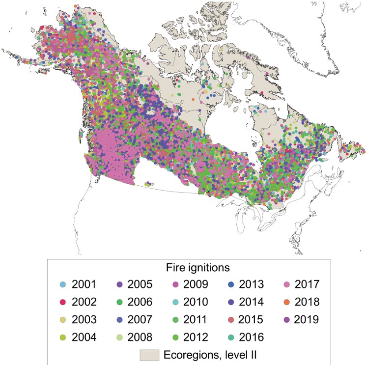
Figure 1. Fire ignition locations across Canada and Alaska, U.S., for 2001 - 2019. For Canada, temperate prairies, the Atlantic Highlands, and Mixed Wood Plains were not included.
Citation
Hessilt, T.D., B.M. Rogers, R.C. Scholten, S. Potter, T.A.J. Janssen, and S. Veraverbeke. 2023. ABoVE: Ignitions of ABoVE-FED Fires in Alaska and Canada. ORNL DAAC, Oak Ridge, Tennessee, USA. https://doi.org/10.3334/ORNLDAAC/2316
Table of Contents
- Dataset Overview
- Data Characteristics
- Application and Derivation
- Quality Assessment
- Data Acquisition, Materials, and Methods
- Data Access
- References
Dataset Overview
This dataset provides daily fire ignition locations and timing for boreal fires in Alaska, U.S., and Canada between 2001 and 2019. The fire ignition locations and timing are extracted from the Arctic–Boreal Vulnerability Experiment Fire Emission Database (ABoVE-FED) product (Potter et al., 2022); however, the temperate prairies of Canada, the Atlantic Highlands, and Mixed Wood Plains were not included. Fires were detected from Landsat differenced normalized burn ratio (dNBR) and the daily MODIS burned area and active fire products. Detections by dNBR were limited to fire perimeters from national fire databases. Fire ignition locations were retrieved using a local minimum within the fire perimeters. However, when fire locations were confounded due to simultaneous active fire detections, the fire ignition location was set as the centroid of these pixels. A spatial uncertainty equaling the standard deviation of the pixels' coordinates and the nominal nadir of 1000 m was applied to the fire ignition location. The temporal resolution of the ignition timing is within one day.
Project: ABoVE
The Arctic-Boreal Vulnerability Experiment (ABoVE) is a NASA Terrestrial Ecology Program field campaign being conducted in Alaska and western Canada, for 8 to 10 years, starting in 2015. Research for ABoVE links field-based, process-level studies with geospatial data products derived from airborne and satellite sensors, providing a foundation for improving the analysis, and modeling capabilities needed to understand and predict ecosystem responses to, and societal implications of, climate change in the Arctic and Boreal regions.
Related datasets
Potter, S., S. Veraverbeke, X.J. Walker, M.C. Mack, S.J. Goetz, J.L. Baltzer, C. Dieleman, N.H.F. French, E.S. Kane, M.R. Turetsky, E.B. Wiggins, and B.M. Rogers. 2022. ABoVE: Burned Area, Depth, and Combustion for Alaska and Canada, 2001-2019. ORNL DAAC, Oak Ridge, Tennessee, USA. https://doi.org/10.3334/ORNLDAAC/2063
- Provides burned area data
Scholten, R.C., S. Veraverbeke, R. Jandt, E.A. Miller, and B.M. Rogers. 2021. ABoVE: Ignitions, Burned Area, and Emissions of Fires in AK, YT, and NWT, 2001-2018. ORNL DAAC, Oak Ridge, Tennessee, USA. https://doi.org/10.3334/ORNLDAAC/1812
- Provides fire ignition data from Alaska, Yukon, and the Northwest Territories
Hall, D. K. and G. A. Riggs. 2016. MODIS/Terra Snow Cover Daily L3 Global 500m SIN Grid, Version 6. Boulder, Colorado USA. NASA National Snow and Ice Data Center Distributed Active Archive Center. https://doi.org/10.5067/MODIS/MOD10A1.006
- Provides MODIS and NSIDC snow cover data
Brodzik, M. J. and R. Armstrong. 2013. Northern Hemisphere EASE-Grid 2.0 Weekly Snow Cover and Sea Ice Extent, Version 4. Boulder, Colorado USA. NASA National Snow and Ice Data Center Distributed Active Archive Center. https://doi.org/10.5067/P7O0HGJLYUQU
- Provides MODIS and NSIDC snow cover data
Related publication
Hessilt, T.D., B.M. Rogers, R.C. Scholten, S. Potter, T.A. J. Janssen, and S. Veraverbeke. 2024. Geographically divergent trends in snow disappearance timing and fire ignitions across boreal North America. Biogeosciences 21:109–129. https://doi.org/10.5194/bg-21-109-2024
Acknowledgements
This project was funded by NASA's ABoVE program (grant NNX15AU56A).
Data Characteristics
Spatial Coverage: Alaska and Canada
ABoVE Reference Locations:
Domain: Core and Extended
Grid cells: Ah000v000, Ah000v001, Ah001v000, Ah001v001, Ah001v002, Ah001v003, Ah002v000, Ah002v001, Ah002v002,
Ah002v003, Ah003v000, Ah003v001, Ah003v002, Ah003v003, Ah004v001, Ah004v002, Ah004v003, Ah005v002
Spatial resolution: Points with 463 m location precision
Temporal coverage: 2001-01-01 to 2019-12-31
Temporal resolution: Daily
Study Areas (All latitude and longitude given in decimal degrees)
| Site | Westernmost Longitude | Easternmost Longitude | Northernmost Latitude | Southernmost Latitude |
|---|---|---|---|---|
| Alaska and Canada | -166.18901 | -52.8945 | 73.0144 | 44.9060 |
Data file information
There is one file in comma-separated values format (ignition_20012019_ak_canada.csv) and one shapefile provided in compressed zip archive (ignition_20012019_ak_canada_shapefile.zip).
The data include fire ignition locations, fire ignition timing, and fire ignition uncertainty (Table 1). Both files provide locations in geographic coordinates (WGS 84 datum, EPSG: 4326).
Table 1. Variables in ignition_20012019_ak_canada.csv and (ignition_20012019_ak_canada.zip.
| Variable | Units | Description |
|---|---|---|
| id | - | Record ID number |
| doy | d | Day of year of detected ignition |
| fireID | - | FireID number from ABoVE-Fire Emission Database (Potter et al., 2022) |
| year | y | Year of detected ignition |
| standard_deviation | m | Uncertainty in ignition location (SD) |
| longitude | degrees east | Location longitude in decimal degrees |
| latitude | degrees north | Location latitude in decimal degrees |
Application and Derivation
Fire is the most widespread ecosystem disturbance change in boreal North America and these increasing trends in fire occurrence are expected to continue in the future (Flannigan et al., 2005; Balshi et al., 2009; 49 Chen et al., 2021; Phillips et al., 2022). Relationships between snow disappearance and early season ignition timing across boreal North America between 2001 and 2019 were investigated. Results are reported in Hessilt et al. (2024).
Quality Assessment
The retrieval of ignition timing and location was adapted from Scholten et al. (2021a). This algorithm uses the spatiotemporal information in the ABoVE-FED burned area product to delineate individual fire perimeters and a minimum search radius to detect the location of each unique ignition spatially and temporally. Since burned area pixels in boreal regions can be discontinuous due to varying fire severity and possibly omitted pixels, different buffer sizes (1 km and 2 km) were applied to group the fire pixels into fire perimeters. Several combinations of the fire perimeter buffers (1 km and 2 km), search radii (5 km, 7.5 km, 10 km, and 15 km), and minimum fire sizes (i.e., exclusion of fires from 1 or 2 individual burned pixels) were examined to minimize the commission and omission errors. These three fire size thresholds were tested because the single or double-pixel burned areas could be small anthropogenic fires or commission errors.
The results were compared to the ignitions present in the Alaskan Fire Emission Database (AKFED) version 2 (Scholten et al., 2021b). Ignition locations and timing retrieved inside 2 km buffered fire perimeters were used, using a 7.5 km search radius for fires larger than 50 ha because these parameters agreed with the AKFED-derived ignitions; single pixel and two-pixel fires were removed . These criteria led to an exclusion of 15% of ignition locations compared to an inclusion of all fire sizes. In Alaska, Yukon, and the Canadian Northwest Territories, approximately 6% more ignitions were found in ABoVE-FED compared to AKFED. There was a 76% overlap between the two ignition datasets.
Uncertainty in ignition locations is provided by the standard_deviation variable in the files.
Data Acquisition, Materials, and Methods
The location and timing of the fire ignitions, and their associated burned area, were derived from the Arctic-Boreal Vulnerability Experiment Fire Emission Database (ABoVE-FED) product (Potter et al., 2022). The ABoVE-FED burned area product covers Alaska and Canada (2001-2019); the temperate prairies of Canada, the Atlantic Highlands, and Mixed Wood Plains were not included. The ABoVE-FED burned area is derived from thresholding the differenced normalized burn ratio (dNBR) from Landsat imagery at 30-m resolution complemented by MODIS surface reflectance products at 500- m resolution (MOD09GA and MYD09GY v6) when no Landsat data were available. Fire ignition locations were retrieved using a local minimum within the fire perimeters. However, with confounding fire locations due to simultaneous active fire detection, the fire ignition location was set as the centroid of these pixels.
The dNBR thresholding within the ABoVE-FED product was limited to the fire perimeters from the Alaskan Large Fire Database (ALFD, Kasischke et al., 2002) and the Canadian National Fire Database (CNFDB, Stocks et al., 2002), as well as MODIS active fire locations and their surroundings to minimize commission errors from non-fire disturbances (Veraverbeke et al., 2015; Potter et al., 2023).
The retrieval of ignition timing and location was adapted from Scholten et al. (2021b). This algorithm uses the spatiotemporal information in the ABoVE-FED burned area product to delineate individual fire perimeters and a minimum search radius to detect the location of each unique ignition spatially and temporally. Since burned area pixels in boreal regions can be discontinuous due to varying fire severity and possibly omitted pixels, different buffers (1 km and 2 km) were applied to group the fire pixels into fire perimeters. Several combinations of the fire perimeter buffers (1 and 2 km), search radii (5, 7.5, 10, and 15 km), and minimum fire sizes (i.e., exclusion of fires from 1 or 2 individual burned pixels) were examined to minimize the commission and omission errors. For example, single- or double-pixel burned areas could be small anthropogenic fires or commission errors.
Details of methods and subsequent analysis are available in Hessilt et al. (2024).
Data Access
These data are available through the Oak Ridge National Laboratory (ORNL) Distributed Active Archive Center (DAAC).
ABoVE: Ignitions of ABoVE-FED Fires in Alaska and Canada
Contact for Data Center Access Information:
- E-mail: uso@daac.ornl.gov
- Telephone: +1 (865) 241-3952
References
Balshi, M.S., A.D. McGuire, P. DUFFY, M. Flannigan, J. Walsh, And J. Melillo. 2009. Assessing the response of area burned to changing climate in western boreal North America using a Multivariate Adaptive Regression Splines (MARS) approach. Global Change Biology 15:578–600. https://doi.org/10.1111/j.1365-2486.2008.01679.x
Brodzik, M.J. and R. Armstrong. 2013. Northern Hemisphere EASE-Grid 2.0 Weekly Snow Cover and Sea Ice Extent, Version 4. Boulder, Colorado USA. NASA National Snow and Ice Data Center Distributed Active Archive Center. https://doi.org/10.5067/P7O0HGJLYUQU
Chen, Y., D.M. Romps, J.T. Seeley, S. Veraverbeke, W.J. Riley, Z.A. Mekonnen, and J.T. Randerson. 2021. Future increases in Arctic lightning and fire risk for permafrost carbon. Nature Climate Change 11:404–410. https://doi.org/10.1038/s41558-021-01011-y
Flannigan, M.D., K.A. Logan, B.D. Amiro, W.R. Skinner, and B.J. Stocks. 2005. Future area burned in Canada. Climatic Change 72:1–16. https://doi.org/10.1007/s10584-005-5935-y
Hall, D.K. and G.A. Riggs. 2016. MODIS/Terra Snow Cover Daily L3 Global 500m SIN Grid, Version 6. Boulder, Colorado USA. NASA National Snow and Ice Data Center Distributed Active Archive Center. https://doi.org/10.5067/MODIS/MOD10A1.006
Hessilt, T.D., B.M. Rogers, R.C. Scholten, S. Potter, T.A. J. Janssen, and S. Veraverbeke. 2024. Geographically divergent trends in snow disappearance timing and fire ignitions across boreal North America. Biogeosciences 21:109–129. https://doi.org/10.5194/bg-21-109-2024
Kasischke, E.S., D. Williams, and D. Barry. 2002. Analysis of the patterns of large fires in the boreal forest region of Alaska. International Journal of Wildland Fire 11:131-144. https://doi.org/10.1071/WF02023
Phillips, C.A., B.M. Rogers, M. Elder, S. Cooperdock, M. Moubarak, J.T. Randerson, and P.C. Frumhoff. 2022. Escalating carbon emissions from North American boreal forest wildfires and the climate mitigation potential of fire management. Science Advances 8:eabl7161. https://doi.org/10.1126/sciadv.abl7161
Potter, S., S. Cooperdock, S. Veraverbeke, X. Walker, M.C. Mack, S.J. Goetz, J. Baltzer, L. Bourgeau-Chavez, A. Burrell, C. Dieleman, N. French, S. Hantson, E.E. Hoy, L. Jenkins, J.F. Johnstone, E.S. Kane, S.M. Natali, J.T. Randerson, M.R. Turetsky, E. Whitman, E. Wiggins, and B.M. Rogers. 2023. Burned area and carbon emissions across northwestern boreal North America from 2001–2019. Biogeosciences 20:2785–2804. https://doi.org/10.5194/bg-20-2785-2023.
Potter, S., S. Veraverbeke, X.J. Walker, M.C. Mack, S.J. Goetz, J.L. Baltzer, C. Dieleman, N.H.F. French, E.S. Kane, M.R. Turetsky, E.B. Wiggins, and B.M. Rogers. 2022. ABoVE: Burned Area, Depth, and Combustion for Alaska and Canada, 2001-2019. ORNL DAAC, Oak Ridge, Tennessee, USA. https://doi.org/10.3334/ORNLDAAC/2063
Scholten, R.C., S. Veraverbeke, R. Jandt, E.A. Miller, and B.M. Rogers. 2021a. ABoVE: Ignitions, Burned Area, and Emissions of Fires in AK, YT, and NWT, 2001-2018. ORNL DAAC, Oak Ridge, Tennessee, USA. https://doi.org/10.3334/ORNLDAAC/1812
Scholten, R.C., R. Jandt, E.A. Miller, B.M. Rogers, and S. Veraverbeke. 2021b. Overwintering fires in boreal forests, Nature 593:399–404. https://doi.org/10.1038/s41586-021-03437-y.
Stocks, B.J., J.A. Mason, J.B. Todd, E.M. Bosch, B.M. Wotton, B.D. Amiro, M.D. Flannigan, K.G. Hirsch, K.A. Logan, D.L. Martell, and W.R. Skinner. 2002. Large forest fires in Canada, 1959–1997. Journal of Geophysical Research: Atmospheres 107:8149. https://doi.org/10.1029/2001jd000484
Veraverbeke, S., B.M. Rogers, and J.T. Randerson. 2015. Daily burned area and carbon emissions from boreal fires in Alaska. Biogeosciences 12:3579–3601. https://doi.org/10.5194/bg-12-3579-2015