![]() The BOREAS Information System
The BOREAS Information System
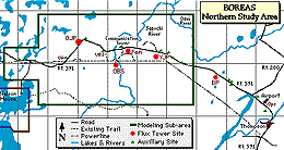
This long table contains complete positional information on every site where data was taken in the Northern Study Area (NSA). Click here to see the Southern Study Area (SSA) Site Reference Table, or the Regional (REG) Site Reference Table, or the Transect (TRN) Site Reference Table.
Note: This is a very big page, please wait for it to load.
| BOREAS Site Name | Sub-Site | Location Description | Latitude | Longitude | UTM Zone | UTM Easting | UTM Northing | Elevation (m ASL) | BOREAS X | BOREAS Y | Comments (Location, Soil, Vegetation Info.) |
|---|---|---|---|---|---|---|---|---|---|---|---|
| NSA-999-99FW2 | TGB12-CON01 | Gillam Road |
14 |
Near 89/90 marker on Gillam Road. | |||||||
| NSA-999-99FW3 | TGB12-CON01 | Gillam Road |
14 |
Near 89/90 marker on Gillam Road. | |||||||
| NSA-999-99FW9 | TGB12-CON01 | Gillam Road |
14 |
Gillam Road 1992 burn, near 89/90 km marker on Gillam Road, Lake Aggasiz Clay, dead standing black spruce. | |||||||
| NSA-999-99GR1 | TGB12-CON01 | Gillam Road | 55.9055 | 97.7087 |
14 |
Gillam Road 1964 burn site. East of Ag Canadas temperature-probe trail on north side of Gillam Road to the east of the Gillam Road Cabin. Stongly aggregated lacustrine clay, Jack pine and Black Spruce. | |||||
| NSA-999-99GR2 | TGB12-CON01 | Gillam Road | 55.9082 | 97.7003 |
14 |
Gillam Road, 17 km from turn off on Hwy 280, about 0.2 km NE of the cabin. It is used as a control for the 1964 fire scar. Black Spruce. | |||||
| NSA-999-99GR3 | TGB12-CON01 | Gillam Road | 55.906 | 97.7098 |
14 |
Gillam Road, 17 km from turn off on Hwy 280, North of the road, down the Ag Canada trail to the wet. Small black spruce and small pine. | |||||
| NSA-999-99GR4 | TGB12-CON01 | Gillam Road | 55.9041 | 97.7063 |
14 |
This site is used as a relatively unburned control site for 1964 fire, it is across Hwy 280 from the cabin, up trail about 70 m and to the left. It is in the unburned edge of the 1964 fire scar. Black Spruce. | |||||
| NSA-999-99GR5 | TGB12-CON01 | Gillam Road | 55.9055 | 97.7087 |
14 |
Gillam Road, 17 km from turn off on Hwy 280, North down the Ag Canada trail, west of the cabin. Aggregated well drained clay soil. 10m jack pine and 1-2m black spruce. | |||||
| NSA-999-99NW1 | HYD09-SGNW1 | Stream Gauge NW-1 | 55.90877 | -98.49168 |
14 |
531777.2 | 6196042.5 | 213.76 | 777.011 | 616.549 | |
| NSA-999-99NW2 | HYD09-SGNW2 | Stream Gauge NW-2 | 55.91528 | -98.52746 |
14 |
529535.5 | 6196751.8 | 210.69 | 774.683 | 616.865 | |
| HYD09-BRGN2 | Belfort Rain Gauge near Stream Gauge NW-2 | 55.91528 | -98.52806 |
14 |
529498.4 | 6196750.9 | 774.646 | 616.857 | |||
| NSA-999-99NW3 | HYD09-BRGN3 | Belfort Rain Gauge near Stream Gauge NW-3 | 55.91686 | -98.37603 |
14 |
538999 | 6197002.4 | 783.954 | 618.733 | ||
| HYD09-SGNW3 | Stream Gauge NW-3 | 55.91683 | -98.37563 |
14 |
539023.8 | 6196999.2 | 211.42 | 783.979 | 618.734 | ||
| NSA-999-9FW10 | TGB12-CON01 | Gillam Road |
14 |
Gillam Road 1992 burn, near 89/90 km marker on Gillam Road. Lake Aggasiz Clay. Dead standing black spruce. | |||||||
| NSA-999-9GRS1 | TGB12-CON01 | Gillam Road |
14 |
Gillam Road, 1994 burn. Well drained sand. Black spruce and aspen, charred moss. | |||||||
| BOREAS Site Name | Sub-Site | Location Description | Latitude | Longitude | UTM Zone | UTM Easting | UTM Northing | Elevation (m ASL) | BOREAS X | BOREAS Y | Comments (Location, Soil, Vegetation Info.) |
| NSA-999-AFM06 | AFM06-CDR01 | AFM06 cloud radar located 1km WNW of OJP tower. | 55.93333 | -98.60611 |
|
290 | 769.493 | 617.973 | |||
| NSA-999-BRG21 | HYD09-BRG21 | Belfort Rain Gauge 21 | 55.88857 | -98.41114 |
14 |
536831.3 | 6193834.4 | 782.365 | 615.235 | ||
| NSA-999-BRG22 | HYD09-BRG22 | Belfort Rain Gauge 22 | 55.77653 | -98.49892 |
14 |
531431.4 | 6181321.8 | 779.2 | 601.961 | ||
| NSA-999-BRG23 | HYD09-BRG23 | Belfort Rain Gauge 23 | 55.89147 | -98.55822 |
14 |
527629.8 | 6194089 | 773.264 | 613.91 | ||
| NSA-999-BRG24 | HYD09-BRG24 | Belfort Rain Gauge 24 | 55.91236 | -98.34275 |
14 |
541083.6 | 6196520.8 | 786.088 | 618.615 | ||
| NSA-999-BRG25 | HYD09-BRG25 | Belfort Rain Gauge 25 | 55.92661 | -98.566 |
14 |
527118.8 | 6197996.7 | 772.09 | 617.679 | ||
| NSA-999-GMR02 | TGB12-CON01 | East of Ag Canadas temperature probe trail on north side of Gillam Road. | 55.9055 | -97.70872 |
14 |
580728.1 | 6196315.4 | 825.142 | 625.2 | Site is recovering from 1964 burn with 3m tall jack pine interspersed with 1 to 2 m tall black spruce. | |
| NSA-999-GMR02 | TGB12-FLX01 | East of Ag Canadas temperature probe trail on north side of Gillam Road. | 55.9055 | -97.70872 |
14 |
580728.1 | 6196315.4 | 825.142 | 625.2 | Site is recovering from 1964 burn with 3m tall jack pine interspersed with 1 to 2 m tall black spruce. | |
| NSA-999-GMR05 | TGB12-IST01 | East of Ag Canadas temperature probe trail on north side of Gillam Road. | 55.90539 | -97.70845 |
14 |
580729.4 | 6196315.5 | 825.142 | 625.2 | Site is among earth hummocks, and upper soil horizons vary in thickness above a horizon. | |
| NSA-999-GRC12 | TGB12-CON01 | Gillam Road |
14 |
Gillam Road unburned control for 1992 burn, near 89/90 km marker on Gillam Road, North side of road, across from 1992 burn. Lake Aggasiz Clay. Black Spruce. | |||||||
| NSA-999-GRC13 | TGB12-CON01 | Gillam Road |
14 |
Gillam Road unburned control for 1992 burn, near 89/90 km marker on Gillam Road, North side of road, across from 1992 burn. Lake Aggasiz Clay. Black Spruce. | |||||||
| NSA-999-GRJ11 | TGB12-CON01 | Gillam Road |
14 |
Gillam Road Cabin site, 1964 burn. Lake Aggasiz Clay. Young black spruce, jack pine. | |||||||
| NSA-999-GRMJ1 | TGB12-CON01 | Gillam Road | 55.9055 | 97.7087 |
14 |
GRMJ transect starts 100m SW of so82715C, where GR5 was sampled in detail and continues SW parallel to road with sampling approximately every 100m. | |||||
| NSA-999-GRMJ2 | TGB12-CON01 | Gillam Road | 55.9055 | 97.7087 |
14 |
GRMJ transect starts 100m SW of so82715C, where GR5 was sampled in detail and continues SW parallel to road with sampling approximately every 100m. | |||||
| NSA-999-GRMJ3 | TGB12-CON01 | Gillam Road | 55.9055 | 97.7087 |
14 |
GRMJ transect starts 100m SW of so82715C, where GR5 was sampled in detail and continues SW parallel to road with sampling approximately every 100m. | |||||
| NSA-999-GRMJ4 | TGB12-CON01 | Gillam Road | 55.9055 | 97.7087 |
14 |
GRMJ transect starts 100m SW of so82715C, where GR5 was sampled in detail and continues SW parallel to road with sampling approximately every 100m. | |||||
| NSA-999-GRMJ5 | TGB12-CON01 | Gillam Road | 55.9055 | 97.7087 |
14 |
GRMJ transect starts 100m SW of so82715C, where GR5 was sampled in detail and continues SW parallel to road with sampling approximately every 100m. | |||||
| NSA-999-GRMJ6 | TGB12-CON01 | Gillam Road | 55.9055 | 97.7087 |
14 |
GRMJ transect starts 100m SW of so82715C, where GR5 was sampled in detail and continues SW parallel to road with sampling approximately every 100m. | |||||
| NSA-999-GRMJ7 | TGB12-CON01 | Gillam Road | 55.9055 | 97.7087 |
14 |
GRMJ transect starts 100m SW of so82715C, where GR5 was sampled in detail and continues SW parallel to road with sampling approximately every 100m. | |||||
| BOREAS Site Name | Sub-Site | Location Description | Latitude | Longitude | UTM Zone | UTM Easting | UTM Northing | Elevation (m ASL) | BOREAS X | BOREAS Y | Comments (Location, Soil, Vegetation Info.) |
| NSA-999-T06GR | TGB06-CON01 | Gilliam Road | 55.89004 | -97.74716 |
14 |
6194550.9 | 823.111 | 623.053 | CH4 concentration data along Gillam Road. | ||
| NSA-999-THO01 | STAFF-HISDY | Historic data site for Thompson containing daily met data. | 55.8 | -97.87 |
|
Station identifier number 5062922 | |||||
| STAFF-HISHY | Historic data site for Thompson containing hourly met data. | 55.8 | -97.87 |
|
Station identifier number 5062922 | ||||||
| NSA-999-TRG21 | HYD09-TRG21 | Tipping Bucket Rain Gauge 21 | 55.91236 | -98.34275 |
14 |
541083.5 | 6196520.9 | 225.77 | 786.088 | 618.615 | |
| NSA-999-TRG22 | HYD09-TRG22 | Tipping Bucket Rain Gauge 22 | 55.88842 | -98.43671 |
14 |
535232.4 | 6193804.8 | 238.87 | 780.796 | 614.932 | |
| NSA-999-TRG23 | HYD09-TRG23 | Tipping Bucket Rain Gauge 23 | 55.88866 | -98.37767 |
14 |
538924.3 | 6193863.3 | 234.85 | 784.42 | 615.622 | |
| NSA-999-TRG24 | HYD09-TRG24 | Tipping Bucket Rain Gauge 24 | 55.92662 | -98.56599 |
14 |
527119.1 | 6197997.7 | 229.16 | 772.09 | 617.68 | |
| NSA-999-TRG25 | HYD09-TRG25 | Tipping Bucket Rain Gauge 25 | 55.91119 | -98.44883 |
14 |
534453.7 | 6196333.1 | 779.595 | 617.294 | ||
| NSA-999-TRG26 | HYD09-TRG26 | Tipping Bucket Rain Gauge 26 | 55.88856 | -98.4111 |
14 |
536833.8 | 6193833 | 782.367 | 615.234 | ||
| NSA-999-TRG27 | HYD09-TRG27 | Tipping Bucket Rain Gauge 27 | 55.89147 | -98.55822 |
14 |
527629.8 | 6194089 | 773.264 | 613.91 | ||
| NSA-999-TRG29 | HYD09-TRG29 | Tipping Bucket Rain Gauge 29 | 55.9112 | -98.6155 |
14 |
524035.3 | 6196263.2 | 769.353 | 615.44 | ||
| NSA-999-WTH01 | RSS11-SPH01 | RSS-11 handheld sunphotometer in Thompson. |
14 |
Handheld measurements were taken by Mary Block at her residence in Thompson | |||||||
| NSA-999-WTH02 | RSS11-SPH01 | RSS-11 automated sunphotometer in Thompson during 1995 and 1996. Co-located with the AMS site at the Thompson Zoo. | 55.75 | -97.8867 |
14 |
571137 | 6178837 | 206 | 818.7 | 606.3 | |
| AFM05-AES02 | The AES upper air site at the zoo in Thompson, MB | 55.75 | -97.8867 |
14 |
571137 | 6178837 | 206 | 818.7 | 606.3 | Radiosondes released at south end of zoo operations building. | |
| NSA-999-YTH01 | RSS11-SPH01 | RSS-11 automated sunphotometer at Thompson Airport in 1994. | 55.78344 | -97.83359 |
14 |
573151.1 | 6182593.1 | 218 | 820.04 | 610.36 | In 1994 the instrument traveled between Thompson and Prince Albert airports depending upon which site was "hot", the instrument was moved to Thompson Zoo for 1995 and 1996 seasons. |
| NSA-9BS-9TETR Also called NSA-UBS |
9TE06-WRP01 | Water potential measurements | 55.90802 | -98.51865 |
14 |
530092 | 6195947 | 239.51 | 775.369 | 616.166 | Measurements taken at the TE-Black Spruce Auxillary site |
| 9TE09-DIR01 | TE_Black Spruce Auxiliary Canopy access site | 55.90802 | -98.51865 |
14 |
530092 | 6195947 | 239.51 | 775.369 | 616.166 | Diurnal measurements | |
| 9TE05-CO2P1 | NSA TE black spruce site | 55.90802 | -98.51865 |
14 |
530092 | 6195947 | 239.51 | 775.369 | 616.166 | Measurements taken at the TE-Black Spruce Auxillary site | |
| 9TE09-CHL01 | TE_Black Spruce Auxiliary Canopy access site | 55.90802 | -98.51865 |
14 |
530092 | 6195947 | 239.51 | 775.369 | 616.166 | Chlorophyll measurements | |
| 9TE09-PRN01 | TE_Black Spruce Auxiliary Canopy access site | 55.90802 | -98.51865 |
14 |
530092 | 6195947 | 239.51 | 775.369 | 616.166 | PAR and nitrogen measurements | |
| 9TE09-BCP01 | TE_Black Spruce Auxiliary Canopy access site | 55.90802 | -98.51865 |
14 |
530092 | 6195947 | 239.51 | 775.369 | 616.166 | Biochemistry measurements | |
| 9TE09-NPH01 | TE_Black Spruce Auxiliary Canopy access site | 55.90802 | -98.51865 |
14 |
530092 | 6195947 | 239.51 | 775.369 | 616.166 | Nitrogen and photosynthesis measurements | |
| 9TE09-BCA01 | TE_Black Spruce Auxiliary Canopy access site | 55.90802 | -98.51865 |
14 |
530092 | 6195947 | 239.51 | 775.369 | 616.166 | Biochemistry measurements | |
| 9TE05-TRC01 | NSA TE black spruce site | 55.90802 | -98.51865 |
14 |
530092 | 6195947 | 239.51 | 775.369 | 616.166 | Tree ring measurements taken around the te-Black spruce aux site | |
| 9TE05-AIS01 | NSA TE black spruce site | 55.90802 | -98.51865 |
14 |
530092 | 6195947 | 239.51 | 775.369 | 616.166 | Stable air isotope measurments taken at the TE BS site | |
| HYD04-SWE01 | NTS, This course is located off highway #391 along the access trail to the old black spruce flux tower site. | 55.90621 | -98.50308 |
14 |
531067 | 6195752.2 | 776.362 | 616.14 | HYD-04 snow water equivalent measurements site. | ||
| STAFF-AUX11 | 55.90802 | -98.51865 |
14 |
530092 | 6195947 | 239.51 | 775.369 | 616.166 | Auxiliary Site, Carbon Model Evaluation, Categoty II, and Intensive Allometry Site. | ||
| 9TE05-LCI01 | NSA TE black spruce site | 55.90802 | -98.51865 |
14 |
530092 | 6195947 | 239.51 | 775.369 | 616.166 | Measurements taken near TE BS site | |
| 9TE05-MET01 | NSA TE black spruce site | 55.90802 | -98.51865 |
14 |
530092 | 6195947 | 239.51 | 775.369 | 616.166 | MEterologcial measurments taken at the TE BS site | |
| 9TE05-SXC01 | NSA TE black spruce site | 55.90802 | -98.51865 |
14 |
530092 | 6195947 | 239.51 | 775.369 | 616.166 | Soil gas exchange measurments taken at the TE BS site | |
| 9TE05-LGS01 | NSA TE black spruce site | 55.90802 | -98.51865 |
14 |
530092 | 6195947 | 239.51 | 775.369 | 616.166 | Leaf Gas exchange measurements. | |
| 9TE20-SOL01 | 55.90802 | -98.51865 |
14 |
530092 | 6195947 | 239.51 | 775.369 | 616.166 | Differential GPS from Darcy Snell | ||
| 9TE06-NPP01 | TE_Black Spruce Auxiliary Canopy access site | 55.90802 | -98.51865 |
14 |
530092 | 6195947 | 239.51 | 775.369 | 616.166 | ||
| BOREAS Site Name | Sub-Site | Location Description | Latitude | Longitude | UTM Zone | UTM Easting | UTM Northing | Elevation (m ASL) | BOREAS X | BOREAS Y | Comments (Location, Soil, Vegetation Info.) |
| NSA-9BS-AUX01 | STAFF-AUX01 | 55.76824 | -97.84024 |
14 |
572761.9 | 6180894.9 | 184.88 | 819.951 | 608.618 | Category III Auxiliary Site | |
| 9TE06-NPP01 | 55.76824 | -97.84024 |
14 |
572761.9 | 6180894.9 | 184.88 | 819.951 | 608.618 | Auxiliary Site | ||
| NSA-9BS-AUX02 | STAFF-AUX02 | 55.78239 | -97.80937 |
14 |
574671.7 | 6182502 | 167.17 | 821.554 | 610.531 | Category III Auxiliary Site | |
| 9TE06-NPP01 | 55.78239 | -97.80937 |
14 |
574671.7 | 6182502 | 167.17 | 821.554 | 610.531 | Auxiliary Site | ||
| NSA-9BS-AUX03 | STAFF-AUX03 | 55.83083 | -97.98339 |
14 |
563679.1 | 6187719.2 | 194.55 | 809.839 | 613.798 | Category III Auxiliary Site | |
| 9TE06-NPP01 | 55.83083 | -97.98339 |
14 |
563679.1 | 6187719.2 | 194.55 | 809.839 | 613.798 | Auxiliary Site | ||
| NSA-9BS-AUX04 | STAFF-AUX04 | 55.83455 | -97.98364 |
14 |
563657.5 | 6188132.8 | 197.03 | 809.747 | 614.202 | Category III Auxiliary Site | |
| 9TE06-NPP01 | 55.83455 | -97.98364 |
14 |
563657.5 | 6188132.8 | 197.03 | 809.747 | 614.202 | Auxiliary Site | ||
| NSA-9BS-AUX05 | STAFF-AUX05 | 55.83913 | -97.99325 |
14 |
563048.2 | 6188633.4 | 205.03 | 809.061 | 614.592 | Category III Auxiliary Site | |
| 9TE06-NPP01 | 55.83913 | -97.99325 |
14 |
563048.2 | 6188633.4 | 205.03 | 809.061 | 614.592 | Auxiliary Site | ||
| NSA-9BS-AUX06 | STAFF-AUX06 | 55.87968 | -98.18658 |
14 |
550887.9 | 6192987.9 | 200.6 | 796.345 | 616.807 | Category III Auxiliary Site | |
| 9TE06-NPP01 | 55.87968 | -98.18658 |
14 |
550887.9 | 6192987.9 | 200.6 | 796.345 | 616.807 | Auxiliary Site | ||
| NSA-9BS-AUX07 | STAFF-AUX07 | 55.88351 | -98.80225 |
14 |
512370.1 | 6193132 | 237.56 | 758.41 | 610.352 | Category III Auxiliary Site | |
| 9TE06-NPP01 | 55.88351 | -98.80225 |
14 |
512370.1 | 6193132 | 237.56 | 758.41 | 610.352 | Auxiliary Site | ||
| NSA-9BS-AUX08 | STAFF-AUX08 | 55.88371 | -98.82345 |
14 |
511043.9 | 6193151.1 | 239.72 | 757.101 | 610.143 | Category III Auxiliary Site | |
| 9TE06-NPP01 | 55.88371 | -98.82345 |
14 |
511043.9 | 6193151.1 | 239.72 | 757.101 | 610.143 | Auxiliary Site | ||
| NSA-9BS-AUX09 | STAFF-AUX09 | 55.89358 | -98.22621 |
14 |
548391.8 | 6194505.6 | 199.86 | 793.628 | 617.877 | Category III Auxiliary Site | |
| 9TE06-NPP01 | 55.89358 | -98.22621 |
14 |
548391.8 | 6194505.6 | 199.86 | 793.628 | 617.877 | Auxiliary Site | ||
| NSA-9BS-AUX10 | STAFF-AUX10 | 55.9061 | -97.70986 |
14 |
580655.5 | 6196380.8 | 175.59 | 825.06 | 625.252 | Category III Auxiliary Site | |
| 9TE06-NPP01 | 55.9061 | -97.70986 |
14 |
580655.5 | 6196380.8 | 175.59 | 825.06 | 625.252 | Auxiliary Site | ||
| NSA-9BS-AUX12 | STAFF-AUX12 | BIL-21 | 55.91021 | -97.70281 |
14 |
581087.8 | 6196846.5 | 825.405 | 625.786 | Carbon Model Evaluation, Category II, and Intensive Allometry Site. | |
| 9TE06-NPP01 | BIL-21 | 55.91021 | -97.70281 |
14 |
581087.8 | 6196846.5 | 825.405 | 625.786 | |||
| NSA-9BS-AUX13 | STAFF-AUX13 | 55.91506 | -98.44877 |
14 |
534454.5 | 6196763.6 | 234.05 | 779.522 | 617.719 | Category III Auxiliary Site | |
| 9TE06-NPP01 | 55.91506 | -98.44877 |
14 |
534454.5 | 6196763.6 | 234.05 | 779.522 | 617.719 | Auxiliary Site | ||
| NSA-9BS-AUX14 | STAFF-AUX14 | 55.9161 | -98.64022 |
14 |
522487.2 | 6196800.5 | 237.12 | 767.737 | 615.705 | Category III Auxiliary Site | |
| 9TE06-NPP01 | 55.9161 | -98.64022 |
14 |
522487.2 | 6196800.5 | 237.12 | 767.737 | 615.705 | Auxiliary Site | ||
| NSA-9BS-AUX15 | STAFF-AUX15 | 55.91689 | -98.37111 |
14 |
539306.4 | 6197008.6 | 219.54 | 784.255 | 618.792 | Category III Auxiliary Site | |
| 9TE06-NPP01 | 55.91689 | -98.37111 |
14 |
539306.4 | 6197008.6 | 219.54 | 784.255 | 618.792 | Auxiliary Site | ||
| BOREAS Site Name | Sub-Site | Location Description | Latitude | Longitude | UTM Zone | UTM Easting | UTM Northing | Elevation (m ASL) | BOREAS X | BOREAS Y | Comments (Location, Soil, Vegetation Info.) |
| NSA-9BS-FCA01 | FORCN-4BIMC | BIM-12a Plot4 | 55.8306 | -97.98158 |
14 |
563793.1 | 6187695.6 | 809.956 | 613.794 | Forestry Canada Plot | |
| FORCN-5BIMC | BIM-12a Plot5 | 55.82935 | -97.98387 |
14 |
563651.7 | 6187554.1 | 809.841 | 613.63 | Forestry Canada Plot | ||
| FORCN-1BIMC | BIM-12a Plot 1 | 55.83069 | -97.98429 |
14 |
563623.1 | 6187702.4 | 809.787 | 613.772 | Forestry Canada Plot | ||
| FORCN-6BIMC | BIM-12a Plot6 | 55.8304 | -97.9849 |
14 |
563585.4 | 6187669.6 | 809.756 | 613.733 | Forestry Canada Plot | ||
| FORCN-3BIMC | BIM-12a Plot3 | 55.82927 | -97.98116 |
14 |
563821.7 | 6187547.3 | 810.009 | 613.653 | Forestry Canada Plot | ||
| FORCN-2BIMC | BIM-12a Plot2 | 55.82998 | -97.98272 |
14 |
563722.4 | 6187624.8 | 809.898 | 613.712 | Forestry Canada Plot | ||
| NSA-9BS-FCA02 | FORCN-2BIH1 | BIH-1a Plot2 | 55.83329 | -97.98122 |
14 |
563811.4 | 6187995.3 | 809.922 | 614.093 | Forestry Canada Plot | |
| FORCN-7BIH1 | BIH-1a Plot7 | 55.8335 | -97.97975 |
14 |
563903.1 | 6188019.9 | 810.008 | 614.133 | Forestry Canada Plot | ||
| FORCN-9BIH1 | BIH-1a Plot9 | 55.83191 | -97.97442 |
14 |
564239.2 | 6187847.7 | 810.369 | 614.021 | Forestry Canada Plot | ||
| FORCN-8BIH1 | BIH-1a Plot8 | 55.83194 | -97.97776 |
14 |
564030.2 | 6187847.7 | 810.163 | 613.985 | Forestry Canada Plot | ||
| FORCN-1BIH1 | BIH-1a Plot 1 | 55.83429 | -97.9843 |
14 |
563616.3 | 6188103.4 | 809.712 | 614.166 | Forestry Canada Plot | ||
| FORCN-6BIH1 | BIH-1a Plot6 | 55.83429 | -97.98309 |
14 |
563692.3 | 6188104.8 | 809.786 | 614.181 | Forestry Canada Plot | ||
| FORCN-3BIH1 | BIH-1a Plot3 | 55.83248 | -97.97915 |
14 |
563942.3 | 6187907 | 810.066 | 614.028 | Forestry Canada Plot | ||
| FORCN-4BIH1 | BIH-1a Plot4 | 55.8322 | -97.97841 |
14 |
563988.8 | 6187875.7 | 810.117 | 614.005 | Forestry Canada Plot | ||
| FORCN-5BIH1 | BIH-1a Plot5 | 55.83405 | -97.98537 |
14 |
563550 | 6188075.3 | 809.651 | 614.127 | Forestry Canada Plot | ||
| NSA-9BS-FCA03 | FORCN-2BIM1 | BIM-1a Plot2 | 55.83883 | -97.98997 |
14 |
563254.2 | 6188603.7 | 809.269 | 614.598 | Forestry Canada Plot | |
| FORCN-3BIM1 | BIM-1a Plot3a | 55.84085 | -97.9884 |
14 |
563349.2 | 6188829.9 | 809.324 | 614.837 | Forestry Canada Plot | ||
| FORCN-4BIM1 | BIM-1a Plot4 | 55.83927 | -97.99142 |
14 |
563162.4 | 6188650.5 | 809.171 | 614.628 | Forestry Canada Plot | ||
| FORCN-1BIM1 | BIM-1a Plot 1 | 55.83862 | -97.99144 |
14 |
563162.4 | 6188579.1 | 809.183 | 614.558 | Forestry Canada Plot | ||
| FORCN-6BIM1 | BIM-1a Plot6 | 55.84221 | -97.98878 |
14 |
563323.4 | 6188980.7 | 809.273 | 614.982 | Forestry Canada Plot | ||
| FORCN-7BIM1 | BIM-1a Plot7 | 55.8405 | -97.98889 |
14 |
563319.2 | 6188790 | 809.301 | 614.793 | Forestry Canada Plot | ||
| FORCN-5BIM1 | BIM-1a Plot5 | 55.83947 | -97.99001 |
14 |
563250.4 | 6188674.6 | 809.253 | 614.667 | Forestry Canada Plot | ||
| NSA-9BS-FCA04 | FORCN-2BIL2 | BIL-2 Plot2 | 55.87981 | -98.18888 |
14 |
550743.7 | 6193000.1 | 796.201 | 616.794 | Forestry Canada Plot | |
| FORCN-1BIL2 | BIL-2 Plot 1 | 55.87968 | -98.18713 |
14 |
550853.9 | 6192986.6 | 796.312 | 616.8 | Forestry Canada Plot | ||
| FORCN-3BIL2 | BIL-2 Plot3 | 55.8796 | -98.19062 |
14 |
550635.6 | 6192975.2 | 796.099 | 616.751 | Forestry Canada Plot | ||
| NSA-9BS-FCA05 | FORCN-4BMM8 | BMM-8a Plot4 | 55.88588 | -98.82242 |
14 |
511108 | 6193392.6 | 757.123 | 610.393 | Forestry Canada Plot | |
| FORCN-5BMM8 | BMM-8a Plot5 | 55.88334 | -98.82387 |
14 |
511018.1 | 6193110 | 757.083 | 610.098 | Forestry Canada Plot | ||
| FORCN-6BMM8 | BMM-8a Plot6 | 55.88484 | -98.8245 |
14 |
510978.4 | 6193277 | 757.015 | 610.256 | Forestry Canada Plot | ||
| FORCN-1BMM8 | BMM-8a Plot 1 | 55.88326 | -98.82297 |
14 |
511074 | 6193101.4 | 757.139 | 610.099 | Forestry Canada Plot | ||
| FORCN-3BMM8 | BMM-8a Plot3 | 55.88524 | -98.82306 |
14 |
511068.3 | 6193320.9 | 757.096 | 610.315 | Forestry Canada Plot | ||
| FORCN-2BMM8 | BMM-8a Plot2 | 55.88425 | -98.82275 |
14 |
511087.5 | 6193211.6 | 757.134 | 610.21 | Forestry Canada Plot | ||
| BOREAS Site Name | Sub-Site | Location Description | Latitude | Longitude | UTM Zone | UTM Easting | UTM Northing | Elevation (m ASL) | BOREAS X | BOREAS Y | Comments (Location, Soil, Vegetation Info.) |
| NSA-9BS-FCA06 | FORCN-1BMH7 | BMH-7 Plot 1 | 55.8844 | -98.80186 |
14 |
512394.4 | 6193232 | 758.416 | 610.454 | Forestry Canada Plot | |
| FORCN-3BMH7 | BMh-7 Plot3 | 55.88371 | -98.80513 |
14 |
512190.3 | 6193153.6 | 758.229 | 610.342 | Forestry Canada Plot | ||
| FORCN-2BMH7 | BMH-7 Plot2 | 55.88422 | -98.8036 |
14 |
512285.4 | 6193210.8 | 758.313 | 610.415 | Forestry Canada Plot | ||
| NSA-9BS-FCA07 | FORCN-1BIH9 | BIH-9 Plot 1 | 55.90906 | -98.52057 |
14 |
529971.1 | 6196062 | 775.23 | 616.258 | Forestry Canada Plot | |
| FORCN-3BIH9 | BIH-9 Plot3 | 55.9071 | -98.52127 |
14 |
529928.7 | 6195844 | 775.226 | 616.036 | Forestry Canada Plot | ||
| FORCN-2BIH9 | BIH-9 Plot2 | 55.90808 | -98.52092 |
14 |
529949.9 | 6195953 | 775.228 | 616.147 | Forestry Canada Plot | ||
| NSA-9BS-FCA08 | FORCN-1BDH3 | BDH-3a(1) Plot 1 | 55.91593 | -98.44882 |
14 |
534450.6 | 6196859.7 | 779.502 | 617.813 | Forestry Canada Plot | |
| FORCN-6BDH3 | BDH-3a Plot6 | 55.916 | -98.45262 |
14 |
534212.6 | 6196866.6 | 779.266 | 617.779 | Forestry Canada Plot | ||
| FORCN-3BDH3 | BDH-3a Plot3 | 55.91539 | -98.45104 |
14 |
534312.1 | 6196799.5 | 779.376 | 617.73 | Forestry Canada Plot | ||
| FORCN-4BDH3 | BDH-3a Plot4 | 55.91455 | -98.45307 |
14 |
534185.9 | 6196704.4 | 779.268 | 617.614 | Forestry Canada Plot | ||
| FORCN-2BDH3 | BDH-3a Plot2 | 55.91527 | -98.44928 |
14 |
534422.2 | 6196785.9 | 779.487 | 617.735 | Forestry Canada Plot | ||
| FORCN-5BDH3 | BDH-3a Plot5 | 55.91652 | -98.44937 |
14 |
534415.3 | 6196925.9 | 779.456 | 617.872 | Forestry Canada Plot | ||
| NSA-9BS-FCA09 | FORCN-1BMH6 | BMH-6 Plot 1 | 55.91497 | -98.64244 |
14 |
522348.9 | 6196673.5 | 767.623 | 615.556 | Forestry Canada Plot | |
| FORCN-2BMH6 | BMH-6 Plot2 | 55.91585 | -98.64163 |
14 |
522399.3 | 6196772.4 | 767.655 | 615.663 | Forestry Canada Plot | ||
| FORCN-3BMH6 | BMH-6 Plot3 | 55.91667 | -98.63896 |
14 |
522565.5 | 6196864.6 | 767.803 | 615.782 | Forestry Canada Plot | ||
| NSA-9BS-FCA10 | FORCN-1TBI1 | T-BI-1 Plot 1 | 56.05449 | -97.06824 |
14 |
620301.4 | 6213826.6 | 861.083 | 649.251 | Forestry Canada Plot | |
| FORCN-2TBI1 | T-BI-1 Plot2 | 56.05649 | -97.0669 |
14 |
620378.9 | 6214051.6 | 861.12 | 649.486 | Forestry Canada Plot | ||
| FORCN-3TBI1 | T-BI-1 Plot3 | 56.05796 | -97.0638 |
14 |
620566.9 | 6214220.9 | 861.276 | 649.686 | Forestry Canada Plot | ||
| NSA-9BS-FCA11 | FORCN-1BMHL | BML-21 Plot 1 | 55.8934 | -98.22747 |
14 |
548312.8 | 6194485.6 | 793.553 | 617.844 | Forestry Canada Plot | |
| FORCN-2BMHL | BML-21 Plot2 | 55.89291 | -98.22624 |
14 |
548390.6 | 6194431.1 | 793.639 | 617.804 | Forestry Canada Plot | ||
| FORCN-3BMHL | BML-21 Plot3 | 55.89241 | -98.225 |
14 |
548468.5 | 6194376.6 | 793.725 | 617.763 | Forestry Canada Plot | ||
| NSA-9BS-HYD08 | HYD08-MOS01 | Moss monitoring near Joey Lake | 55.46676 | -98.15026 |
14 |
553722.9 | 6147062.6 | 807.025 | 571.969 | Moss gravimetric measurements. Location is not precise. | |
| HYD08-TFL01 | Joey Lake | 55.46676 | -98.15026 |
14 |
553722.9 | 6147062.6 | 807.025 | 571.969 | Throughfall measurements. Location of site is not precise. | ||
| NSA-9BS-HYD3A | HYD03-SHT01 | A black spruce stand 2.6 km along Gillam Rd. | 55.81011 | -97.89026 |
14 |
569549.7 | 6185502.4 | 815.998 | 612.615 | Snow height and temperature measurements | |
| HYD03-SHT02 | A black spruce stand 2.6 km along Gillam Rd. | 55.81011 | -97.89026 |
14 |
569549.7 | 6185502.4 | 815.998 | 612.615 | Snow height and temperature measurements | ||
| HYD03-SWE02 | Mature BS, near AYJP, Gillam Road | 55.81011 | -97.89026 |
14 |
569549.7 | 6185502.4 | 815.998 | 612.615 | Snow Water Equivalent measurements | ||
| HYD03-SWE01 | Open | 55.81011 | -97.89026 |
14 |
569549.7 | 6185502.4 | 815.998 | 612.615 | Snow Water Equivalent measurements | ||
| HYD03-CND01 | HYD-3 canopy measurement area in a black spruce stand 2.6 km along Gillam Rd. | 55.81011 | -97.89026 |
14 |
569549.7 | 6185502.4 | 815.998 | 612.615 | |||
| NSA-9BS-HYD3B | HYD03-SHT06 | A spruce stand 9.9 km along Gillam Rd. | 55.87011 | -97.82025 |
14 |
573822.9 | 6192252.2 | 819.044 | 620.008 | Snow height and temperature measurements | |
| HYD03-CND04 | HYD-3 canopy density measurement area in a spruce stand, 9.9 km along Gillam Rd. | 55.87011 | -97.82025 |
14 |
573822.9 | 6192252.2 | 819.044 | 620.008 | |||
| HYD03-SWE02 | OPEN, near AYJP, Gillam Road | 55.87011 | -97.82025 |
14 |
573822.9 | 6192252.2 | 819.044 | 620.008 | Snow Water Equivalent measurements | ||
| HYD03-SHT05 | A spruce stand 9.9 km along Gillam Rd. | 55.87011 | -97.82025 |
14 |
573822.9 | 6192252.2 | 819.044 | 620.008 | Snow height and temperature measurements | ||
| HYD03-SWE01 | EDGE, near AYJP, Gillam Road | 55.87011 | -97.82025 |
14 |
573822.9 | 6192252.2 | 819.044 | 620.008 | Snow Water Equivalent measurements | ||
| BOREAS Site Name | Sub-Site | Location Description | Latitude | Longitude | UTM Zone | UTM Easting | UTM Northing | Elevation (m ASL) | BOREAS X | BOREAS Y | Comments (Location, Soil, Vegetation Info.) |
| NSA-9BS-T03BS | TGB03-FOBSS | Old Black Spruce Trail | 55.902 | -97.497 |
14 |
a mature moderately wet black spruce stand with sphagnum moss surface cover, underlain by clay. | |||||
| TGB03-FLXBS | footprint river | 55.906 | -98.949 |
14 |
89 burn spruce a recently burned area of black spruce with a clay subsurface. By the footprint River. | ||||||
| TGB03-FLXBM | 55.906 | -98.947 |
14 |
89 burn moss. a recently burned porrly drained area of black spruce with a sphagnum ground cover and a clay subsurface. | |||||||
| TGB03-FLXPM | 55.902 | -98.418 |
14 |
a mature stand of black spruce with a sphagnum surface and frozen at approximately 40cm. | |||||||
| TGB03-SOBSS | Old Black Spruce Trail | 55.902 | -97.497 |
14 |
a mature moderately wet black spruce stand with sphagnum moss surface cover, underlain by clay. | ||||||
| TGB03-SPRPM | 55.902 | -98.418 |
14 |
a mature stand of black spruce with a sphagnum surface and frozen at approximately 40cm. | |||||||
| TGB03-SPRBS | footprint river | 55.906 | -98.949 |
14 |
89 burn spruce a recently burned area of black spruce with a clay subsurface. By the footprint River. | ||||||
| TGB03-SPRBM | 55.906 | -98.947 |
14 |
89 burn moss. a recently burned porrly drained area of black spruce with a sphagnum ground cover and a clay subsurface. | |||||||
| NSA-9BS-T03GR | TGB03-FLXGS | Gilliam Road | 55.904 | -97.706 |
14 |
an intermediate stand of black spruce with a sphagnum surface and clay subsurface approximately 20Km along Gillian rd. | |||||
| TGB03-SPRGS | Gilliam Road | 55.904 | -97.706 |
14 |
an intermediate stand of black spruce with a sphagnum surface and clay subsurface approximately 20Km along Gillian rd. | ||||||
| NSA-9BS-T05GR | TGB05-F92GR | Carbon Flux site in Black spruce stand, burned in 1992 on Gillam Rd. 100km from Thompson. | 55.149 | -96.712 |
14 |
160.4 | |||||
| TGB05-FXCGR | Carbon Flux site in Control Black Spruce stand (not burned in >60 years) on Gillam Rd. 100 km from Thompson. | 55.154 | -96.718 |
14 |
163.4 | ||||||
| TGB05-F95GR | Carbon Flux site in Black Spruce stand (burned in 1995) 94 km from Thompson along Gillam Road. | 56.1741 | -96.51963 |
14 |
653980.7 | 6228226.8 | 891.756 | 669.217 | |||
| TGB05-N92GR | Nitrogen Flux site in Black spruce stand, burned in 1992 on Gillam Rd. 100km from Thompson. | 55.149 | -96.712 |
14 |
160.4 | ||||||
| TGB05-N95GR | Nitrogen Flux site in Black Spruce stand (burned in 1995) 94 km from Thompson along Gillam Road. | 56.1741 | -96.51963 |
14 |
653980.7 | 6228226.8 | 891.756 | 669.217 | |||
| TGB05-NFCGR | Nitrogen Flux site in Control Black Spruce stand (not burned in >60 years) on Gillam Rd. 100 km from Thompson. | 55.154 | -96.718 |
14 |
163.4 | ||||||
| TGB05-N87GR | Nitrogen Flux site in Black spruce stand, burned in 1987 on Gillam Rd. 99 km from Thompson. | 55.158 | -96.727 |
14 |
153.1 | ||||||
| TGB05-N94GR | Nitrogen Flux site in Black spruce stand, burned in 1994 on Gillam Rd. 98 km from Thompson. | 55.158 | -96.735 |
14 |
167.8 | ||||||
| TGB05-F87GR | Carbon Flux site in Black spruce stand, burned in 1987 on Gillam Rd. 99 km from Thompson. | 55.158 | -96.727 |
14 |
153.1 | ||||||
| TGB05-F94GR | Carbon Flux site in Black spruce stand, burned in 1994 on Gillam Rd. 98 km from Thompson. | 55.158 | -96.735 |
14 |
167.8 | ||||||
| BOREAS Site Name | Sub-Site | Location Description | Latitude | Longitude | UTM Zone | UTM Easting | UTM Northing | Elevation (m ASL) | BOREAS X | BOREAS Y | Comments (Location, Soil, Vegetation Info.) |
| NSA-9BS-T05NR | TGB05-N93NR | Nitrogen Flux site in black spruce stand burned in 1993, 70 km SE of Thompson, Nelson River. |
|
||||||||
| NSA-9BS-T12GR | TGB12-FLX01 | Gilliam Road | 55.158 | -96.727 |
14 |
153.1 | Black spruce stand, burned in 1987 on Gillam Rd. 99 km from Thompson. | ||||
| NSA-9BS-T5391 | TGB05-NFCFR | Nitrogen Flux site in the Control black spruce near Footprint River on Hwy 391, 82 km from Thompson. |
|
||||||||
| TGB05-N89FR | Nitrogen Flux site in black spruce stand burned in 1989, near Footprint River on Hwy 391, 82 km from Thompson. |
|
|||||||||
| NSA-9BS-YTHSA | AFM07-SRCA1 | SRC Suite A site in spruce stand at Thompson Airport, MB | 55.804 | -97.874 |
14 |
570580 | 6184839 | 220.97 | 817.1 | 612.1 | Spruce and poplar. |
| STAFF-MOD01 | SRC Suite A mesonet tower site--Thompson Airport, MB | 55.804 | -97.874 |
14 |
570580 | 6184839 | 220.97 | 817.1 | 612.1 | Spruce and poplar. | |
| NSA-9JP-AUX01 | 9TE06-NPP01 | 55.55712 | -98.02473 |
14 |
561517.9 | 6157222.2 | 185.5 | 812.952 | 583.331 | Auxiliary Site | |
| NSA-9JP-AUX02 | STAFF-AUX02 | 55.88173 | -99.03952 |
14 |
497527.8 | 6192917.5 | 255.21 | 743.838 | 607.597 | Category III Auxiliary Site | |
| 9TE06-NPP01 | 55.88173 | -99.03952 |
14 |
497527.8 | 6192917.5 | 255.21 | 743.838 | 607.597 | Auxiliary Site | ||
| NSA-9JP-AUX03 | STAFF-AUX03 | JIM-4 | 55.89486 | -98.30037 |
14 |
543752.4 | 6194599.1 | 789.045 | 617.175 | Category III | |
| 9TE06-NPP01 | JIM-4 | 55.89486 | -98.30037 |
14 |
543752.4 | 6194599.1 | 789.045 | 617.175 | |||
| NSA-9JP-AUX04 | STAFF-AUX04 | 55.90456 | -98.28385 |
14 |
544774.3 | 6195688.9 | 253.98 | 789.864 | 618.426 | Category III Auxiliary Site | |
| 9TE06-NPP01 | 55.90456 | -98.28385 |
14 |
544774.3 | 6195688.9 | 253.98 | 789.864 | 618.426 | Auxiliary Site | ||
| NSA-9JP-AUX05 | STAFF-AUX05 | 55.90539 | -98.26269 |
14 |
546096.3 | 6195795.3 | 224.69 | 791.147 | 618.757 | Category III Auxiliary Site | |
| 9TE06-NPP01 | 55.90539 | -98.26269 |
14 |
546096.3 | 6195795.3 | 224.69 | 791.147 | 618.757 | Auxiliary Site | ||
| NSA-9JP-AUX06 | STAFF-AUX06 | 55.93219 | -98.6105 |
14 |
524334.5 | 6198601.4 | 252.88 | 769.246 | 617.799 | Category III Auxiliary Site | |
| 9TE06-NPP01 | 55.93219 | -98.6105 |
14 |
524334.5 | 6198601.4 | 252.88 | 769.246 | 617.799 | Auxiliary Site | ||
| NSA-9JP-AUX07 | STAFF-AUX07 | 55.93737 | -98.59568 |
14 |
525257.1 | 6199183.2 | 258.05 | 770.054 | 618.531 | Category II Auxiliary Site | |
| 9TE06-NPP01 | 55.93737 | -98.59568 |
14 |
525257.1 | 6199183.2 | 258.05 | 770.054 | 618.531 | Auxiliary Site | ||
| NSA-9JP-FCA01 | FORCN-1PJM1 | P-JM-1 Plot 1 | 55.55704 | -98.02473 |
14 |
561518.2 | 6157212.7 | 812.954 | 583.322 | Forestry Canada Plot | |
| FORCN-3PJM1 | P-JM-1 Plot3 | 55.55769 | -98.0244 |
14 |
561537.9 | 6157286 | 812.96 | 583.397 | Forestry Canada Plot | ||
| FORCN-2PJM1 | P-JM-1 Plot2 | 55.55754 | -98.02564 |
14 |
561460 | 6157268 | 812.887 | 583.366 | Forestry Canada Plot | ||
| NSA-9JP-FCA02 | FORCN-3NJM1 | N-JM-1 Plot3 | 55.87857 | -99.03524 |
14 |
497795 | 6192565.7 | 744.162 | 607.295 | Forestry Canada Plot | |
| FORCN-1NJM1 | N-JM-1 Plot 1 | 55.88221 | -99.0384 |
14 |
497597.8 | 6192970.2 | 743.898 | 607.661 | Forestry Canada Plot | ||
| FORCN-2NJM1 | N-JM-1 Plot2 | 55.88019 | -99.03665 |
14 |
497707.3 | 6192745.5 | 744.044 | 607.458 | Forestry Canada Plot | ||
| NSA-9JP-FCA03 | FORCN-1JIM4 | JIM-4 Plot 1 | 55.89702 | -98.30191 |
14 |
543653.7 | 6194838 | 788.907 | 617.394 | Forestry Canada Plot | |
| FORCN-2JIM4 | JIM-4 Plot2 | 55.8957 | -98.30095 |
14 |
543715.4 | 6194692.5 | 788.993 | 617.261 | Forestry Canada Plot | ||
| FORCN-3JIM4 | JIM-4 Plot3 | 55.89432 | -98.30154 |
14 |
543679.9 | 6194538.6 | 788.984 | 617.103 | Forestry Canada Plot | ||
| NSA-9JP-FCA04 | FORCN-1JDH3 | JDH-3 Plot 1 | 55.9047 | -98.28668 |
14 |
544597.3 | 6195703 | 789.687 | 618.409 | Forestry Canada Plot | |
| FORCN-2JDH3 | JDH-3 Plot2 | 55.90391 | -98.28457 |
14 |
544729.8 | 6195616.9 | 789.832 | 618.347 | Forestry Canada Plot | ||
| FORCN-3JDH3 | JDH-3 Plot3 | 55.90313 | -98.28247 |
14 |
544862.3 | 6195530.9 | 789.978 | 618.285 | Forestry Canada Plot | ||
| NSA-9JP-FCA05 | FORCN-1JDM1 | JDM-1 Plot 1 | 55.90416 | -98.2647 |
14 |
545972.1 | 6195657.4 | 791.048 | 618.6 | Forestry Canada Plot | |
| FORCN-3JDM1 | JDM-1 Plot3 | 55.90699 | -98.26255 |
14 |
546102.9 | 6195973.6 | 791.123 | 618.934 | Forestry Canada Plot | ||
| FORCN-2JDM1 | JDM-1 Plot2 | 55.90502 | -98.26302 |
14 |
546075.9 | 6195754.3 | 791.134 | 618.713 | Forestry Canada Plot | ||
| NSA-9JP-FCA06 | FORCN-1JIL1 | JIL-1 Plot 1 | 55.93266 | -98.61152 |
14 |
524270.8 | 6198653.4 | 769.174 | 617.84 | Forestry Canada Plot | |
| FORCN-3JIL1 | JIL-1 Plot3 | 55.93351 | -98.60462 |
14 |
524701 | 6198750.5 | 769.581 | 618.009 | Forestry Canada Plot | ||
| FORCN-2JIL1 | JIL-1 Plot2 | 55.93321 | -98.60864 |
14 |
524450.5 | 6198715.3 | 769.34 | 617.931 | Forestry Canada Plot | ||
| NSA-9JP-FCA07 | FORCN-1JIH2 | JIH-2 Plot 1 | 55.93885 | -98.59385 |
14 |
525370.8 | 6199348 | 770.138 | 618.713 | Forestry Canada Plot | |
| FORCN-3JIH2 | JIH-2 Plot3 | 55.9399 | -98.59988 |
14 |
524993.1 | 6199463.4 | 769.746 | 618.763 | Forestry Canada Plot | ||
| FORCN-2JIH2 | JIH-2 Plot2 | 55.93927 | -98.59626 |
14 |
525219.8 | 6199394.2 | 769.981 | 618.733 | Forestry Canada Plot | ||
| BOREAS Site Name | Sub-Site | Location Description | Latitude | Longitude | UTM Zone | UTM Easting | UTM Northing | Elevation (m ASL) | BOREAS X | BOREAS Y | Comments (Location, Soil, Vegetation Info.) |
| NSA-9JP-T03GR | TGB03-SPRGP | Gillam Road | 55.901 | -97.709 |
14 |
an intermediate stand of mixed black spruce and jack pine with a clay subsurface. | |||||
| TGB03-FLXGP | Gillam Road | 55.901 | -97.709 |
14 |
an intermediate stand of mixed black spruce and jack pine with a clay subsurface. | ||||||
| NSA-9JP-T5391 | TGB05-FXCJP | Carbon Flux site in Control Jack Pine, 130 km from Thompson, along Hwy 391. | 55.96257 | -99.83004 |
14 |
448183.1 | 6202225 | 693.673 | 608.324 | ||
| TGB05-NFCJP | Nitrogen Flux site in Control Jack Pine, 130 km from Thompson, along Hwy 391. | 55.96257 | -99.83004 |
14 |
448183.1 | 6202225 | 693.673 | 608.324 | |||
| TGB05-N89JP | Nitrogen Flux site in Jack Pine stand (burned in 1989) 138 km from Thompson along Hwy 391. | 56.02696 | -99.87474 |
14 |
445483.2 | 6209424.9 | 689.778 | 614.967 | |||
| TGB05-F89JP | Carbon Flux site in Jack Pine stand (burned in 1989) 138 km from Thompson along Hwy 391. | 56.02696 | -99.87474 |
14 |
445483.2 | 6209424.9 | 689.778 | 614.967 | |||
| NSA-9OA-9TETR Also called NSA-OA |
9TE05-LCI01 | NSA Aspen site | 55.88691 | -98.67479 |
14 |
520342 | 6193540.7 | 259.09 | 766.186 | 612.121 | Measurements taken around the TE-OASP site |
| 9TE20-SOL01 | 55.88691 | -98.67479 |
14 |
520342 | 6193540.7 | 259.09 | 766.186 | 612.121 | Differential GPS from Darcy Snell | ||
| 9TE05-SXC01 | NSA Aspen site | 55.88691 | -98.67479 |
14 |
520342 | 6193540.7 | 259.09 | 766.186 | 612.121 | Soil gas exchange measurements | |
| 9TE05-LGS01 | NSA Aspen site | 55.88691 | -98.67479 |
14 |
520342 | 6193540.7 | 259.09 | 766.186 | 612.121 | Measurements taken around the TE-OASP site | |
| 9TE20-SOL02 | 55.88691 | -98.67479 |
14 |
520342 | 6193540.7 | 259.09 | 766.186 | 612.121 | Differential GPS from Darcy Snell | ||
| 9TE05-MET01 | TE-OA site | 55.88691 | -98.67479 |
14 |
520.4 | 6193316 | 766.186 | 612.121 | Meterological data collected at TEOA site | ||
| STAFF-AUX06 | TE Carbon Auxilliary Site | 55.88691 | -98.67479 |
14 |
520342 | 6193540.7 | 259.09 | 766.186 | 612.121 | Auxiliary Site, Category I Site, and Te Tower (special). | |
| 9TE06-NPP01 | TE-Old Aspen Auxiliary Canopy Access site. | 55.88691 | -98.67479 |
14 |
520342 | 6193540.7 | 259.09 | 766.186 | 612.121 | ||
| 9TE09-DIR01 | TE-Old Aspen Auxiliary Canopy Access site. | 55.88691 | -98.67479 |
14 |
520342 | 6193540.7 | 259.09 | 766.186 | 612.121 | Diurnal measurements | |
| 9TE06-WRP01 | Water potential measurements | 55.88691 | -98.67479 |
14 |
520342 | 6193540.7 | 259.09 | 766.186 | 612.121 | Measurements taken around the TE-OASP site | |
| 9TE05-AIS01 | TE-OA site | 55.88691 | -98.67479 |
14 |
520.4 | 6193316 | 766.186 | 612.121 | Stable air isotope data collected at TEOA site | ||
| 9TE09-CHL01 | TE-Old Aspen Auxiliary Canopy Access site. | 55.88691 | -98.67479 |
14 |
520342 | 6193540.7 | 259.09 | 766.186 | 612.121 | Chlorophyll measurements | |
| 9TE05-CO2P1 | NSA Aspen site | 55.88691 | -98.67479 |
14 |
520342 | 6193540.7 | 259.09 | 766.186 | 612.121 | Measurements taken around the TE-OASP site | |
| 9TE09-BCP01 | TE-Old Aspen Auxiliary Canopy Access site. | 55.88691 | -98.67479 |
14 |
520342 | 6193540.7 | 259.09 | 766.186 | 612.121 | Biochemistry measurements | |
| 9TE09-PRN01 | TE-Old Aspen Auxiliary Canopy Access site. | 55.88691 | -98.67479 |
14 |
520342 | 6193540.7 | 259.09 | 766.186 | 612.121 | PAR and nitrogen measurements | |
| 9TE09-NPH01 | TE-Old Aspen Auxiliary Canopy Access site. | 55.88691 | -98.67479 |
14 |
520342 | 6193540.7 | 259.09 | 766.186 | 612.121 | Nitrogen and photosynthesis measurements | |
| 9TE09-BCA01 | TE-Old Aspen Auxiliary Canopy Access site. | 55.88691 | -98.67479 |
14 |
520342 | 6193540.7 | 259.09 | 766.186 | 612.121 | Biochemistry measurements | |
| 9TE09-PHR01 | TE-Old Aspen Auxiliary Canopy Access site. | 55.88691 | -98.67479 |
14 |
520342 | 6193540.7 | 259.09 | 766.186 | 612.121 | Photo response data collection | |
| NSA-9OA-FCA01 | FORCN-1FCAN | TE-OA Plot 1 | 55.88834 | -98.67799 |
14 |
520140.9 | 6193699.5 | 765.96 | 612.243 | Forestry Canada Plot | |
| FORCN-2FCAN | TE-OA Plot2 | 55.88762 | -98.67894 |
14 |
520082.1 | 6193618.6 | 765.917 | 612.153 | Forestry Canada Plot | ||
| FORCN-3FCAN | TE-OA Plot3 | 55.88697 | -98.67783 |
14 |
520151.6 | 6193546.6 | 765.997 | 612.094 | Forestry Canada Plot | ||
| NSA-ASP-AUX01 | STAFF-AUX01 | AMH-1 | 55.50253 | -98.07478 |
14 |
558442.1 | 6151103.7 | 810.976 | 576.766 | Category III | |
| NSA-ASP-AUX02 | STAFF-AUX02 | 55.56227 | -98.02635 |
14 |
561407.9 | 6157793.5 | 812.745 | 583.876 | Category III | ||
| 9TE06-NPP01 | 55.56227 | -98.02635 |
14 |
561407.9 | 6157793.5 | 812.745 | 583.876 | ||||
| NSA-ASP-AUX03 | STAFF-AUX03 | 55.67779 | -97.8926 |
14 |
569638.4 | 6170774.8 | 210.8 | 818.615 | 598.096 | Category III Auxiliary Site | |
| NSA-ASP-AUX04 | STAFF-AUX04 | 55.84757 | -98.04329 |
14 |
559901.6 | 6189528.2 | 203.39 | 805.811 | 614.936 | Category III Auxiliary Site | |
| 9TE06-NPP01 | 55.84757 | -98.04329 |
14 |
559901.6 | 6189528.2 | 203.39 | 805.811 | 614.936 | Auxiliary Site | ||
| NSA-ASP-AUX05 | STAFF-AUX05 | 55.88576 | -98.87621 |
14 |
507743.3 | 6193371.6 | 235.47 | 753.815 | 609.795 | Category III Auxiliary Site | |
| 9TE06-NPP01 | 55.88576 | -98.87621 |
14 |
507743.3 | 6193371.6 | 235.47 | 753.815 | 609.795 | Auxiliary Site | ||
| NSA-ASP-AUX07 | STAFF-AUX07 | 55.91856 | -98.37041 |
14 |
539348.3 | 6197194.6 | 225.33 | 784.265 | 618.982 | Category III Auxiliary Site | |
| 9TE06-NPP01 | 55.91856 | -98.37041 |
14 |
539348.3 | 6197194.6 | 225.33 | 784.265 | 618.982 | Auxiliary Site | ||
| NSA-ASP-AUX08 | STAFF-AUX08 | AIH-30 | 55.97396 | -97.48565 |
14 |
594506.1 | 6204216.6 | 837.346 | 635.355 | Category III | |
| 9TE06-NPP01 | AIH-30 | 55.97396 | -97.48565 |
14 |
594506.1 | 6204216.6 | 837.346 | 635.355 | |||
| NSA-ASP-AUX09 | STAFF-AUX09 | 56.00339 | -97.3355 |
14 |
603796.6 | 6207706.6 | 216.46 | 845.89 | 640.389 | Auxiliary Site, Carbon Model Evaluation, Category II, and Intensive Allometry Site. | |
| 9TE06-NPP01 | 56.00339 | -97.3355 |
14 |
603796.6 | 6207706.6 | 216.46 | 845.89 | 640.389 | Auxiliary Site | ||
| 9TE09-SPC01 | 56.00339 | -97.3355 |
14 |
603796.6 | 6207706.6 | 216.46 | 845.89 | 640.389 | Spectral Reflectance measurements | ||
| BOREAS Site Name | Sub-Site | Location Description | Latitude | Longitude | UTM Zone | UTM Easting | UTM Northing | Elevation (m ASL) | BOREAS X | BOREAS Y | Comments (Location, Soil, Vegetation Info.) |
| NSA-ASP-FCA01 | FORCN-1PAM1 | P-AM-1 Plot 1 | 55.50524 | -98.07531 |
14 |
558404.7 | 6151404.8 | 810.887 | 577.057 | Forestry Canada Plot | |
| FORCN-2PAM1 | P-AM-1 Plot 2 | 55.50611 | -98.07378 |
14 |
558499.8 | 6151503.4 | 810.964 | 577.17 | Forestry Canada Plot | ||
| FORCN-3PAM1 | P-AM-1 Plot 3 | 55.50675 | -98.07267 |
14 |
558569.3 | 6151575.3 | 811.02 | 577.253 | Forestry Canada Plot | ||
| NSA-ASP-FCA02 | FORCN-1TAM1 | T-AM-1 Plot 1 | 55.67734 | -97.89176 |
14 |
569691.5 | 6170726.2 | 818.676 | 598.057 | Forestry Canada Plot | |
| FORCN-3TAM1 | T-AM-1 Plot 3 | 55.67572 | -97.89323 |
14 |
569602.2 | 6170543.7 | 818.619 | 597.862 | Forestry Canada Plot | ||
| FORCN-2TAM1 | T-AM-1 Plot 2 | 55.67706 | -97.89327 |
14 |
569596.9 | 6170693.6 | 818.588 | 598.009 | Forestry Canada Plot | ||
| NSA-ASP-FCA03 | FORCN-2AIM1 | AIM-1 Plot 2 | 55.84628 | -98.04288 |
14 |
559929.3 | 6189385.2 | 805.863 | 614.8 | Forestry Canada Plot | |
| FORCN-3AIM1 | AIM-1 Plot 3 | 55.84793 | -98.04409 |
14 |
559851.1 | 6189567.4 | 805.754 | 614.966 | Forestry Canada Plot | ||
| FORCN-1AIM1 | AIM-1 Plot 1 | 55.84777 | -98.04203 |
14 |
559980.2 | 6189551.6 | 805.884 | 614.973 | Forestry Canada Plot | ||
| NSA-ASP-FCA04 | FORCN-1AIHE | AIH-14 Plot 1 | 55.88544 | -98.87944 |
14 |
507541.6 | 6193335.6 | 753.622 | 609.725 | Forestry Canada Plot | |
| FORCN-2AIHE | AIH-14 Plot 2 | 55.8863 | -98.87777 |
14 |
507645.4 | 6193432.4 | 753.708 | 609.839 | Forestry Canada Plot | ||
| FORCN-3AIHE | AIH-14 Plot 3 | 55.88727 | -98.87592 |
14 |
507761 | 6193540.2 | 753.803 | 609.965 | Forestry Canada Plot | ||
| NSA-ASP-FCA05 | FORCN-3SAD1 | S-AD-1 Plot 3 | 55.91914 | -98.37514 |
14 |
539052.3 | 6197256.9 | 783.963 | 618.993 | Forestry Canada Plot | |
| FORCN-2SAD1 | S-AD-1 Plot 2 | 55.91882 | -98.37199 |
14 |
539249.3 | 6197222.2 | 784.163 | 618.993 | Forestry Canada Plot | ||
| FORCN-1SAD1 | S-AD-1 Plot 1 | 55.91841 | -98.3697 |
14 |
539392.7 | 6197178.3 | 784.311 | 618.974 | Forestry Canada Plot | ||
| FORCN-4SAD1 | S-AD-1 Plot 4 | 55.91945 | -98.37559 |
14 |
539023.5 | 6197291 | 783.929 | 619.022 | Forestry Canada Plot | ||
| NSA-ASP-FCA06 | FORCN-2AIHU | AIH-30 Plot 2 | 55.97276 | -97.47976 |
14 |
594876.4 | 6204091 | 837.732 | 635.295 | Forestry Canada Plot | |
| FORCN-1AIHU | AIH-30 Plot 1 | 55.97249 | -97.48108 |
14 |
594795.1 | 6204059.8 | 837.657 | 635.25 | Forestry Canada Plot | ||
| FORCN-3AIHU | AIH-30 Plot 3 | 55.97343 | -97.47882 |
14 |
594933.5 | 6204166.8 | 837.775 | 635.379 | Forestry Canada Plot | ||
| NSA-ASP-FCA07 | FORCN-2AIMK | AIM-20 Plot 2 | 56.00469 | -97.33505 |
14 |
603821.1 | 6207852.9 | 845.889 | 640.537 | Forestry Canada Plot | |
| FORCN-3AIMK | AIM-20 Plot 3 | 56.00545 | -97.33435 |
14 |
603862.7 | 6207938.3 | 845.915 | 640.629 | Forestry Canada Plot | ||
| FORCN-1AIMK | AIM-20 Plot 1 | 56.00381 | -97.33587 |
14 |
603772.4 | 6207753.1 | 845.858 | 640.431 | Forestry Canada Plot | ||
| NSA-ASP-T03BS | TGB03-SOBSA | Old black spruce trail-aspen | 55.906 | -98.5 |
14 |
a mature moderately wet trembling aspen stand with a clay subsurface | |||||
| TGB03-FOBSA | Old black spruce trail-aspen | 55.906 | -98.5 |
14 |
a mature moderately wet trembling aspen stand with a clay subsurface | ||||||
| NSA-ASP-T03GR | TGB03-FLXGA | Gilliam Road | 53.901 | -97.712 |
14 |
and intermediate stand of mixed black spruce and jack pine with a clay suburface. | |||||
| TGB03-SPRGA | Gilliam Road | 53.901 | -97.712 |
14 |
and intermediate stand of mixed black spruce and jack pine with a clay suburface. | ||||||
| NSA-BIR-T03PB | TGB03-FLXPB | 55.902 | -98.419 |
14 |
a mature stand of paperbirch with a clay subsurface. | ||||||
| BOREAS Site Name | Sub-Site | Location Description | Latitude | Longitude | UTM Zone | UTM Easting | UTM Northing | Elevation (m ASL) | BOREAS X | BOREAS Y | Comments (Location, Soil, Vegetation Info.) |
| NSA-BVP-FLXTR | TGB04-FLX01 | NSA Beaver Pond Flux Tower | 55.84225 | -98.02747 |
14 |
560900.6 | 6188950.7 | 186.74 | 806.893 | 614.537 | NSA Beaver Pond Tower (Category I site). |
| TGB01-SPR01 | TGB-01 soil profile site near the NSA Beaver Pond Tower | 55.84225 | -98.02747 |
14 |
560900.6 | 6188950.7 | 186.74 | 806.893 | 614.537 | ||
| TGB01-FLX01 | TGB-01 flux site near the NSA Beaver Pond Flux Tower | 55.84225 | -98.02747 |
14 |
560900.6 | 6188950.7 | 186.74 | 806.893 | 614.537 | ||
| TGB04-WTM01 | NSA Beaver Pond Flux Tower | 55.84225 | -98.02747 |
14 |
560900.6 | 6188950.7 | 186.74 | 614.537 | NSA Beaver Pond Tower | ||
| RSS03-MMR01 | NSA Beaver Pond Flux Tower | 55.84225 | -98.02747 |
14 |
560900.6 | 6188950.7 | 186.74 | 806.893 | 614.537 | NSA Beaver Pond Tower | |
| TGB06-CON01 | NSA Beaver Pond Flux Tower | 55.84225 | -98.02747 |
14 |
560900.6 | 6188950.7 | 186.74 | 806.893 | 614.537 | CH4 concentration data. | |
| TGB05-DOC05 | NSA Beaver Pond Tower: P_FP-Samples from intermittent surface inflows along the SW, S and SE perimeter of TP | 55.84225 | -98.02747 |
14 |
560900.6 | 6188950.7 | 186.74 | 806.893 | 614.537 | Dissolved Organic Carbon measurements taken from the beaver pond site. . These flowed only occasionally after rain events during the thaw period. | |
| TGB05-DOC08 | NSA Beaver Pond Tower: P_I1-Inflow creeks on the south end of the pond, sampled at their mouths. | 55.84225 | -98.02747 |
14 |
560900.6 | 6188950.7 | 186.74 | 806.893 | 614.537 | Dissolved Organic Carbon measurements taken from the beaver pond site. | |
| TGB05-DOC10 | NSA Beaver Pond Tower: P_I3-Inflow creeks on the south end of the pond, sampled at their mouths. | 55.84225 | -98.02747 |
14 |
560900.6 | 6188950.7 | 186.74 | 806.893 | 614.537 | Dissolved Organic Carbon measurements taken from the beaver pond site. I3 is the main inflow of surface water to the pond. | |
| TGB05-DOC09 | NSA Beaver Pond Tower: P_I2-Inflow creeks on the south end of the pond, sampled at their mouths. | 55.84225 | -98.02747 |
14 |
560900.6 | 6188950.7 | 186.74 | 806.893 | 614.537 | Dissolved Organic Carbon measurements taken from the beaver pond site. | |
| TGB05-DOC22 | NSA Beaver Pond Tower: P_P4-refers to 10 open water sites on the BP. | 55.84225 | -98.02747 |
14 |
560900.6 | 6188950.7 | 186.74 | 806.893 | 614.537 | Dissolved Organic Carbon measurements taken from the beaver pond site. | |
| TGB05-DOC21 | NSA Beaver Pond Tower: P_P3-refers to 10 open water sites on the BP. | 55.84225 | -98.02747 |
14 |
560900.6 | 6188950.7 | 186.74 | 806.893 | 614.537 | Dissolved Organic Carbon measurements taken from the beaver pond site. | |
| TGB05-DOC19 | NSA Beaver Pond Tower: P_P10-refers to 10 open water sites on the BP. | 55.84225 | -98.02747 |
14 |
560900.6 | 6188950.7 | 186.74 | 806.893 | 614.537 | Dissolved Organic Carbon measurements taken from the beaver pond site. | |
| TGB05-DOC18 | NSA Beaver Pond Tower: P_P1-refers to 10 open water sites on the BP. | 55.84225 | -98.02747 |
14 |
560900.6 | 6188950.7 | 186.74 | 806.893 | 614.537 | Dissolved Organic Carbon measurements taken from the beaver pond site. . Site P1 is our "main" site and is at the deepest part of the pond. | |
| TGB05-DOC17 | NSA Beaver Pond Tower: P_OD-Sample from over and under the main (east) dam. | 55.84225 | -98.02747 |
14 |
560900.6 | 6188950.7 | 186.74 | 806.893 | 614.537 | Dissolved Organic Carbon measurements taken from the beaver pond site. | |
| TGB05-DOC16 | NSA Beaver Pond Tower: P_NZDP2-Refers to the first and second pools of groundwater collected from the NZ(D) piezometers over a number of days during FFC-T and IFC-1. | 55.84225 | -98.02747 |
14 |
560900.6 | 6188950.7 | 186.74 | 806.893 | 614.537 | Dissolved Organic Carbon measurements taken from the beaver pond site. | |
| TGB05-DOC14 | NSA Beaver Pond Tower: P_NZ(S)-Shallow Deep piezometers (wells) from a nest adjacent to the older pond to the north of ar the west end of the old dam. | 55.84225 | -98.02747 |
14 |
560900.6 | 6188950.7 | 186.74 | 806.893 | 614.537 | Dissolved Organic Carbon measurements taken from the beaver pond site. | |
| TGB05-DOC13 | NSA Beaver Pond Tower: P_NZ(M)-Middle piezometers (wells) from a nest adjacent to the older pond to the north of TP and also near the west end of the old dam. | 55.84225 | -98.02747 |
14 |
560900.6 | 6188950.7 | 186.74 | 806.893 | 614.537 | Dissolved Organic Carbon measurements taken from the beaver pond site. | |
| TGB05-DOC15 | NSA Beaver Pond Tower: P_NZDP1-Refers to the first and second pools of groundwater collected from the NZ(D) piezometer over a number of days during FFC-T and IFC-1. | 55.84225 | -98.02747 |
14 |
560900.6 | 6188950.7 | 186.74 | 806.893 | 614.537 | Dissolved Organic Carbon measurements taken from the beaver pond site. | |
| TGB05-DOC12 | NSA Beaver Pond Tower: P_NZ(D)-Deep piezometers (wells) from a nest adjacent to the older pond to the north of TP and also near the west end of the old dam. | 55.84225 | -98.02747 |
14 |
560900.6 | 6188950.7 | 186.74 | 806.893 | 614.537 | Dissolved Organic Carbon measurements taken from the beaver pond site. | |
| TGB05-DOC06 | NSA Beaver Pond Tower: P_H-Samples from intermittent surface inflows along the SW, S and SE perimeter of TP. | 55.84225 | -98.02747 |
14 |
560900.6 | 6188950.7 | 186.74 | 806.893 | 614.537 | Dissolved Organic Carbon measurements taken from the beaver pond site. These flowed only occasionally after rain events during the thaw period. | |
| TGB05-DOC04 | NSA Beaver Pond Tower: P_D2-Sampled from the Highway 391 (100 m from road) end of the drainage creeks which flow from the west and east dams respectively. | 55.84225 | -98.02747 |
14 |
560900.6 | 6188950.7 | 186.74 | 806.893 | 614.537 | Dissolved Organic Carbon measurements taken from the beaver pond site. | |
| TGB05-DOC34 | NSA Beaver Pond Tower: P_WD-Sampled from the footbridge at the West dam outlet. | 55.84225 | -98.02747 |
14 |
560900.6 | 6188950.7 | 186.74 | 806.893 | 614.537 | Dissolved Organic Carbon measurements taken from the beaver pond site. | |
| TGB05-DOC33 | NSA Beaver Pond Tower: P_UD-Sample from over and under the main (east) dam. | 55.84225 | -98.02747 |
14 |
560900.6 | 6188950.7 | 186.74 | 806.893 | 614.537 | Dissolved Organic Carbon measurements taken from the beaver pond site. | |
| TGB05-DOC32 | NSA Beaver Pond Tower: P_SZ(S)-Shallow piezometers (wells) from a nest adjacent to TP at the west end of the main (east) dam. | 55.84225 | -98.02747 |
14 |
560900.6 | 6188950.7 | 186.74 | 806.893 | 614.537 | Dissolved Organic Carbon measurements taken from the beaver pond site. | |
| TGB05-DOC31 | NSA Beaver Pond Tower: P_SZ(M)-Middle piezometers (wells) from a nest adjacent to TP at the west end of the main (east) dam. | 55.84225 | -98.02747 |
14 |
560900.6 | 6188950.7 | 186.74 | 806.893 | 614.537 | Dissolved Organic Carbon measurements taken from the beaver pond site. | |
| TGB05-DOC20 | NSA Beaver Pond Tower: P_P2-refers to 10 open water sites on the BP. | 55.84225 | -98.02747 |
14 |
560900.6 | 6188950.7 | 186.74 | 806.893 | 614.537 | Dissolved Organic Carbon measurements taken from the beaver pond site. | |
| TGB05-DOC30 | NSA Beaver Pond Tower: P_SZ(D)-Deep piezometers (wells) from a nest adjacent to TP at the west end of the main (east) dam. | 55.84225 | -98.02747 |
14 |
560900.6 | 6188950.7 | 186.74 | 806.893 | 614.537 | Dissolved Organic Carbon measurements taken from the beaver pond site. | |
| TGB05-DOC29 | NSA Beaver Pond Tower: P_SM-Snowmelt collected during the thaw period. | 55.84225 | -98.02747 |
14 |
560900.6 | 6188950.7 | 186.74 | 806.893 | 614.537 | Dissolved Organic Carbon measurements taken from the beaver pond site. | |
| TGB05-DOC28 | NSA Beaver Pond Tower: P_PL-Sites along the boardwalk to the tower platform. | 55.84225 | -98.02747 |
14 |
560900.6 | 6188950.7 | 186.74 | 806.893 | 614.537 | Dissolved Organic Carbon measurements taken from the beaver pond site. | |
| TGB05-DOC27 | NSA Beaver Pond Tower: P_P9-refers to 10 open water sites on the BP. | 55.84225 | -98.02747 |
14 |
560900.6 | 6188950.7 | 186.74 | 806.893 | 614.537 | Dissolved Organic Carbon measurements taken from the beaver pond site. | |
| TGB05-DOC26 | NSA Beaver Pond Tower: P_P8-refers to 10 open water sites on the BP. | 55.84225 | -98.02747 |
14 |
560900.6 | 6188950.7 | 186.74 | 806.893 | 614.537 | Dissolved Organic Carbon measurements taken from the beaver pond site. | |
| TGB05-DOC25 | NSA Beaver Pond Tower: P_P7-refers to 10 open water sites on the BP. | 55.84225 | -98.02747 |
14 |
560900.6 | 6188950.7 | 186.74 | 806.893 | 614.537 | Dissolved Organic Carbon measurements taken from the beaver pond site. | |
| TGB05-DOC24 | NSA Beaver Pond Tower: P_P6-refers to 10 open water sites on the BP. | 55.84225 | -98.02747 |
14 |
560900.6 | 6188950.7 | 186.74 | 806.893 | 614.537 | Dissolved Organic Carbon measurements taken from the beaver pond site. | |
| TGB05-DOC23 | NSA Beaver Pond Tower: P_P5-refers to 10 open water sites on the BP. | 55.84225 | -98.02747 |
14 |
560900.6 | 6188950.7 | 186.74 | 806.893 | 614.537 | Dissolved Organic Carbon measurements taken from the beaver pond site. | |
| TGB05-DOC11 | NSA Beaver Pond Tower: P_NOD-Sampled from over the dam on the older pond to the north of TP. | 55.84225 | -98.02747 |
14 |
560900.6 | 6188950.7 | 186.74 | 806.893 | 614.537 | Dissolved Organic Carbon measurements taken from the beaver pond site. | |
| TGB05-DOC07 | NSA Beaver Pond Tower: P_HOLE-Water sampled through a hole in the ice adjacent to the boardwalk, equivalent to "B3" under ice conditions. | 55.84225 | -98.02747 |
14 |
560900.6 | 6188950.7 | 186.74 | 806.893 | 614.537 | Dissolved Organic Carbon measurements taken from the beaver pond site. | |
| TGB05-DOC03 | NSA Beaver Pond Tower: P_D-Sampled from the Highway 391 (100 m from road) end of the drainage creeks which flow from the west and est dams respectively. | 55.84225 | -98.02747 |
14 |
560900.6 | 6188950.7 | 186.74 | 806.893 | 614.537 | Dissolved Organic Carbon measurements taken from the beaver pond site. | |
| TGB05-DOC01 | NSA Beaver Pond Tower: P_B3-Sites along the boardwalk to the tower platform | 55.84225 | -98.02747 |
14 |
560900.6 | 6188950.7 | 186.74 | 806.893 | 614.537 | Dissolved Organic Carbon measurements taken from the beaver pond site. | |
| TGB05-DOC02 | NSA Beaver Pond Tower: P_C-Samples from intermittent surface inflows along the SW, S and SE perimeter of T | 55.84225 | -98.02747 |
14 |
560900.6 | 6188950.7 | 186.74 | 806.893 | 614.537 | Dissolved Organic Carbon measurements taken from the beaver pond site. These flowed only occasionally after rain events during the thaw period. | |
| BOREAS Site Name | Sub-Site | Location Description | Latitude | Longitude | UTM Zone | UTM Easting | UTM Northing | Elevation (m ASL) | BOREAS X | BOREAS Y | Comments (Location, Soil, Vegetation Info.) |
| NSA-FEN-FLXTR | TGB03-WATCF | The designation for the set of water table collars in the collapse fen located off the mian tower boardwalk. | 55.917 | -98.418 |
14 |
218.4 | NSA Fen Tower, 100 collars were placed to cover the environmental gradients in the tower fen complex, an area of approximately 6 square Km. This was the collapsed fen. | ||||
| 9TF10-SOL06 | 55.91481 | -98.42072 |
14 |
536207.9 | 6196749.6 | 211.33 | 781.25 | 618.005 | NSA Fen Tower | ||
| 9TF10-SOL04 | 55.91481 | -98.42072 |
14 |
536207.9 | 6196749.6 | 211.33 | 781.25 | 618.005 | NSA Fen Tower | ||
| HYD04-SWE01 | NTF, This course is located off highway #391 on the north side approximately 200 m west of fen flux tower access point. | 55.92261 | -98.42247 |
14 |
536090.8 | 6197616.6 | 780.986 | 618.841 | HYD-04 snow water equivalent measurements site. | ||
| TGB12-CON01 | NSA Fen Flux Tower | 55.91481 | -98.42072 |
14 |
536207.9 | 6196749.6 | 211.33 | 781.25 | 618.005 | NSA Fen Tower | |
| 9TF10-SOL09 | 55.91481 | -98.42072 |
14 |
536207.9 | 6196749.6 | 211.33 | 781.25 | 618.005 | NSA Fen Tower | ||
| 9TF10-SOL08 | 55.91481 | -98.42072 |
14 |
536207.9 | 6196749.6 | 211.33 | 781.25 | 618.005 | NSA Fen Tower | ||
| 9TF10-SOL07 | 55.91481 | -98.42072 |
14 |
536207.9 | 6196749.6 | 211.33 | 781.25 | 618.005 | NSA Fen Tower | ||
| TGB12-FLXCB | NSA Fen Flux Tower, collapse bog | 55.918 | -98.418 |
14 |
217.2 | NSA Fen Tower. | |||||
| TGB03-WATZF | The designation for the set of water table collars in the Zoltai Fen, located north of the NSA Fen Flux tower off of Rt 391. | 55.918 | -98.418 |
14 |
217.1 | NSA Fen Tower, 100 collars were placed so as to cover the environmental gradients in the tower fen complex, and area approximately 6 square Km. This was the zoltai fen. | |||||
| TGB06-CON01 | NSA Fen Flux Tower | 55.91481 | -98.42072 |
14 |
536207.9 | 6196749.6 | 211.33 | 781.25 | 618.005 | CH4 concentration data. | |
| 9TF10-SOL02 | 55.91481 | -98.42072 |
14 |
536207.9 | 6196749.6 | 211.33 | 781.25 | 618.005 | NSA Fen Tower | ||
| TGB12-FLX01 | NSA Fen Flux Tower | 55.91481 | -98.42072 |
14 |
536207.9 | 6196749.6 | 211.33 | 781.25 | 618.005 | NSA Fen Tower | |
| TGB03-WAT01 | The designation for the set of water table collars near the NSA Fen flux tower. | 55.91481 | -98.42072 |
14 |
536207.9 | 6196749.6 | 211.33 | 781.25 | 618.005 | ||
| HYD01-SMT01 | NSA Fen Soil Moisture Tube located along boardwalk, close to flux tower | 55.91481 | -98.42072 |
14 |
536207.9 | 6196749.6 | 211.33 | 781.25 | 618.005 | The coordinate given is of the tower. The location of the tube is given relative to the tower. | |
| 9TF10-FLX01 | NSA Fen Flux Tower | 55.91481 | -98.42072 |
14 |
536207.9 | 6196749.6 | 211.33 | 781.25 | 618.005 | Category 1 site | |
| TGB03-WATCB | The designation for the set of water table collars in the collapse bog located off the main tower boardwalk. | 55.918 | -98.418 |
14 |
217.2 | ||||||
| TGB01-FLX01 | TGB-01 flux site near the NSA Fen Flux Tower | 55.91481 | -98.42072 |
14 |
536207.9 | 6196749.6 | 211.33 | 781.25 | 618.005 | ||
| TGB03-FLX01 | NSA Fen Flux Tower | 55.91481 | -98.42072 |
14 |
536207.9 | 6196749.6 | 211.33 | 781.25 | 618.005 | NSA Fen Tower | |
| TGB03-FLXZF | NSA Fen Flux Tower, zoltai fen | 55.918 | -98.418 |
14 |
217.1 | NSA Fen Tower, 100 collars were placed so as to cover the environmental gradients in the tower fen complex, and area approximately 6 square Km. This was the zoltai fen. | |||||
| TGB03-FLXCF | NSA Fen Flux Tower, collapse fen | 55.917 | -98.418 |
14 |
218.4 | NSA Fen Tower, 100 collars were placed so as to cover the environmental gradients in the tower fen complex, and area approximately 6 square Km. This was the collapsed fen. | |||||
| TGB03-FLXCB | NSA Fen Flux Tower, collapse bog | 55.918 | -98.418 |
14 |
217.2 | NSA Fen Tower, 100 collars were placed so as to cover the environmental gradients in the tower fen complex, and area approximately 6 square Km. This was the collapsed bog. | |||||
| AFM07-SRCB1 | SRC Suite B site at Nelson House MB | 55.916 | -98.42 |
14 |
536251 | 6196883 | 781.3 | 618.1 | Fen. | ||
| HYD01-SMT02 | NSA Fen Soil Moisture Tube located along boardwalk, further from tower than rod 1 | 55.91481 | -98.42072 |
14 |
536207.9 | 6196749.6 | 211.33 | 781.25 | 618.005 | The coordinate given is of the tower. The location of the tube is given relative to the tower. | |
| HYD01-SMT03 | NSA Fen Soil Moisture Tube located along boardwalk, further from tower than tube 2. | 55.91481 | -98.42072 |
14 |
536207.9 | 6196749.6 | 211.33 | 781.25 | 618.005 | The coordinate given is of the tower. The location of the tube is given relative to the tower. | |
| BOREAS Site Name | Sub-Site | Location Description | Latitude | Longitude | UTM Zone | UTM Easting | UTM Northing | Elevation (m ASL) | BOREAS X | BOREAS Y | Comments (Location, Soil, Vegetation Info.) |
| NSA-MIX-AUX01 | STAFF-AUX01 | MW-2 | 55.54568 | -98.03769 |
14 |
560718.3 | 6155937.3 | 812.385 | 581.926 | Category III | |
| NSA-MIX-AUX02 | STAFF-AUX02 | 55.88911 | -98.85662 |
14 |
508967.7 | 6193747.3 | 231.36 | 754.955 | 610.376 | Category III Auxiliary Site | |
| 9TE06-NPP01 | 55.88911 | -98.85662 |
14 |
508967.7 | 6193747.3 | 231.36 | 754.955 | 610.376 | Auxiliary Site | ||
| NSA-MIX-FCA01 | FORCN-1SOM1 | SO-M-1 Plot 1 | 55.2293 | -98.39709 |
14 |
538346.5 | 6120473.3 | 796.461 | 543.095 | Forestry Canada Plot | |
| FORCN-3SOM1 | SO-M-1 Plot 3 | 55.2306 | -98.39325 |
14 |
538590 | 6120620.9 | 796.675 | 543.282 | Forestry Canada Plot | ||
| FORCN-2SOM1 | SO-M-1 Plot 2 | 55.23036 | -98.39556 |
14 |
538442.8 | 6120592.2 | 796.535 | 543.228 | Forestry Canada Plot | ||
| NSA-MIX-FCA02 | FORCN-3MWX2 | MW-2a Plot 3 | 55.54506 | -98.03844 |
14 |
560672.1 | 6155867.6 | 812.352 | 581.849 | Forestry Canada Plot | |
| FORCN-4MWX2 | MW-2a Plot 4 | 55.54526 | -98.03689 |
14 |
560769.1 | 6155891.8 | 812.443 | 581.89 | Forestry Canada Plot | ||
| FORCN-5MWX2 | MW-2a Plot 5 | 55.54396 | -98.03997 |
14 |
560576.8 | 6155743.4 | 812.279 | 581.71 | Forestry Canada Plot | ||
| FORCN-1MWX2 | MW-2a Plot 1 | 55.54465 | -98.04152 |
14 |
560478 | 6155819.2 | 812.169 | 581.768 | Forestry Canada Plot | ||
| FORCN-2MWX2 | MW-2a Plot 2 | 55.54485 | -98.03998 |
14 |
560575.1 | 6155843.4 | 812.261 | 581.809 | Forestry Canada Plot | ||
| NSA-MIX-FCA03 | FORCN-4MWX1 | MW-1a Plot 4 | 55.89074 | -98.8529 |
14 |
509200.3 | 6193928.8 | 755.153 | 610.595 | Forestry Canada Plot | |
| FORCN-3MWX1 | MW-1a Plot 3 | 55.89067 | -98.85467 |
14 |
509089.5 | 6193921.1 | 755.045 | 610.568 | Forestry Canada Plot | ||
| FORCN-1MWX1 | MW-1a Plot 1 | 55.88961 | -98.85776 |
14 |
508896.5 | 6193802.5 | 754.876 | 610.418 | Forestry Canada Plot | ||
| FORCN-2MWX1 | MW-1a Plot 2 | 55.89023 | -98.85549 |
14 |
509038.5 | 6193871.8 | 755.003 | 610.511 | Forestry Canada Plot | ||
| NSA-MIX-HYD03 | HYD03-SHT04 | An aspen/spruce stand 8.5 km along Gillam Rd. | 55.85011 | -97.84025 |
14 |
572608.7 | 6190005.3 | 818.235 | 617.583 | Snow height and temperature measurements | |
| HYD03-CND03 | HYD-3 canopy density measurement in an aspen/spruce area, 8.5 km along Gillam Rd. (Canopy density measurements) | 55.85011 | -97.84025 |
14 |
572608.7 | 6190005.3 | 818.235 | 617.583 | |||
| HYD03-SWE01 | MIXED, near AYJP, Gillam Road | 55.85011 | -97.84025 |
14 |
572608.7 | 6190005.3 | 818.235 | 617.583 | Snow Water Equivalent measurements | ||
| NSA-OBS-9OBS1 | TGB12-CON01 | Old Black Spruce |
14 |
Site is very wet, seasonally if not perenially somewhat frozen. Bear east on catwalk, south on first spur, east about 5m. Sphagnum moss and mature black spruce. | |||||||
| NSA-OBS-FCA01 | FORCN-1FCAN | TE-OBS Plot 1 | 55.88329 | -98.47756 |
14 |
532681.3 | 6193213.8 | 778.387 | 613.912 | Forestry Canada Plot | |
| FORCN-2FCAN | TE-OBS Plot 2 | 55.88316 | -98.47574 |
14 |
532795.4 | 6193199.8 | 778.501 | 613.918 | Forestry Canada Plot | ||
| FORCN-3FCAN | TE-OBS Plot 3 | 55.88304 | -98.47415 |
14 |
532894.7 | 6193187.6 | 778.601 | 613.923 | Forestry Canada Plot | ||
| BOREAS Site Name | Sub-Site | Location Description | Latitude | Longitude | UTM Zone | UTM Easting | UTM Northing | Elevation (m ASL) | BOREAS X | BOREAS Y | Comments (Location, Soil, Vegetation Info.) |
| NSA-OBS-FLXTR | TGB06-CON01 | NSA Old Black Spruce Flux Tower | 55.88007 | -98.48139 |
14 |
532444.5 | 6192853.4 | 778.216 | 613.516 | CH4 concentration data. | |
| HYD01-SHP01 | NSA OBS flux tower Soil Hydraulic properties measurement site. | 55.88007 | -98.48139 |
14 |
532444.5 | 6192853.4 | 778.216 | 613.516 | Soil hydraulic properties are based on several measurements near the tower. | ||
| HYD03-CND01 | CO2 flux, HYD-3 canopy density measurement site near the NSA-OBS flux tower. | 55.8801 | -98.48027 |
14 |
532514.2 | 6192857.8 | 778.283 | 613.532 | |||
| HYD03-CND03 | CO2 flux, HYD-3 canopy density measurement site at a short young black spruce stand near the NSA-OBS flux tower. | 55.8801 | -98.48027 |
14 |
532514.2 | 6192857.8 | 778.283 | 613.532 | |||
| HYD03-SWE01 | OBS, site near radiometers | 55.8801 | -98.48027 |
14 |
532514.2 | 6192857.8 | 778.283 | 613.532 | Snow Water Equivalent measurements | ||
| 9TE20-SOL07 | 55.88007 | -98.48139 |
14 |
532444.5 | 6192853.4 | 778.216 | 613.516 | ||||
| 9TE20-SOL06 | 55.88007 | -98.48139 |
14 |
532444.5 | 6192853.4 | 778.216 | 613.516 | ||||
| 9TE20-SOL05 | 55.88007 | -98.48139 |
14 |
532444.5 | 6192853.4 | 778.216 | 613.516 | ||||
| 9TE20-SOL04 | 55.88007 | -98.48139 |
14 |
532444.5 | 6192853.4 | 778.216 | 613.516 | ||||
| 9TE20-SOL03 | 55.88007 | -98.48139 |
14 |
532444.5 | 6192853.4 | 778.216 | 613.516 | ||||
| 9TE20-SOL02 | 55.88007 | -98.48139 |
14 |
532444.5 | 6192853.4 | 778.216 | 613.516 | ||||
| 9TE20-SOL01 | 55.88007 | -98.48139 |
14 |
532444.5 | 6192853.4 | 778.216 | 613.516 | ||||
| TGB12-STM01 | NSA Old Black Spruce Flux Tower | 55.88007 | -98.48139 |
14 |
532444.5 | 6192853.4 | 778.216 | 613.516 | Soil temperature site | ||
| HYD03-SHT01 | HYD03 snow temp site near the NSA-OBS flux tower. | 55.8801 | -98.48027 |
14 |
532514.2 | 6192857.8 | 778.283 | 613.532 | Snow height and temperature measurements | ||
| HYD08-MOS02 | Moss monitoring Plot 2, near NSA-OBS flux tower | 55.88007 | -98.48139 |
14 |
532444.5 | 6192853.4 | 778.216 | 613.516 | Moss Monitoring Plot 2, near NSA-OBS flux tower | ||
| HYD08-MOS01 | Moss monitoring Plot 1, near NSA-OBS flux tower | 55.88007 | -98.48139 |
14 |
532444.5 | 6192853.4 | 778.216 | 613.516 | Moss Monitoring Plot 1, near NSA-OBS flux tower | ||
| HYD01-SMT04 | NSA OBS Soil Moisture Tube, located 55 m from tower at N 37 E (true) | 55.88007 | -98.48139 |
14 |
532444.5 | 6192853.4 | 778.216 | 613.516 | The coordinate given is of the tower. The location of the tube is given relative to the tower. | ||
| HYD01-SMT02 | NSA OBS Soil Moisture Tube, located 35 m from tower at N 37 E (true) | 55.88007 | -98.48139 |
14 |
532444.5 | 6192853.4 | 778.216 | 613.516 | The coordinate given is of the tower. The location of the tube is given relative to the tower. | ||
| 9TE06-NPP01 | NSA-OBS tower flux area. | 55.88007 | -98.48139 |
14 |
532444.5 | 6192853.4 | 778.216 | 613.516 | |||
| TGB03-FLX01 | NSA-OBS tower. | 55.88007 | -98.48139 |
14 |
532444.5 | 6192853.4 | 778.216 | 613.516 | NSA Old Black Spruce Flux Tower | ||
| 9TF03-FLX01 | NSA Old Black Spruce Flux Tower | 55.88007 | -98.48139 |
14 |
532444.5 | 6192853.4 | 778.216 | 613.516 | Category 1 site | ||
| HYD01-SMT01 | NSA OBS Soil Moisture Tube, located 25 m from tower at N 37 E (true) | 55.88007 | -98.48139 |
14 |
532444.5 | 6192853.4 | 778.216 | 613.516 | The coordinate given is of the tower. The location of the tube is given relative to the tower. | ||
| HYD01-SMT03 | NSA OBS Soil Moisture Tube, located 45 m from tower at N 37 E (true) | 55.88007 | -98.48139 |
14 |
532444.5 | 6192853.4 | 778.216 | 613.516 | The coordinate given is of the tower. The location of the tube is given relative to the tower. | ||
| HYD03-CND02 | HYD-3 Canopy Density Measurement area near the NSA-OBS flux tower. | 55.8801 | -98.48027 |
14 |
532514.2 | 6192857.8 | 778.283 | 613.532 | |||
| 9TE06-WRP01 | Water potential measurements | 55.88007 | -98.48139 |
14 |
532444.5 | 6192853.4 | 778.216 | 613.516 | Measurements taken around NSA-OBS tower site. | ||
| 9TE09-DIR01 | NSA-OBS tower flux area. | 55.88007 | -98.48139 |
14 |
532444.5 | 6192853.4 | 778.216 | 613.516 | NSA Old Black Spruce Flux Tower | ||
| HYD08-TFL01 | near NSA-OBS flux tower | 55.88007 | -98.48139 |
14 |
532444.5 | 6192853.4 | 778.216 | 613.516 | Throughfall site | ||
| TGB12-FLX01 | NSA Old Black Spruce Flux Tower | 55.88007 | -98.48139 |
14 |
532444.5 | 6192853.4 | 778.216 | 613.516 | NSA Old Black Spruce Flux Tower | ||
| TGB01-SPR04 | TGB-01 soil profile site near the NSA Old Black Spruce Flux Tower, OBS7 DATA | 55.88007 | -98.48139 |
14 |
532444.5 | 6192853.4 | 778.216 | 613.516 | |||
| TGB01-SPR03 | TGB-01 soil profile site near the NSA Old Black Spruce Flux Tower, OBS5 DATA | 55.88007 | -98.48139 |
14 |
532444.5 | 6192853.4 | 778.216 | 613.516 | |||
| TGB01-SPR02 | TGB-01 soil profile site near the NSA Old Black Spruce Flux Tower, OBS3 DATA | 55.88007 | -98.48139 |
14 |
532444.5 | 6192853.4 | 778.216 | 613.516 | |||
| TGB01-SPR01 | TGB-01 soil profile site near the NSA Old Black Spruce Flux Tower, OBS1 DATA | 55.88007 | -98.48139 |
14 |
532444.5 | 6192853.4 | 778.216 | 613.516 | |||
| TGB01-SPR06 | TGB-01 soil profile site near the NSA Old Black Spruce Flux Tower, OBS11 DATA | 55.88007 | -98.48139 |
14 |
532444.5 | 6192853.4 | 778.216 | 613.516 | |||
| TGB01-SPR05 | TGB-01 soil profile site near the NSA Old Black Spruce Flux Tower, OBS9 DATA | 55.88007 | -98.48139 |
14 |
532444.5 | 6192853.4 | 778.216 | 613.516 | |||
| TGB01-SPR07 | TGB-01 soil profile site near the NSA Old Black Spruce Flux Tower, OBS-amb DATA | 55.88007 | -98.48139 |
14 |
532444.5 | 6192853.4 | 778.216 | 613.516 | |||
| 9TE09-PHR01 | NSA-OBS tower flux area. | 55.88007 | -98.48139 |
14 |
532444.5 | 6192853.4 | 778.216 | 613.516 | Photo response data collection | ||
| 9TE09-PRN01 | NSA-OBS tower flux area. | 55.88007 | -98.48139 |
14 |
532444.5 | 6192853.4 | 778.216 | 613.516 | PAR and Nitrogen measurements | ||
| 9TE09-NPH01 | NSA-OBS tower flux area. | 55.88007 | -98.48139 |
14 |
532444.5 | 6192853.4 | 778.216 | 613.516 | Nitrogen and photosynthesis measurements | ||
| 9TE09-CHL01 | NSA-OBS tower flux area. | 55.88007 | -98.48139 |
14 |
532444.5 | 6192853.4 | 778.216 | 613.516 | Chlorophyll measurements | ||
| 9TE09-BCP01 | NSA-OBS tower flux area. | 55.88007 | -98.48139 |
14 |
532444.5 | 6192853.4 | 778.216 | 613.516 | Biochemistry measurements | ||
| 9TE09-BCA01 | NSA-OBS tower flux area. | 55.88007 | -98.48139 |
14 |
532444.5 | 6192853.4 | 778.216 | 613.516 | Biochemistry measurements | ||
| TGB01-FLX01 | TGB-01 flux site near the NSA Old Black Spruce Flux Tower | 55.88007 | -98.48139 |
14 |
532444.5 | 6192853.4 | 778.216 | 613.516 | |||
| TGB12-SPR01 | NSA Old Black Spruce Flux Tower | 55.88007 | -98.48139 |
14 |
532444.5 | 6192853.4 | 778.216 | 613.516 | NSA Old Black Spruce Flux Tower | ||
| TGB12-CON01 | NSA Old Black Spruce Flux Tower | 55.88007 | -98.48139 |
14 |
532444.5 | 6192853.4 | 778.216 | 613.516 | NSA Old Black Spruce Flux Tower | ||
| TGB12-IST02 | NSA Old Black Spruce Flux Tower | 55.88007 | -98.48139 |
14 |
532444.5 | 6192853.4 | 778.216 | 613.516 | NSA Old Black Spruce Flux Tower | ||
| TGB12-IST01 | NSA Old Black Spruce Flux Tower | 55.88007 | -98.48139 |
14 |
532444.5 | 6192853.4 | 778.216 | 613.516 | NSA Old Black Spruce Flux Tower | ||
| BOREAS Site Name | Sub-Site | Location Description | Latitude | Longitude | UTM Zone | UTM Easting | UTM Northing | Elevation (m ASL) | BOREAS X | BOREAS Y | Comments (Location, Soil, Vegetation Info.) |
| NSA-OBS-OBS11 | TGB12-CON01 | Old Black Spruce |
14 |
Veldhuis Mapped name: Sipewisk. Well-drained Lake Aggasiz clay. Black spruce trees and feather moss | |||||||
| NSA-OBS-OBSF3 | TGB12-CON01 | Old Black Spruce |
14 |
End of TGB spur, 2.5 m east of small corral. | |||||||
| NSA-OBS-OBSF4 | TGB12-CON01 | Old Black Spruce |
14 |
NW corner of boardwalk-TGB spur, 3m N and 3m W of intersection of spur and boardwalk | |||||||
| NSA-OBS-OBSP9 | TGB12-CON01 | Old Black Spruce |
14 |
Veldhuis mapped name: Nicohols Lake (NIC).Lake Aggasiz clay. Black spruce, birch, willow trees | |||||||
| NSA-OJP-9OJP1 | TGB12-CON01 | Old Black Spruce | 55.9287 | -98.6248 |
14 |
West of the tower, follow pathway to the west, bear south. Mature Jack Pine. | |||||
| NSA-OJP-9OJP2 | TGB12-CON01 | Old Black Spruce | 55.9287 | -98.6248 |
14 |
West of the tower, follow pathway to the west, bear south. Mature Jack Pine. | |||||
| NSA-OJP-FCA01 | FORCN-1FCAN | TE-OJP Plot 1 | 55.92573 | -98.62441 |
14 |
523469.8 | 6197876.8 | 768.519 | 616.936 | Forestry Canada Plot | |
| FORCN-2FCAN | TE-OJP Plot2 | 55.92656 | -98.62341 |
14 |
523531.6 | 6197969.9 | 768.564 | 617.038 | Forestry Canada Plot | ||
| FORCN-3FCAN | TE-OJP Plot3 | 55.92773 | -98.62395 |
14 |
523497.2 | 6198100.1 | 768.508 | 617.161 | Forestry Canada Plot | ||
| NSA-OJP-FLXTR | 9TE06-WRP01 | Water potential measurements | 55.92842 | -98.62396 |
14 |
523496.2 | 6198176.3 | 255.1 | 768.494 | 617.236 | Measurements taken around NSA Old Jack Pine Tower |
| 9TE09-DIR01 | NSA-OJP Tower Flux Area. | 55.92842 | -98.62396 |
14 |
523496.2 | 6198176.3 | 255.1 | 768.494 | 617.236 | Diurnal measurements | |
| 9TE05-TRC01 | NSA Old Jack Pine site | 55.92842 | -98.62396 |
14 |
523496.2 | 6198176.3 | 255.1 | 768.494 | 617.236 | Tree ring and cellose C13 measurements taken from trees around tower | |
| TGB01-SPR01 | TGB-01 soil profile site near the NSA Old Jack Pine Tower, OJP-A DATA | 55.92842 | -98.62396 |
14 |
523496.2 | 6198176.3 | 255.1 | 768.494 | 617.236 | ||
| TGB12-CON02 | NSA Old Jack Pine Flux Tower | 55.92842 | -98.62396 |
14 |
523496.2 | 6198176.3 | 255.1 | 768.494 | 617.236 | NSA Old Jack Pine Tower | |
| 9TE09-BCA01 | NSA-OJP Tower Flux Area. | 55.92842 | -98.62396 |
14 |
523496.2 | 6198176.3 | 255.1 | 768.494 | 617.236 | Biochemistry measurements | |
| 9TE09-PRN01 | NSA-OJP Tower Flux Area. | 55.92842 | -98.62396 |
14 |
523496.2 | 6198176.3 | 255.1 | 768.494 | 617.236 | PAR and Nitrogen measurements | |
| 9TE09-CHL01 | NSA-OJP Tower Flux Area. | 55.92842 | -98.62396 |
14 |
523496.2 | 6198176.3 | 255.1 | 768.494 | 617.236 | Chlorophyll measurements | |
| 9TE09-BCP01 | NSA-OJP Tower Flux Area. | 55.92842 | -98.62396 |
14 |
523496.2 | 6198176.3 | 255.1 | 768.494 | 617.236 | Biochemistry measurements | |
| TGB01-FLX01 | TGB-01 flux site near the NSA Old Jack Pine Flux Tower | 55.92842 | -98.62396 |
14 |
523496.2 | 6198176.3 | 255.1 | 768.494 | 617.236 | ||
| TGB12-FLX01 | NSA Old Jack Pine Flux Tower | 55.92842 | -98.62396 |
14 |
523496.2 | 6198176.3 | 255.1 | 768.494 | 617.236 | NSA Old Jack Pine Tower | |
| TGB12-SPR01 | NSA Old Jack Pine Flux Tower | 55.92842 | -98.62396 |
14 |
523496.2 | 6198176.3 | 255.1 | 768.494 | 617.236 | NSA Old Jack Pine Tower | |
| TGB01-SPR03 | TGB-01 soil profile site near the NSA Old Jack Pine Tower, OJP-M DATA | 55.92842 | -98.62396 |
14 |
523496.2 | 6198176.3 | 255.1 | 768.494 | 617.236 | ||
| 9TE09-PHR01 | NSA-OJP Tower Flux Area. | 55.92842 | -98.62396 |
14 |
523496.2 | 6198176.3 | 255.1 | 768.494 | 617.236 | Photo response data collection | |
| STAFF-MOD01 | NSA Old Jack Pine Flux Tower | 55.92842 | -98.62396 |
14 |
523496.2 | 6198176.3 | 255.1 | 768.494 | 617.236 | NSA Old Jack Pine Tower | |
| TGB01-SPR02 | TGB-01 soil profile site near the NSA Old Jack Pine Tower, OJP-L DATA | 55.92842 | -98.62396 |
14 |
523496.2 | 6198176.3 | 255.1 | 768.494 | 617.236 | ||
| TGB12-CON01 | NSA Old Jack Pine Flux Tower | 55.92842 | -98.62396 |
14 |
523496.2 | 6198176.3 | 255.1 | 768.494 | 617.236 | NSA Old Jack Pine Tower | |
| TGB12-IST01 | NSA Old Jack Pine Flux Tower | 55.92842 | -98.62396 |
14 |
523496.2 | 6198176.3 | 255.1 | 768.494 | 617.236 | NSA Old Jack Pine Tower | |
| 9TE09-NPH01 | NSA-OJP Tower Flux Area. | 55.92842 | -98.62396 |
14 |
523496.2 | 6198176.3 | 255.1 | 768.494 | 617.236 | Nitrogen and photosynthesis measurements | |
| 9TE05-CO2P1 | NSA Old Jack Pine site | 55.92842 | -98.62396 |
14 |
523496.2 | 6198176.3 | 255.1 | 768.494 | 617.236 | Measurements taken around NSA Old Jack Pine Tower | |
| 9TE05-AIS01 | NSA Old Jack Pine site | 55.92842 | -98.62396 |
14 |
523496.2 | 6198176.3 | 255.1 | 768.494 | 617.236 | Stable air isotope measurements taken at the NSAOJP site. | |
| HYD01-RNG01 | HYD-01 under canopy precipitation rain gauge, coordinate is of the flux tower. | 55.92842 | -98.62396 |
14 |
523496.2 | 6198176.3 | 255.1 | 768.494 | 617.236 | ||
| HYD01-UCP02 | NSA OJP Under Canopy Precipitation gauge located 100 m along N 37 E (true) | 55.92842 | -98.62396 |
14 |
523496.2 | 6198176.3 | 255.1 | 768.494 | 617.236 | The coordinate given is of the tower. The location of the gauge is given relative to the tower. | |
| HYD01-UCP04 | NSA OJP under canopy precipitation gauge 109.8 m along N 37 E (true) | 55.92842 | -98.62396 |
14 |
523496.2 | 6198176.3 | 255.1 | 768.494 | 617.236 | The coordinate given is of the tower. The location of the tube is given relative to the tower. | |
| HYD01-UCP03 | NSA OJP Under Canopy Precipitation Gauge located 104.8 m along N 37 E (true). | 55.92842 | -98.62396 |
14 |
523496.2 | 6198176.3 | 255.1 | 768.494 | 617.236 | The coordinate given is of the tower. The location of the tube is given relative to the tower. | |
| 9TE06-NPP01 | NSA-OJP Tower Flux Area. | 55.92842 | -98.62396 |
14 |
523496.2 | 6198176.3 | 255.1 | 768.494 | 617.236 | ||
| AFM07-SRCA1 | SRC Suite A site by the NSA-OJP flux tower. | 55.928 | -98.622 |
14 |
523619 | 6198131 | 281.93 | 768.6 | 617.2 | Jack pine. | |
| HYD01-SMT03 | NSA OJP Soil Moisture Tube located 104.8 m along N 37 E (true) | 55.92842 | -98.62396 |
14 |
523496.2 | 6198176.3 | 255.1 | 768.494 | 617.236 | The coordinate given is of the tower. The location of the tube is given relative to the tower. | |
| HYD01-SMT02 | NSA OJP Soil Moisture Tube located 100 m along N 37 E (true) | 55.92842 | -98.62396 |
14 |
523496.2 | 6198176.3 | 255.1 | 768.494 | 617.236 | The coordinate given is of the tower. The location of the tube is given relative to the tower. | |
| HYD01-SMT06 | NSA OJP Soil Moisture Tube located 96.2 m along N 37 E (true) | 55.92842 | -98.62396 |
14 |
523496.2 | 6198176.3 | 255.1 | 768.494 | 617.236 | The coordinate given is of the tower. The location of the tube is given relative to the tower. | |
| HYD01-SMT05 | NSA OJP Soil Moisture Tube located 114.2 along N 37 E (true) | 55.92842 | -98.62396 |
14 |
523496.2 | 6198176.3 | 255.1 | 768.494 | 617.236 | The coordinate given is of the tower. The location of the tube is given relative to the tower. | |
| HYD03-SWE01 | OJP | 55.93011 | -98.62028 |
14 |
523725.1 | 6198365.7 | 768.687 | 617.462 | Snow Water Equivalent measurements | ||
| HYD03-CND01 | HYD-3 canopy density measurement area near NSA-OJP flux tower. | 55.93011 | -98.62028 |
14 |
523725.1 | 6198365.7 | 768.687 | 617.462 | |||
| HYD03-CND03 | CO2 flux, HYD-3 canopy density measurement area in aspen grove near NSA-OJP flux tower. | 55.93011 | -98.62028 |
14 |
523725.1 | 6198365.7 | 768.687 | 617.462 | |||
| HYD04-SWE01 | NTJ, This course is located off highway #391 across the road from the old Jackpine flux tower access trail. | 55.93431 | -98.60838 |
14 |
524466 | 6198837.3 | 769.335 | 618.054 | HYD-04 snow water equivalent measurements site. | ||
| HYD03-CND02 | CO2 flux, HYD-03 Canopy Density Measurement area near the NSA-OJP flux tower. | 55.93011 | -98.62028 |
14 |
523725.1 | 6198365.7 | 768.687 | 617.462 | |||
| TGB12-STM01 | NSA Old Jack Pine Flux Tower | 55.92842 | -98.62396 |
14 |
523496.2 | 6198176.3 | 255.1 | 768.494 | 617.236 | Soil temperature site | |
| HYD01-UCP06 | NSA OJP Under Canopy Precipitation gauge located 96.2 m along N 37 E (true) | 55.92842 | -98.62396 |
14 |
523496.2 | 6198176.3 | 255.1 | 768.494 | 617.236 | The coordinate given is of the tower. The location of the gauge is given relative to the tower. | |
| HYD01-UCP05 | NSA OJP Under Canopy precipitation gauge located 114.2 along N 37 E (true) | 55.92842 | -98.62396 |
14 |
523496.2 | 6198176.3 | 255.1 | 768.494 | 617.236 | The coordinate given is of the tower. The location of the gauge is given relative to the tower. | |
| TGB03-SPR01 | NSA Old Jack Pine Flux Tower | 55.92842 | -98.62396 |
14 |
523496.2 | 6198176.3 | 255.1 | 768.494 | 617.236 | NSA Old Jack Pine Tower, soil profile measurements. | |
| TGB03-FLX01 | NSA Old Jack Pine Flux Tower | 55.92842 | -98.62396 |
14 |
523496.2 | 6198176.3 | 255.1 | 768.494 | 617.236 | NSA Old Jack Pine Tower | |
| 9TF08-FLX01 | NSA Old Jack Pine Flux Tower | 55.92842 | -98.62396 |
14 |
523496.2 | 6198176.3 | 255.1 | 768.494 | 617.236 | Category 1 site | |
| HYD01-SMT04 | NSA OJP Soil Moisture Tube located 109.8 m along N 37 E (true) | 55.92842 | -98.62396 |
14 |
523496.2 | 6198176.3 | 255.1 | 768.494 | 617.236 | The coordinate given is of the tower. The location of the tube is given relative to the tower. | |
| HYD03-SHT01 | HYD03 snow temp site near the NSA-OJP flux tower. | 55.93011 | -98.62028 |
14 |
523725.1 | 6198365.7 | 768.687 | 617.462 | Snow height and temperature measurements | ||
| TGB06-CON01 | NSA Old Jack Pine site | 55.92842 | -98.62396 |
14 |
523496.2 | 6198176.3 | 255.1 | 768.494 | 617.236 | CH4 concentration data. | |
| 9TE05-SXC01 | NSA Old Jack Pine site | 55.92842 | -98.62396 |
14 |
523496.2 | 6198176.3 | 255.1 | 768.494 | 617.236 | Soil gas exchange measurements | |
| HYD01-SHP01 | NSA OJP flux tower Soil Hydraulic properties measurement site. | 55.92842 | -98.62396 |
14 |
523496.2 | 6198176.3 | 255.1 | 768.494 | 617.236 | Soil hydraulic properties are based on several measurements near the tower. | |
| 9TE05-LGS01 | NSA Old Jack Pine site | 55.92842 | -98.62396 |
14 |
523496.2 | 6198176.3 | 255.1 | 768.494 | 617.236 | Leaf gas exchange measurements | |
| 9TE05-MET01 | NSA Old Jack Pine site | 55.92842 | -98.62396 |
14 |
523496.2 | 6198176.3 | 255.1 | 768.494 | 617.236 | Meterological measurements taken at the NSAOJP site. | |
| TGB12-SOL07 | 55.92842 | -98.62396 |
14 |
523496.2 | 6198176.3 | 255.1 | 768.494 | 617.236 | NSA Old Jack Pine Tower | ||
| TGB12-SOL06 | 55.92842 | -98.62396 |
14 |
523496.2 | 6198176.3 | 255.1 | 768.494 | 617.236 | NSA Old Jack Pine Tower | ||
| TGB12-SOL01 | 55.92842 | -98.62396 |
14 |
523496.2 | 6198176.3 | 255.1 | 768.494 | 617.236 | NSA Old Jack Pine Tower | ||
| TGB12-SOL02 | 55.92842 | -98.62396 |
14 |
523496.2 | 6198176.3 | 255.1 | 768.494 | 617.236 | NSA Old Jack Pine Tower | ||
| TGB12-SOL03 | 55.92842 | -98.62396 |
14 |
523496.2 | 6198176.3 | 255.1 | 768.494 | 617.236 | NSA Old Jack Pine Tower | ||
| TGB12-SOL05 | 55.92842 | -98.62396 |
14 |
523496.2 | 6198176.3 | 255.1 | 768.494 | 617.236 | NSA Old Jack Pine Tower | ||
| TGB12-SOL04 | 55.92842 | -98.62396 |
14 |
523496.2 | 6198176.3 | 255.1 | 768.494 | 617.236 | NSA Old Jack Pine Tower | ||
| 9TE05-LCI01 | NSA Old Jack Pine site | 55.92842 | -98.62396 |
14 |
523496.2 | 6198176.3 | 255.1 | 768.494 | 617.236 | Meaurements taken around the NSA OJP tower. | |
| 9TE09-SPC01 | NSA-OJP Tower Flux Area. | 55.92842 | -98.62396 |
14 |
523496.2 | 6198176.3 | 255.1 | 768.494 | 617.236 | Spectral Reflectance measurements | |
| BOREAS Site Name | Sub-Site | Location Description | Latitude | Longitude | UTM Zone | UTM Easting | UTM Northing | Elevation (m ASL) | BOREAS X | BOREAS Y | Comments (Location, Soil, Vegetation Info.) |
| NSA-YBS-HYD03 | HYD03-CND02 | HYD-3 canopy density measurement area in a young black spruce stand, 4.0 km along Gillam Rd. | 55.83011 | -97.87026 |
14 |
570766.8 | 6187748.4 | 816.81 | 615.04 | ||
| HYD03-SWE02 | Young BS, near AYJP, Gillam Road. | 55.83011 | -97.87026 |
14 |
570766.8 | 6187748.4 | 816.81 | 615.04 | Snow Water Equivalent measurements | ||
| HYD03-SWE01 | Young BS | 55.83011 | -97.87026 |
14 |
570766.8 | 6187748.4 | 816.81 | 615.04 | Snow Water Equivalent measurements | ||
| HYD03-SHT03 | A young black spruce stand 4.0 km along Gillam Rd. | 55.83011 | -97.87026 |
14 |
570766.8 | 6187748.4 | 816.81 | 615.04 | Snow height and temperature measurements | ||
| NSA-YJP-9YJP1 | TGB12-CON01 | Young Jack Pine | 55.8952 | 98.28686 |
14 |
40m beyond hut, 100m to the west. Well-drained soil. 2-3 m tall jack pine. | |||||
| NSA-YJP-FLXTR | TGB06-CON01 | NSA-YJP Tower Flux Area. | 55.89575 | -98.28706 |
14 |
544583.9 | 6194706.9 | 249.29 | 789.845 | 617.424 | CH4 concentration data. |
| HYD01-SHP01 | NSA YJP flux tower Soil Hydraulic Properties measurement site. | 55.89575 | -98.28706 |
14 |
544583.9 | 6194706.9 | 249.29 | 789.845 | 617.424 | Soil hydraulic properties are based on several measurements near the tower. | |
| HYD03-CND04 | HYD-3 canopy density measurement area near NSA-YJP flux tower, Plot 2 (20 x 20 m plot, random measurements, 0.5 m above snow). | 55.90011 | -98.29027 |
14 |
544378 | 6195189.4 | 789.56 | 617.865 | |||
| HYD03-CND03 | HYD-3 canopy density measurement area near NSA-YJP flux tower. Random measurements of canopy density, 0.5 m above snow, at Plot 1, 20 x 20 m plot. | 55.90011 | -98.29027 |
14 |
544378 | 6195189.4 | 789.56 | 617.865 | |||
| HYD03-SWE01 | YJP | 55.90011 | -98.29027 |
14 |
544378 | 6195189.4 | 789.56 | 617.865 | Snow Water Equivalent measurements | ||
| HYD03-CND02 | HYD-3 canopy density measurement area near NSA-YJP flux tower, near Snow Sensor. | 55.90011 | -98.29027 |
14 |
544378 | 6195189.4 | 789.56 | 617.865 | |||
| TGB12-SOL06 | 55.89575 | -98.28706 |
14 |
544583.9 | 6194706.9 | 249.29 | 789.845 | 617.424 | NSA Young Jack Pine Tower | ||
| TGB12-SOL05 | 55.89575 | -98.28706 |
14 |
544583.9 | 6194706.9 | 249.29 | 789.845 | 617.424 | NSA Young Jack Pine Tower | ||
| TGB12-SOL04 | 55.89575 | -98.28706 |
14 |
544583.9 | 6194706.9 | 249.29 | 789.845 | 617.424 | NSA Young Jack Pine Tower | ||
| TGB12-SOL03 | 55.89575 | -98.28706 |
14 |
544583.9 | 6194706.9 | 249.29 | 789.845 | 617.424 | NSA Young Jack Pine Tower | ||
| 9TE20-SOL02 | 55.89575 | -98.28706 |
14 |
544583.9 | 6194706.9 | 249.29 | 789.845 | 617.424 | NSA Young Jack Pine Tower | ||
| 9TE20-SOL01 | 55.89575 | -98.28706 |
14 |
544583.9 | 6194706.9 | 249.29 | 789.845 | 617.424 | NSA Young Jack Pine Tower | ||
| 9TE09-SPC01 | NSA-YJP Tower Flux Area. | 55.89575 | -98.28706 |
14 |
544583.9 | 6194706.9 | 249.29 | 789.845 | 617.424 | Spectral Reflectance measurments | |
| HYD01-UCP07 | NSA YJP Under Canopy Precipitation gauge located 110 m from flux tower along N 60 E (true) | 55.89575 | -98.28706 |
14 |
544583.9 | 6194706.9 | 249.29 | 789.845 | 617.424 | The coordinate given is of the tower. The location of the gauge is given relative to the tower. | |
| HYD01-UCP06 | NSA YJP Under Canopy Precipitation gauge located 120 m from flux tower along N 60 E (true) | 55.89575 | -98.28706 |
14 |
544583.9 | 6194706.9 | 249.29 | 789.845 | 617.424 | The coordinate given is of the tower. The location of the gauge is given relative to the tower. | |
| HYD01-UCP03 | NSA YJP Under Canopy Precipitation gauge located 104.8 m from flux tower along N 60 E (true) | 55.89575 | -98.28706 |
14 |
544583.9 | 6194706.9 | 249.29 | 789.845 | 617.424 | The coordinate given is of the tower. The location of the gauge is given relative to the tower. | |
| HYD01-UCP04 | NSA YJP Under Canopy Precipitation gauge located 110 m from flux tower along N 60 E (true) | 55.89575 | -98.28706 |
14 |
544583.9 | 6194706.9 | 249.29 | 789.845 | 617.424 | The coordinate given is of the tower. The location of the gauge is given relative to the tower. | |
| HYD01-UCP02 | NSA YJP Under Canopy Precipitation gauge located 97.3 m from flux tower along N 60 E (true) | 55.89575 | -98.28706 |
14 |
544583.9 | 6194706.9 | 249.29 | 789.845 | 617.424 | The coordinate given is of the tower. The location of the gauge is given relative to the tower. | |
| HYD01-UCP05 | NSA YJP Under Canopy Precipitation gauge located 120 m from flux tower along N 60 E true | 55.89575 | -98.28706 |
14 |
544583.9 | 6194706.9 | 249.29 | 789.845 | 617.424 | The coordinate given is of the tower. The location of the gauge is given relative to the tower. | |
| TGB03-SPR01 | NSA Young Jack Pine Flux Tower | 55.89575 | -98.28706 |
14 |
544583.9 | 6194706.9 | 249.29 | 789.845 | 617.424 | NSA Young Jack Pine Tower, soil profile measurements. | |
| TGB03-FLX01 | NSA Young Jack Pine Flux Tower | 55.89575 | -98.28706 |
14 |
544583.9 | 6194706.9 | 249.29 | 789.845 | 617.424 | NSA Young Jack Pine Tower | |
| HYD01-SMT06 | NSA YJP Soil Moisture Tube located 120 m from flux tower along N 60 E (true) | 55.89575 | -98.28706 |
14 |
544583.9 | 6194706.9 | 249.29 | 789.845 | 617.424 | The coordinate given is of the tower. The location of the tube is given relative to the tower. | |
| HYD01-SMT05 | NSA YJP Soil Moisture Tube located 120 m from flux tower along N 60 E true | 55.89575 | -98.28706 |
14 |
544583.9 | 6194706.9 | 249.29 | 789.845 | 617.424 | The coordinate given is of the tower. The location of the tube is given relative to the tower. | |
| HYD01-SMT04 | NSA YJP Soil Moisture Tube located 110 m from flux tower along N 60 E (true) | 55.89575 | -98.28706 |
14 |
544583.9 | 6194706.9 | 249.29 | 789.845 | 617.424 | The coordinate given is of the tower. The location of the tube is given relative to the tower. | |
| HYD01-SMT03 | NSA YJP Soil Moisture Tube located 104.8 m from flux tower along N 60 E (true) | 55.89575 | -98.28706 |
14 |
544583.9 | 6194706.9 | 249.29 | 789.845 | 617.424 | The coordinate given is of the tower. The location of the tube is given relative to the tower. | |
| HYD03-SHT01 | HYD03 snow temp site near the NSA-YJP flux tower. | 55.90011 | -98.29027 |
14 |
544378 | 6195189.4 | 789.56 | 617.865 | Snow height and temperature measurements | ||
| HYD03-CND01 | CO2 flux, HYD-3 canopy density measurement area near the NSA-YJP flux tower. | 55.90011 | -98.29027 |
14 |
544378 | 6195189.4 | 789.56 | 617.865 | |||
| HYD01-RNG01 | HYD-01 under canopy precipitation rain gauge, coordinate is of the flux tower. | 55.89575 | -98.28706 |
14 |
544583.9 | 6194706.9 | 249.29 | 789.845 | 617.424 | ||
| HYD03-SWE03 | OPEN SITE NEAR YJP | 55.90011 | -98.29027 |
14 |
544378 | 6195189.4 | 789.56 | 617.865 | Snow Water Equivalent measurements | ||
| 9TF10-FLX01 | NSA Young Jack Pine Flux Tower | 55.89575 | -98.28706 |
14 |
544583.9 | 6194706.9 | 249.29 | 789.845 | 617.424 | Category 1 site | |
| HYD01-SMT02 | NSA YJP Soil Moisture Tube located 97.3 m from flux tower along N 60 E (true) | 55.89575 | -98.28706 |
14 |
544583.9 | 6194706.9 | 249.29 | 789.845 | 617.424 | The coordinate given is of the tower. The location of the tube is given relative to the tower. | |
| HYD01-SMT07 | NSA YJP Soil Moisture Tube located 110 m from flux tower along N 60 E (true) | 55.89575 | -98.28706 |
14 |
544583.9 | 6194706.9 | 249.29 | 789.845 | 617.424 | The coordinate given is of the tower. The location of the tube is given relative to the tower. | |
| TGB12-STM01 | NSA Young Jack Pine Flux Tower | 55.89575 | -98.28706 |
14 |
544583.9 | 6194706.9 | 249.29 | 789.845 | 617.424 | Soil temperature site | |
| 9TE06-WRP01 | Water potential measurements | 55.89575 | -98.28706 |
14 |
544583.9 | 6194706.9 | 249.29 | 789.845 | 617.424 | Measurements tatken around the NSA Young Jack Pine Tower | |
| 9TE09-NPH01 | NSA-YJP Tower Flux Area. | 55.89575 | -98.28706 |
14 |
544583.9 | 6194706.9 | 249.29 | 789.845 | 617.424 | Nitrogen and photosynthesis measurements | |
| 9TE09-CHL01 | NSA-YJP Tower Flux Area. | 55.89575 | -98.28706 |
14 |
544583.9 | 6194706.9 | 249.29 | 789.845 | 617.424 | Chlorophyll measurements | |
| 9TE09-BCP01 | NSA-YJP Tower Flux Area. | 55.89575 | -98.28706 |
14 |
544583.9 | 6194706.9 | 249.29 | 789.845 | 617.424 | Biochemistry measurements | |
| 9TE09-BCA01 | NSA-YJP Tower Flux Area. | 55.89575 | -98.28706 |
14 |
544583.9 | 6194706.9 | 249.29 | 789.845 | 617.424 | Biochemistry measurements | |
| 9TE10-BCA01 | NSA Young Jack Pine Flux Tower | 55.89575 | -98.28706 |
14 |
544583.9 | 6194706.9 | 249.29 | 789.845 | 617.424 | Measurements tatken around the NSA Young Jack Pine Tower | |
| 9TE09-PRN01 | NSA-YJP Tower Flux Area. | 55.89575 | -98.28706 |
14 |
544583.9 | 6194706.9 | 249.29 | 789.845 | 617.424 | PAR and nitrogen measurements | |
| TGB12-SPR02 | NSA Young Jack Pine Flux Tower | 55.89575 | -98.28706 |
14 |
544583.9 | 6194706.9 | 249.29 | 789.845 | 617.424 | NSA Young Jack Pine Tower | |
| TGB12-FLX02 | NSA Young Jack Pine Flux Tower | 55.89575 | -98.28706 |
14 |
544583.9 | 6194706.9 | 249.29 | 789.845 | 617.424 | NSA Young Jack Pine Tower | |
| TGB12-FLX01 | NSA Young Jack Pine Flux Tower | 55.89575 | -98.28706 |
14 |
544583.9 | 6194706.9 | 249.29 | 789.845 | 617.424 | NSA Young Jack Pine Tower | |
| TGB01-SPR01 | TGB-01 soil profile site near the NSA Young Jack Pine Tower | 55.89575 | -98.28706 |
14 |
544583.9 | 6194706.9 | 249.29 | 789.845 | 617.424 | ||
| TGB12-CON01 | NSA Young Jack Pine Flux Tower | 55.89575 | -98.28706 |
14 |
544583.9 | 6194706.9 | 249.29 | 789.845 | 617.424 | NSA Young Jack Pine Tower | |
| TGB12-IST01 | NSA Young Jack Pine Flux Tower | 55.89575 | -98.28706 |
14 |
544583.9 | 6194706.9 | 249.29 | 789.845 | 617.424 | NSA Young Jack Pine Tower | |
| 9TE09-DIR01 | NSA-YJP Tower Flux Area. | 55.89575 | -98.28706 |
14 |
544583.9 | 6194706.9 | 249.29 | 789.845 | 617.424 | Diurnal measurements | |
| RSS11-SPH01 | RSS-11 automated sunphotometer near the NSA-YJP flux tower. Instrument was mounted on the roof of the hut, located 39 m East of tower location. | 55.89575 | -98.28706 |
14 |
544583.9 | 6194706.9 | 249.29 | 789.85 | 617.42 | Coords given are for tower location, the sunphotometer was actually located on the roof of the main hut, located approx. 39 East of the flux tower | |
| TGB01-FLX01 | TGB-01 flux site near the NSA Young Jack Pine Flux Tower | 55.89575 | -98.28706 |
14 |
544583.9 | 6194706.9 | 249.29 | 789.845 | 617.424 | ||
| TGB12-SPR01 | NSA Young Jack Pine Flux Tower | 55.89575 | -98.28706 |
14 |
544583.9 | 6194706.9 | 249.29 | 789.845 | 617.424 | NSA Young Jack Pine Tower | |
| NSA-YJP-T03JP | TGB03-FYJPD | Young jack pine- dry | 55.896 | -98.298 |
14 |
an intermediate well drained stand of hack pine with a sand subsurface | |||||
| TGB03-SYJPD | Young jack pine- dry | 55.896 | -98.298 |
14 |
an intermediate well drained stand of hack pine with a sand subsurface | ||||||
| TGB03-FYJPW | Young jack pine- wet | 55.883 | -98.286 |
14 |
an intermediate poorly drained stand of jack pine with a 10-15cm organic layer over a sand subsurface. | ||||||
| TGB03-SYJPW | Young jack pine- wet | 55.883 | -98.286 |
14 |
an intermediate poorly drained stand of jack pine with a 10-15cm organic layer over a sand subsurface. | ||||||
| NSA-YJP-YJPK1 | TGB12-CON01 | Young Jack Pine, 1964 burn |
14 |
Veldhuis Map name: Partridge soil; code pcp | |||||||
| NSA-YJP-YJPK2 | TGB12-CON01 | Young Jack Pine, 1964 burn |
14 |
Veldhuis Map name: Partridge soil; code pcp | |||||||
| BOREAS Site Name | Sub-Site | Location Description | Latitude | Longitude | UTM Zone | UTM Easting | UTM Northing | Elevation (m ASL) | BOREAS X | BOREAS Y | Comments (Location, Soil, Vegetation Info.) |
Related Pages:
![]() BOREAS Home
BOREAS Home
![]() Study Region Overview
Study Region Overview
![]() Northern Study Area (NSA)
Northern Study Area (NSA)
![]() NSA
Site Reference Table
NSA
Site Reference Table
![]() SSA Site Reference Table
SSA Site Reference Table
![]() Regional Site Reference Tables
Regional Site Reference Tables
![]() Transect Site Reference Tables
Transect Site Reference Tables
Revison Date: January 25, 1999