Get Data
Summary:
This data set consists of a 1:4 million scale vegetation map for the land area of the Former Soviet Union (FSU). Three hundred seventy-three cover classes are distinguished, of which nearly 145 are forest cover-related classes. Stone and Schlesinger (1993) digitized the map "Vegetation of the Soviet Union, 1990" (Institute of Geography 1990). See the companion file http://daac.ornl.gov/daacdata/russian_land_cover/vegetation_1990/comp/vmap90_method.pdf for a description of their project. Users are cautioned by the investigators that maps at this scale and from the FSU are open to many biases. These maps may well be more art than science, and their pedigree is completely unknown to the investigators.
The data are provided in several formats, including binary raster data in Idrisi format, ASCIIGRID raster data in ASCII format (easily imported into ArcInfo), vector data in ArcView shapefile format, and a graphic map in JPEG format (see Figure 1). Please read all documentation before using these files.
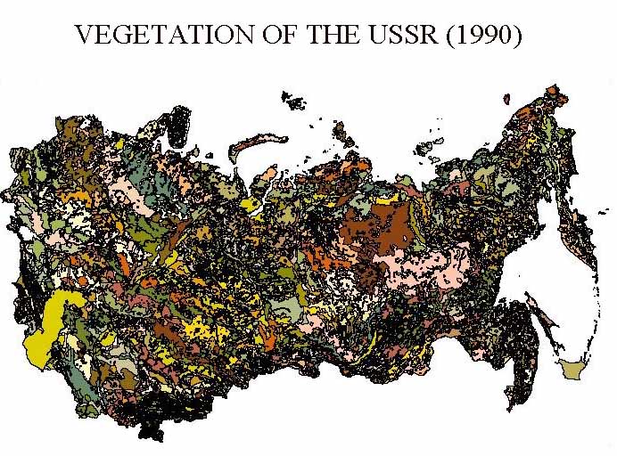
Figure 1. Vegetative Cover for the Land Area of the Former Soviet Union.
Data Citation:
Cite this data set as follows:
Stone, T. A, and P. Schlesinger. 2003. RLC Vegetative Cover of the Former Soviet Union, 1990. Data set. Available on-line [http://www.daac.ornl.gov] from Oak Ridge National Laboratory Distributed Active Archive Center, Oak Ridge, Tennessee, U.S.A. doi:10.3334/ORNLDAAC/700.
Table of Contents:
- 1 Data Set Overview
- 2 Data Characteristics
- 3 Applications and Derivation
- 4 Quality Assessment
- 5 Acquisition Materials and Methods
- 6 Data Description and Access
- 7 References
- 8 Glossary and Acronyms
- 9 Document Information
1. Data Set Overview:
Data Set Contents:
This data set consists of a 1:4 million scale vegetation map for the land area of the FSU. Three hundred seventy-three cover classes are distinguished.
The map is labeled as a "Vegetation Map," although others have suggested that it is a potential vegetation map. We feel that it is not a potential vegetation map. For instance, there are marks on the maps for categories such as "drained marshes with agriculture" and for "previously irrigated ... lands." To our knowledge there is no accompanying text to go with the map.
Related Data Sets:
See other Russian Land Cover data sets.
Title of Investigation:
Measuring Changes to Russian Forest Over the Last 25 Years
Investigator(s) Name and E-mail:
Name Stone, T. A. tstone@whrc.org Schlesinger, P. pschles@whrc.org
Technical Contact(s) Name, Telephone, and E-mail:
Name Phone Schlesinger, P. pschles@whrc.org (508)540-9900
Future Modifications and Plans:
Not available
2. Data Characteristics:
Study Area:
Spatial Coverage:
Min. X: -4737500
Max. X: 3473500
Min. Y: -1590500
Max. Y: 3256500
In meters from 104.5 E, 56.5 N
Spatial Resolution:
1000 meters
Projection:
Lambert Azimuthal Equal Area
Grid Description:
Cols: 8211
Rows: 4547
Resolution: 1000
Temporal Coverage:
Not applicable
Parameter or Variable:
Table for: vmap90.img.gz
Variable Description Units Instrument Range Vegetation Classes Vegetation cover for the land area of Russia None Vegetation Map of the Soviet Union (1990) 1-373 Ecoregions Vegetation communities for the land area of Russia None Vegetation Map of the Soviet Union (1990) See Footnote
Vegetation Classes footnote: See companion file http://daac.ornl.gov/daacdata/russian_land_cover/vegetation_1990/comp/vmap90_legend.txt or http://daac.ornl.gov/daacdata/russian_land_cover/vegetation_1990/comp/vmap90_legend.dbf for complete listing of vegetation cover values and descriptions.
Ecoregions footnote:
ALTITUDINAL VEGETATION FOR TUNDRA
BOGS
BROADLEAF FOREST
DARK CONIFEROUS
DESERTS
ECODYNAMIC SERIES OF FLOODPLAIN COMMUNITIES
HALOPHYTIC VEGETATION
OPEN WOOD
OPEN WOOD AND MOUNTAIN XEROPHYTIC - STEPPE
POLAR DESERT
SHRUB VEGETATION
STEPPES AND SECONDARY COMMUNITIES
TUNDRA
Table for: fmap90.dat.gz
Variable Description Units Instrument Range Vegetation Classes Vegetation cover for the land area of Russia None Vegetation Map of the Soveit Union (1990) 1-373 Ecoregions Vegetation communities for the land area of Russia None Vegetation Map of the Soveit Union (1990) See Footnote
Vegetation Classes footnote: See companion file http://daac.ornl.gov/daacdata/russian_land_cover/vegetation_1990/comp/vmap90_legend.txt or http://daac.ornl.gov/daacdata/russian_land_cover/vegetation_1990/comp/vmap90_legend.dbf for complete listing of vegetation cover values and descriptions.
Ecoregions footnote: See Ecoregions classes above.
Table for: vmap90.zip
Variable Description Units Instrument Range Vegetation Classes Vegetation cover for the land area of Russia None Vegetation Map of the Soveit Union (1990) 1-373 Ecoregions Vegetation communities for the land area of Russia None Vegetation Map of the Soveit Union (1990) See Footnote
Vegetation Classes footnote: See companion file http://daac.ornl.gov/daacdata/russian_land_cover/vegetation_1990/comp/vmap90_legend.txt or http://daac.ornl.gov/daacdata/russian_land_cover/vegetation_1990/comp/vmap90_legend.dbf for complete listing of vegetation cover values and descriptions.
Ecoregions footnote: See Ecoregions classes above.
Data Organization:
Please read all companion documentation before using these files: http://daac.ornl.gov/daacdata/russian_land_cover/vegetation_1990/comp/vmap90_readme.txt
Granule Name or Description:
vmap90.img.gz
Data Format:
A binary raster image depicting vegetative cover (1990) in Idrisi format (compressed). Note: must be converted to an *rst file when using version 3.2 of Idrisi. Use the Idrisi File Conversion (16/32) utility available in the file pulldown menu to convert to the new format. Also note that the Idrisi v. 2 image documentation file, vmap90.doc, MUST be present for the binary data to be read by Idrisi.
Sample Data Record:
Not applicable
Granule Name or Description:
fmap90.dat.gz
Data Format:
A compressed ASCIIGRID version of the binary raster data (vmap90.img). This data file was created by converting the Idrisi binary file (vmap90.img) using Idrisi export utilities. The ASCII file was compressed using the gzip utility available in UNIX. Note: it was necessary to first convert the *.img file to a *rst file and the *doc file to a *rdc file to match the new file format and naming convention of raster data supported by Idrisi 3.2.
Sample Data Record:
Not applicable
Granule Name or Description:
vmap90.zip
Data Format:
A vector map version of data (same info as raster data vmap90.img.gz and map90.dat.gz) in ArcView shapefile format (compressed with WinZip).
Sample Data Record:
Not applicable
3. Application and Derivation:
Typical Application of Data:
Regional-, national-, and sub-national-level forest and vegetation assessments
Theory of Measurements:
Not available
Derivation Techniques and Algorithms:
Formulae:
Not available
Processing Steps:
Vector data for each map sheet were reprojected from Equi-Distant Conic projection to Lambert Azimuthal Equal Area projection using the Earth Resources Data Analysis System (ERDAS) Version 7.5 projection conversion software and the parameters below (See Processing Changes). The subsequent vector coverages were also gridded and mosaiked using this software, and these data were exported to a generic binary format suitable to Idrisi v. 2.0 for Windows.
Processing Changes:
Datum : Undefined
Delta WGS84 : 0 0 0
Ellipsoid : Sphere
Radius of sphere: 6370997.0000
Origin long : 104.5
Origin lat : 56.5
False Easting: 0.0
False Northing: 0.0
Pixel Dimension: 1000 meters
Special Corrections/Adjustments:
Not applicable
Calculated Variables:
Not applicable
Graphs and Plots Used in Analysis:
Not applicable
4. Quality Assessment:
Data Usage Guidance:
Users are cautioned that maps at this scale and from the FSU are open to many biases. First, these maps may well be more art than science, and their pedigree is completely unknown to us. Our experience with other Russian and Soviet maps leads us to be very cautious in their use, particularly when trying to develop numeric or quantitative estimates of forest or other types of land cover. Second, the map projection for the base maps are not well known. To our knowledge the projection of this map is equidistant conic with two standard parallels (42 degrees latitude and 62 degrees latitude) and is based on the Krassovsky spheroid.
The source map sheets are difficult to digitize for several reasons. Map polygon boundaries are not well defined; the color mix of polygons and boundaries are difficult to separate. For instance, rivers and some polygon boundaries are the same color. There are also islands that appear to be unclassified; they do not take on any adjoining landcover color or category. Also, some class label numbers are inconsistent and do not exist in the legend. Similarly, there are categories in the legend that do not appear to exist in the map. We know of no accuracy assessment done on this map. Until recently only maps of 1:500,000 or smaller scale were available, so field checking this map is highly difficult and unlikely to have occurred. Maps available with larger scales did not have latitude and longitude coordinates attached.
The polygons in this map are labelled according to an alphanumeric system that is replicated in English in the database file provided (see VEGMPRU.DBF) and cross-referenced to the raster file with our own sequential numbering system. However, there is a considerable amount of symbolic annotation ("dithering") in the map that we did not digitize because the symbols cross the boundaries of polygons. Some of this symbolic notation is related to various soil types and the presence of forest glades of particular tree species. Without any accompanying map text, it is difficult to know if the map creators intended a separate class for the numeric portion of classes (e.g., # 140) comprising several alphanumeric subclasses (e.g., # 140a, # 140b, # 140c). In all instances where polygons were labelled as strictly numeric classes on the map and not in the translated legend, those polygons were labelled as unclassified in the digitized map. There are about 370 different land cover classes in the map and 11,824 distinct polygons.
Quality Assessment Activities:
Not available
Other Relevant Information about the Study:
Not available
5. Acquisition Materials and Methods:
Source or Platform Collection Environment:
Not available
Source or Platform Program Management:
Not available
Source or Platform Mission Objectives:
Coverage Information:
Not available
Attitude Characteristics:
Not available
Data Collection System:
Not available
Communication Links:
Not available
List of Sensors or Instruments:
Digitizer
Ground Segment Information:
Data Acquisition and Processing:
Not available
Latitude Crossing Times:
Not available
Sensor or Instrument Descriptions:
Key Variables:
Not available
Principles of Operation:
Not available
Sensor or Instrument Measurement Geometry:
Not available
Manufacturer of Sensor or Instrument:
Not available
Calibration:
Specifications:
Not applicable
Tolerance:
Not applicable
Frequency of Calibration:
Not applicable
Other Calibration Information:
Not applicable
Data Acquisition Methods:
The original maps were loaned to the Woods Hole Research Center (WHRC) by Dmitri Varlyguin, who was then a Visiting Fellow at the George Perkins Marsh Institute of Clark University, Worcester, Massachusetts. The original maps, all well worn, were digitized and later photographically reproduced so that we have permanent copies. The map digitizing was done as a collaborative effort by David Kicklighter, The Ecosystems Center, Marine Biological Laboratory, Woods Hole, and Peter Schlesinger of the WHRC. The equipment used was a SUN SPARC I and UNIX-based ArcInfo(c) 6.0 software for data entry of all four map sheets. Each sheet is about 85 by 110 cm. As each map sheet was digitized separately, four separate vector
Observations
Data Notes:
6. Data Description and Access:
Data Access:
This data set is available from the Oak Ridge National Laboratory (ORNL) Distributed Active Archive Center (DAAC).
Data Archive Center:
Contact for Data Center Access Information:
E-mail: uso@daac.ornl.gov
Telephone: +1 (865) 241-3952
FAX: +1 (865) 574-4665
Product Availability:
Data can be accessed electronically on the ORNL DAAC's anonymous HTTP site or from the DAAC's search and order system. Data files are also available by request from uso@daac.ornl.gov.
Reading the Media:
Not applicable
Software and Analyses Tools:
Not applicable
7. References:
The reference for the source data is as follows:
Institute of Geography. 1990. Vegetation of the Soviet Union. Siberian Dept. of the USSR Academy of Sciences. Scale 1:4,000,000.
Other references cited here include the following:
Stone, T. A., and P. Schlesinger. 1993. Digitization of the Map "Vegetation of the Soviet Union, 1990." A Report to the Northeast Forest Experiment Station, USDA Forest Service, Global Change Research Program, Radnor, Pennsylvania. See companion file http://daac.ornl.gov/daacdata/russian_land_cover/vegetation_1990/comp/vmap90_method.pdf.
Kicklighter, D.W. et. al., in prep. A data set of Global Equilibrium Vegetation for Contemporary Climate Organized at a Spatial Resolution of Half-degree Latitude by Half-degree Longitude.
8. Glossary and Acronyms:
Glossary:
Not available
Acronyms:
| Acronym | Definition |
| ASCII | American Standard Code for Information Interchange |
| MB | Megabyte |
| RMS | Root Mean Square |
| JPEG | Joint Photographic Experts Group |
| WHRC | Woods Hole Research Center |
9. Document Information:
2003/11/26
Document Review Date:
2003/11/26
Document Curator:
webmaster@www.daac.ornl.gov