
Overview
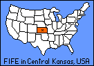
The First ISLSCP Field Experiment (FIFE) was conducted on the Konza Prairie in central Kansas (USA) in 1987 and 1989. The FIFE site was a 15 x 15 km area of grassland, most of which is under private management for grazing. About one-third of the area is managed as a Long Term Ecological Reserve (LTER) [the Konza Prairie] for the study of grassland ecosystem dynamics [north-east corner of the site map below].
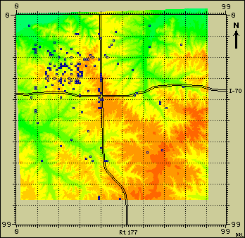
The FIFE Site Map in Kansas (overlaid on an elevation map)
FIFE Images
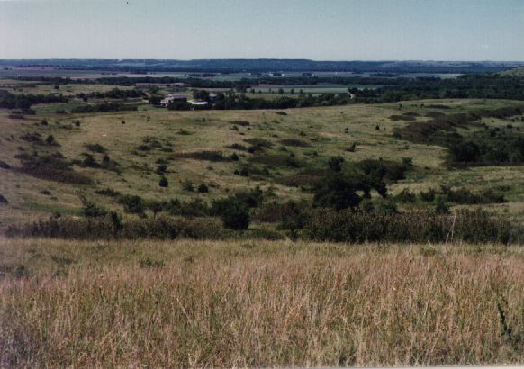
There are several images available for viewing that can give you an idea of what the experiment site in Kansas was like.- View a SPOT Image of the FIFE Site (Konza Prairie) in Kansas (1991)
- See a general view of the Konza Prairie
- See a general view of the Flint Hills on the Konza Prairie
The FIFE Sitegrid System
A system of site identifiers was developed to help locate the FIFE data. A 20 km by 20 km grid was superimposed on the FIFE area to provide a reference frame for the site identifiers. Each SITEGRID_ID specifies a node on this grid, thereby locating the site to within plus or minus 100 m in each direction. The northwest corner of the FIFE Study Area was located at UTM coordinates Northing 4,334,000 m and Easting 705,000 m.
The full SITEGRID_ID has the form "SSEE". The four digits of the SITEGRID_ID define the location of the site in terms of the number of nodes south (SS) and east (EE) of the grid origin. Colocated sites share the same SITEGRID_ID. For example, the STATION_ID 902 is replaced by the SITEGRID_ID with location code 1916, where 19 is the number of nodes south (SS) from the grid origin, and 16 is the number of nodes east (EE) from the grid origin.
The SITEGRID Origin (0,0) is located at the upper left corner of the SITEGRID, with the following UTM coordinates:
        SITEGRID Origin Northing = UTM Northing 4,334,000
        SITEGRID Origin Easting  = UTM Easting    705,000
These coordinates correspond to the upper left corner of the GIS grid which was used as the template for all of the FIFE GIS imagery.
The 20 km by 20 km grid contains 100 by 100 grid lines (numbered 0 to 99). Northings increase with increasing "y", and decreasing SITEGRID "SS", whereas Eastings increase with increasing "x", and increasing SITEGRID "EE".