Get Data
Revision date: December 8, 2008
Summary:
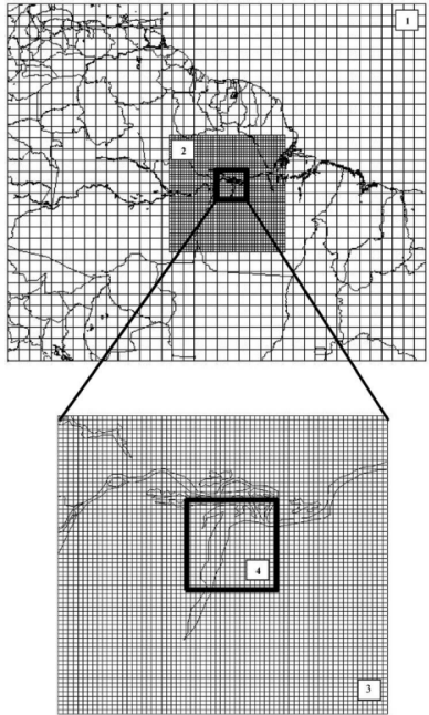
This data set consists of a single NetCDF file containing simulated three dimensional winds and CO2 concentrations centered on the Tapajos National Forest in Brazil in August 2001 (Figure 1). Winds (u, v, and w components) and CO2 concentrations were generated at 31 vertical levels at 1 km grid increment with the Brazilian version of Colorado State University (CSU) Regional Atmospheric Modeling System (RAMS). The simulation ran from the 1st through the 15th of August 2001, which was concurrent with the Santarem Mesoscale Campaign. The data file is in NetCDF format.
Mesoscale circulations and atmospheric CO2 variations were investigated over a heterogeneous landscape of forests, pastures, and large rivers during the Santarem Mesoscale Campaign (SMC) of August 2001 (Silva Dias et al., 2004). The atmospheric CO2 concentration variations were simulated using the Colorado State University Regional Atmospheric Modeling System with four nested grids that included a 1-km finest grid centered on the Tapajos National Forest. Surface CO2 fluxes were prescribed using idealized diurnal cycles over forest and pasture that derived from flux tower observations; while surface water CO2 efflux was prescribed using a value suggested by in situ measurements in the Amazon region (Lu et al., 2005). Simulation ran from 1 August through 15 August 2001, which was concurrent with the SMC. Evaluation against flux tower observations and Belterra meteorological tower measurements showed that the model captured the observed 2-m temperatures and 10-m winds reasonably well. At 57 m the model reproduced the daytime CO2 concentration better than the nighttime concentration but missed the observed early morning CO2 maxima, in part because of the difficulties of simulating stable nocturnal boundary conditions and subgrid-scale intra-canopy processes. The results also suggested that the topography, the differences in roughness length between water and land, the "T" shape juxtaposition of Amazon and Tapajos Rivers, and the resulting horizontal and vertical wind shears all facilitated the generation of local mesoscale circulations. Possible mechanisms producing a low-level convergence (LLC) line near the east bank of the Tapajos River were explored. Under strong trade wind conditions, mechanical forcing is more important than thermal forcing in LLC formation. Persistent clouds near the east side of the Tapajos River may have a significant impact on observed ecosystem carbon flux and should be taken into account if tower fluxes are to be generalized to a larger region.
Figure 1. Model simulation domain and grid configuration of four nested grids. The coarsest to the finest grid intervals are 100 km, 25 km, 5 km, and 1 km, respectively. The 1-km grid increments of the inner grid are omitted for clarity. The pole point for the oblique polar stereographic projection for each grid is -2.8 deg latitude, -55.0 deg longitude (Source: Lu et al., 2005).
Data Citation:
Cite this data set as follows:
Lu, L., A.S. Denning, M.A. da Silva-Dias, P. Silva-Dias, M. Longo, S.R. Freitas, S.Saatchi. 2008. LBA-ECO CD-01 Simulated Atmospheric Circulation, CO2 Variation, Tapajos: August 2001. Data set. Available on-line [http://daac.ornl.gov] from Oak Ridge National Laboratory Distributed Active Archive Center, Oak Ridge, Tennessee, U.S.A. doi:10.3334/ORNLDAAC/907
Implementation of the LBA Data and Publication Policy by Data Users:
The LBA Data and Publication Policy [http://daac.ornl.gov/LBA/lba_data_policy.html] is in effect for a period of five (5) years from the date of archiving and should be followed by data users who have obtained LBA data sets from the ORNL DAAC. Users who download LBA data in the five years after data have been archived must contact the investigators who collected the data, per provisions 6 and 7 in the Policy.
This data set was archived in January of 2009. Users who download the data between January of 2009 and July 2014 must comply with the LBA Data and Publication Policy.
Data users should use the Investigator contact information in this document to communicate with the data provider. Alternatively, the LBA Web Site [http://lba.inpa.gov.br/lba/] in Brazil will have current contact information.
Data users should use the Data Set Citation and other applicable references provided in this document to acknowledge use of the data.
Table of Contents:
- 1 Data Set Overview
- 2 Data Characteristics
- 3 Applications and Derivation
- 4 Quality Assessment
- 5 Acquisition Materials and Methods
- 6 Data Access
- 7 References
1. Data Set Overview:
Project: LBA (Large-Scale Biosphere-Atmosphere Experiment in the Amazon)
Activity: LBA-ECO
LBA Science Component: Carbon Dynamics
Team ID: CD-01 (Denning / Dias)
The investigators were Denning, Allan Scott; Silva Dias, Pedro Leite; Anhuf, Dieter Volkhard; Baker, Ian; Gevaerd, Rodrigo; Inazawa, Elicia Eri; Kleist, John; Longo, Marcos; Lu, Lixin; Moreira, Demerval Soares; Prihodko, Lara; Rist, Jason; Silva Dias, Maria Assucao Faus da; Uliasz, Connie and Uliasz, Marek . You may contact Denning, Dr. A. Scott (denning@atmos.colostate.edu)
LBA Data Set Inventory ID: CD01_BRAMS
Three dimensional winds and variations of atmospheric CO2 concentration were simulated using the Colorado State University (CSU) Regional Atmospheric Modeling System (RAMS) with four nested grids that included a 1-km finest grid centered on the Flona Tapajos. Surface fluxes of CO2 were prescribed in the model using idealized diurnal cycles over forest and pasture vegetation derived from flux tower observations, and over surface water using a value suggested by in situ measurements in the Amazon region. The distribution of vegetation types was derived from the 1-km International Geosphere-Biosphere Programme (IGBP) land-cover data set version 2.0 (Loveland et al., 2000). The simulation ran from the 1st through the 15th of August 2001, which was concurrent with the Santarem Mesoscale Campaign.
2. Data Characteristics:
Model outputs are provided in a single netCDF format data file, Tapajos_winds_CO2.nc with the following dimensions: time(360- ,level (31), x (97) and y (97).
-
Hourly model output beginning at 01-August-2001 and ending 15-August-2001.
-
1 kilometer grid increment.
-
The pole point for the oblique polar stereographic projection for each grid is -2.8 deg latitude, -55.0 deg longitude.
-
31 vertical levels (meters):
57.3, 188.7, 346.5, 535.8, 762.9, 1035.5, 1362.6, 1755.1, 2226.1, 2791.4, 3469.6, 4287.3, 5242.5, 6249.7, 7250., 8250., 9250., 10250., 11250., 12250., 13250., 14250., 15250., 16250., 17250., 18250., 19250., 20250., 21250., 22250., 23250.
Output variables: u, v, and w wind components and CO2 concentration.
-
u = zonal velocity component (m/s), range in this data set: -34.36687 to 21.89755
> Positive zonal velocities are from the west, negative zonal velocities are from the east.
-
v = meridional velocity component (m/s), range in this data set: -12.68975 to 16.59277
> Positive meridional velocities are from the south and negative meridional velocities are from the north.
-
w = vertical velocity component (m/s), range in this data set: -3.563875 to 12.91778
-
co2_t3 = CO2 concentration (ppm), range in this data set: 342.8621 to 407.8740
Site boundaries: (All latitude and longitude given in degrees and fractions)
| Site (Region) | Westernmost Longitude | Easternmost Longitude | Northernmost Latitude | Southernmost Latitude | Geodetic Datum |
|---|---|---|---|---|---|
| Flona Tapajos (Para Western (Santarem)) | -55.424 | -54.558 | -2.204 | -3.069 | World Geodetic System, 1984 (WGS-84) |
Time period:
- The data set covers the period 2001/08/01 to 2001/08/15.
- Temporal Resolution: Hourly
Platform/Sensor/Parameters measured include:
- COMPUTER MODEL / ANALYSIS / UPPER LEVEL WINDS
- COMPUTER MODEL / ANALYSIS / CARBON DIOXIDE
- COMPUTER MODEL / ANALYSIS / SURFACE WINDS
3. Data Application and Derivation:
Evaluation of mesoscale circulations, interpreting flux tower measurements, regional upscaling.
4. Quality Assessment:
Users of this model output should keep in mind that surface fluxes of CO2 were prescribed in the model using idealized diurnal cycles over forest and pasture vegetation derived from flux tower observations, and over surface water using a value suggested by in situ measurements in the Amazon region. The exact methodology of prescribing the surface fluxes as well as model comparisons to observations are described in Lu et al. (2005).
5. Data Acquisition Materials and Methods:
Three dimensional winds and variations of atmospheric CO2 concentration were simulated using the Colorado State University (CSU) Regional Atmospheric Modeling System (RAMS) with four nested grids that included a 1-km finest grid centered on the Flona Tapajos. Surface fluxes of CO2 were prescribed in the model using idealized diurnal cycles over forest and pasture vegetation derived from flux tower observations, and over surface water using a value suggested by in situ measurements in the Amazon region. The distribution of vegetation types was derived from the 1-km International Geosphere-Biosphere Programme (IGBP) land-cover data set version 2.0 (Loveland et al., 2000). The simulation ran from the 1st through the 15th of August 2001, which was concurrent with the Santarem Mesoscale Campaign. Model configuration details, the methodology of prescribing the surface fluxes and model comparisons to observations are described in Lu et al., 2005. A summary is shown in Table 1.
Table 1. Model Configurations Used in the Study (Source: Lu et al., 2005)
| Category | Options Selected | References |
|---|---|---|
| Basic equations | nonhydrostatic, compressible | Tripoli and Cotton [1980] |
| Vertical coordinates | terrain-following sigma z | Clark [1977] and Tripoli and Cotton [1982] |
| Horizontal coordinates | oblique polar-stereographic projection | |
| Grid stagger and structure | Arakawa C grid, multiple nested grid (fixed) | Arakawa and Lamb [1977] |
| Time differencing | hybrid | |
| Microphysics | bulk microphysics (single moment) | Walko et al. [1995] |
| Convective parameterization | modified-Kuo for grids 1 and 2 | Tremback [1990] |
| Radiation | Harrington | Harrington et al. [1999, 2000] |
| Surface layer | Louis | Louis [1979] and Louis et al. [1982], Walko et al. [2000] |
| CO2 fluxes | LEAF-2, prognostic soil and vegetation model prescribed diurnal variation of GPP and respiration river CO2 efflux | flux tower data (Km 67 and Km 77), Richey et al. [1990] |
Sensors used include:
- ANALYSIS
6. Data Access:
This data is available through the Oak Ridge National Laboratory (ORNL) Distributed Active Archive Center (DAAC).
Data Archive Center:
Contact for Data Center Access Information:
E-mail: uso@daac.ornl.gov
Telephone: +1 (865) 241-3952
7. References:
Loveland, T. R., B. C. Reed, J. F. Brown, D. O. Ohlen, J. Zhu, L. Yang, and J. Merchant (2000), Development of a Global Land Cover Characteristics Database and IGBP DISCover from 1-km AVHRR data, Int. J. Remote Sens., 21(6/7), 1303– 1330.
Lu, L., A.S. Denning, M.A. da Silva-Dias, P. Silva-Dias, M. Longo, S.R. Freitas, S. Saatchi. 2005. Mesoscale circulation and atmospheric CO2 variation in the Tapajos Region, Para, Brazil. Journal of Geophysical Research-Atmospheres, 110, D21:102, doi:10.1029/2004JD005757.
Silva Dias, M. A. F., P. L. Silva Dias, M. Longo, D. R. Fitzjarrald, and A. S. Denning (2004), River breeze circulation in eastern Amazon: Observationsand modeling results, Theor. Appl. Climatol., 78(1– 3), 111– 121.
References for the RAMS model:
Cotton, W. R., R. A. Pielke, R. L. Walko, G. E. Liston, C. J. Tremback, H. Jiang, R. L. McAnelly, J. Y. Harrington, M. E. Nicholls, G. G. Carrio and J. P. McFadden (2003). RAMS 2001: Current status and future directions. Meteorology and Atmospheric Physics 82(1-4): 5-29.
Pielke, R. A., W. R. Cotton, R. L. Walko, C. J. Tremback, W. A. Lyons, L. D. Grasso, M. E. Nicholls, M. D. Moran, D. A. Wesley, T. J. Lee and J. H. Copeland (1992). A Comprehensive Meteorological Modeling System - Rams. Meteorology and Atmospheric Physics 49(1-4): 69-91.
Related Publications
- Lu, L., A.S. Denning, M.A. da Silva-Dias, P. Silva-Dias, M. Longo, S.R. Freitas, S. Saatchi. 2005. Mesoscale circulation and atmospheric CO2 variation in the Tapajos Region, Para, Brazil. Journal of Geophysical Research-Atmospheres, 110, D21:102,doi:10.1029/2004JD005757.