Documentation Revision Date: 2017-06-30
Data Set Version: 1
Summary
The FIFE site was a 15 x 15 km area of grassland, most of which is under private management for grazing. About one-third of the area was managed as a Long Term Ecological Reserve (the Konza Prairie) for the study of grassland ecosystem dynamics.
There are 60 images in *.jpg format with this data set.
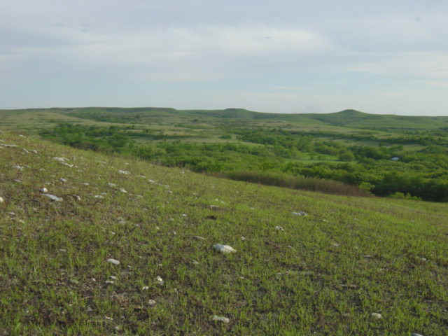
Figure 1. The Konza Prairie.
Citation
Strebel, D.E., D.R. Landis, K.F. Huemmrich, and B.W. Meeson. 2017. FIFE CDROM Vol. 3 Contents: NS001 Thematic Mapper Simulator (TMS) Imagery, 1987-1989. ORNL DAAC, Oak Ridge, Tennessee, USA. https://doi.org/10.3334/ORNLDAAC/130
Table of Contents
- Data Set Overview
- Data Characteristics
- Application and Derivation
- Quality Assessment
- Data Acquisition, Materials, and Methods
- Data Access
- References
Data Set Overview
The FIFE Study Region was 15 x 15 km located south of the Tuttle Reservoir and Kansas River, and about 10 km from Manhattan, Kansas, US. Most of the site is under private management for grazing. About one-third of the area was managed as a Long Term Ecological Reserve (the Konza Prairie) for the study of grassland ecosystem dynamics. The first experiment was initially during the summer of 1987. A follow-up experiment at the same location took place in 1989. This data set provides the original contents of the FIFE CD-ROM Volume 3, and provides aircraft-based NS001 Thematic Mapper Simulator (TMS) image data files acquired over the period of June 1987 to August 1989. The NS001 TMS was flown aboard NASA's C-130 aircraft.
Data Characteristics
Spatial Coverage: Konza Prairie, Kansas, US
Spatial Resolution: flight lines that were approximately 3.5 km apart and 8 km wide
Temporal Coverage: 1987-06-04 to 1989-08-11
Temporal Resolution: The grid-pattern flight lines are 10-20 minutes apart. The lines processed to level 1 average 20-30 minutes apart, depending on the day.
Study Area: (All latitude and longitude given in decimal degrees)
|
Site |
Westernmost Longitude |
Easternmost Longitude |
Northernmost Latitude |
Southernmost Latitude |
|
FIFE study site: Konza Prairie Reserve near Manhattan, Kansas |
-96.58333 |
-96.58333 |
39.08333 |
39.08333 |
Data file information
There are 60 images in the original TMS format included within the compressed file "FIFE_CDROM_Volume_3.zip". The image files are named according to the date, study area, and site.
Application and Derivation
The data are relevant to studies of grassland ecology and provide a historical snapshot of conditions in the late 1980s.
Quality Assessment
Not provided.
Data Acquisition, Materials, and Methods
FIFE Study Site:
The FIFE Study Region was a 15 x 15 km area located south of the Tuttle Reservoir and Kansas River, and about 10-km from Manhattan, Kansas, US. Most of the site is under private management for grazing. About one-third of the area was managed as a Long Term Ecological Reserve (the Konza Prairie) for the study of grassland ecosystem dynamics. The FIFE experiment was initially during the summer of 1987. A follow-up experiment at the same location took place in 1989.
Methods
This data set provides aircraft-based NS001 Thematic Mapper Simulator (TMS) image data files acquired over the period of June 1987 to August 1989. The NS001 TMS was flown aboard NASA's C-130 aircraft. The data were collected at the 4,878 meter altitude during 1987 on flight lines that were approximately 3.5 km apart and 8 km wide. The flight lines were oriented perpendicular and parallel to the solar plane, ideally with three lines in each direction. This pattern covered the entire FIFE area, with multiple views (up to 6) of most of the central portion.
The data acquisition effort of FIFE included monitoring activities and Intensive Field Campaigns (IFCs). The monitoring effort, which operated more or less continuously through 1987, 1988 and 1989 consisted of the acquisition of AVHRR, Landsat, SPOT and GOES satellite data, ground data (soil, stream, biometric), relevant meteorological, and the observation of atmospheric optical properties. The IFCs had the specific objective of acquiring surface and airborne data in conjunction with satellite overpasses to study the biophysical and energetic processes over spatial scales from mm to km and temporal scales from seconds to an entire season. The IFCs required a large commitment of manpower and resources; thus, their combined duration during 1987 was only 57 days. The IFC periods targeted the critical phases of vegetative development (IFC-1 "greenup"; IFC-2 "peak greenness"; IFC-3 "dry-down"; IFC-4 "senescence"). In 1987 unusual weather conditions produced very similar conditions during the first three IFC's (wet soils and green vegetation) followed by a totally senescent vegetation cover and dry soil in IFC-4. During 1989 a 20 day (July 24-August 12) IFC was instituted to obtain the "dry down" missed during IFC-3.
Data Access
These data are available through the Oak Ridge National Laboratory (ORNL) Distributed Active Archive Center (DAAC).
FIFE CDROM Vol. 3 Contents: NS001 Thematic Mapper Simulator (TMS) Imagery, 1987-1989
Contact for Data Center Access Information:
- E-mail: uso@daac.ornl.gov
- Telephone: +1 (865) 241-3952
References
Airborne Instrumentation Research Project - Flight Summary Report, Flight No. 87-004 Series. May-June 1987. NASA Ames Research Center. Airborne Missions and Applications Division. Moffett Field. California 94035.
Airborne Instrumentation Research Project - Flight Summary Report, Flight No. 87-005 Series. June-July 1987. NASA Ames Research Center. Airborne Missions and Applications Division. Moffett Field. California 94035.
Airborne Instrumentation Research Project - Flight Summary Report, Flight No. 87-006 Series. August 1987. NASA Ames Research Center. Airborne Missions and Applications Division. Moffett Field. California 94035
Airborne Instrumentation Research Project - Flight Summary Report, Flight No. 88-001 Series. October 1987. NASA Ames Research Center. Airborne Missions and Applications Division. Moffett Field. California 94035.
Airborne Instrumentation Research Project - Flight Summary Report, Flight No. 89-006 Series. July-August 1987. NASA Ames Research Center. Airborne Missions and Applications Division. Moffett Field. California 94035.
Kneizys, F.X., E.P. Shettle, L.W. Abreu, J.H. Chetwynd, G.P. Anderson, W.O. Gallery, J.E.A. Selby, and S.A. Clough. 1988. User's Guide to LOWTRAN 7. Rep. AFGL-TR-88-0177. E.R.P. 1010. 146 p. Air Force Geophys. Lab. Hanscom AFB, Massachusetts.
NASA. 1990. C-130 Earth Resources Aircraft Experimenter's Handbook. National Aeronautics and Space Administration. Ames Research Center. Moffett Field, California.
Operations Manual - NS001 Multispectral Scanner. 1977. Lyndon B. Johnson Space Flight Center. Document No. JSC 12715.
Strebel, D.E., S.J. Goetz, and F.G. Hall. 1987. Atmospheric correction of NS001 data and extraction of multiple angle reflectance data sets. In: Proc. 21st Int. Sym. Remote Sens. Environ. ERIM. Ann Arbor, MI. p. 939-948.