![]() The BOREAS Information System
The BOREAS Information System
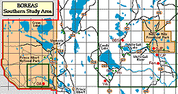
This long table contains complete positional information on every site where data was taken in the Southern Study Area (SSA). Click here to see the Northern Study Area (NSA) Site Reference Table, or the Regional (REG) Site Reference Table, or the Transect (TRN) Site Reference Table.
Note: This is a very big page, please wait for it to load.
| BOREAS Site Name | Sub-Site | Location Description | Latitude | Longitude | UTM Zone | UTM Easting | UTM Northing | Elevation (m ASL) | BOREAS X | BOREAS Y | Comments (Location, Soil, Vegetation Info.) |
|---|---|---|---|---|---|---|---|---|---|---|---|
| SSA-999-110C1 | HYD03-SWE01 | Site 110 C, aspen, some pine | 54.57386 | -105.82461 |
13 |
446694 | 6047685.5 | 333.984 | 410.168 | Snow Water Equivalent measurements. | |
| SSA-999-110I1 | HYD03-CND01 | HYD-3 canopy density measurement area near HYD-4 and HYD-6 site 110-I | 54.49536 | -105.8098 |
13 |
447550.6 | 6038939.5 | 335.59 | 401.514 | ||
| SSA-999-122E1 | HYD03-SWE01 | Site 122 E, very young regenerating community | 53.84916 | -104.61944 |
13 |
525035.8 | 5966806.1 | 418.951 | 336.207 | Snow Water Equivalent measurements. | |
| HYD03-CND01 | HYD-3 canopy density measurement in a forested area near HYD-4 and HYD-6 site 122E | 53.84916 | -104.61944 |
13 |
525035.8 | 5966806.1 | 418.951 | 336.207 | |||
| SSA-999-99SW1 | HYD09-SGSW1 | STREAM GAUGE SW-1 | 53.86453 | -104.61986 |
13 |
524998.7 | 5968516.1 | 418.766 | 337.91 | This stream gauge is operated by the Water Survey of Canada. | |
| SSA-999-99SW2 | HYD09-TRG07 | Tipping Bucket Rain Gauge near to Stream Gauge SW-2 | 53.895 | -104.68167 |
13 |
520918.8 | 5971886.4 | 414.413 | 340.92 | Tipping Bucket Rain Gauge near to Stream Gauge SW-2. | |
| HYD09-SGSW2 | Stream Gauge SW-2 | 53.895 | -104.68167 |
13 |
520918.8 | 5971886.4 | 414.413 | 340.92 | |||
| SSA-999-99SW3 | HYD09-SGSW3 | Stream Gauge SW-3 | 53.92669 | -104.79116 |
13 |
513713.4 | 5975385.4 | 406.937 | 343.791 | ||
| SSA-999-99SW4 | HYD09-BRGS4 | Belfort Rain Gauge near Stream Gauge SW-4 | 53.92639 | -104.82028 |
13 |
511801.3 | 5975346.7 | 405.036 | 343.588 | ||
| HYD09-SGSW4 | Stream Gauge SW-4 | 53.92639 | -104.82028 |
13 |
511801.3 | 5975346.7 | 405.036 | 343.588 | |||
| SSA-999-BRG01 | HYD09-BRG01 | Belfort Rain Gauge 1 | 53.89156 | -105.01149 |
13 |
499244.9 | 5971456.3 | 536.71 | 392.868 | 338.626 | |
| SSA-999-BRG02 | HYD09-BRG02 | Belfort Rain Gauge 2 | 54.08506 | -105.03775 |
13 |
497530.6 | 5992986.6 | 593.15 | 389.306 | 359.959 | |
| SSA-999-BRG03 | HYD09-BRG03 | Belfort Rain Gauge 3 | 54.08551 | -104.76263 |
13 |
515527.6 | 5993062.1 | 533.36 | 407.218 | 361.582 | |
| SSA-999-BRG04 | HYD09-BRG04 | Belfort Rain Gauge 4 | 54.0047 | -104.89617 |
13 |
506805.2 | 5984049.9 | 573.7 | 399.311 | 351.84 | |
| SSA-999-BRG05 | HYD09-BRG05 | Belfort Rain Gauge 5 | 53.92625 | -104.82002 |
13 |
511818.4 | 5975331.6 | 518.61 | 405.054 | 343.574 | |
| SSA-999-CALIB | RSS18-SPH01 | location of RSS-18 sunphotometer measuerments at the AVIRIS calibration site | 53.23888 | -105.69555 |
13 |
453579.7 | 5899070.2 | 300 | 353.62 | 262.5 | |
| SSA-999-CND01 | STAFF-FRS01 | FORESTRY MET STATION AT CANDLE LAKE | 53.783 | -105.133 |
13 |
491236.6 | 5959387 | 510.54 | 385.934 | 325.897 | |
| SSA-999-NIB01 | HYD04-SWE01 | NIB, This course is located west of highway #106 across from site NIM. The spruce trees are located in a long narrow boggy area which drains into the Torch River. | 53.75285 | -104.59484 |
13 |
526714.8 | 5956100.9 | 421.547 | 325.673 | HYD-04 snow water equivalent measurements site. | |
| HYD03-CND03 | HYD-3 canopy density measurement area at a clearing near HYD-4 Standard Snow Course SSS#3. | 53.75285 | -104.59484 |
13 |
526714.8 | 5956100.9 | 421.547 | 325.673 | |||
| HYD03-CND01 | HYD-3 canopy density measurement area with edge effects, near HYD-4 standard snow course SSS#1. | 53.75285 | -104.59484 |
13 |
526714.8 | 5956100.9 | 421.547 | 325.673 | |||
| HYD03-CND02 | HYD-3 canopy density measurement area in a dark forest, near HYD-4 standard snow course site SSS#3. | 53.75285 | -104.59484 |
13 |
526714.8 | 5956100.9 | 421.547 | 325.673 | |||
| BOREAS Site Name | Sub-Site | Location Description | Latitude | Longitude | UTM Zone | UTM Easting | UTM Northing | Elevation (m ASL) | BOREAS X | BOREAS Y | Comments (Location, Soil, Vegetation Info.) |
| SSA-999-NIM01 | HYD04-SWE01 | NTJ, This course is located east of highway #106 at the access road to Evernden Lake (not open in winter). The access road is located 6.4 km south of the correction facility entrance road. The star | 53.75395 | -104.59154 |
13 |
526931.7 | 5956224.5 | 421.752 | 325.815 | HYD-04 snow water equivalent measurements site. | |
| SSA-999-NIO01 | HYD04-SWE01 | NIO, This course is located west of highway #106 across from site NIM and is an extension of site NIB along a line (010_N) pasrallel to the highway about 200 m from the road. | 53.75445 | -104.59434 |
13 |
526746.8 | 5956279.1 | 421.563 | 325.853 | HYD-04 snow water equivalent measurements site. | |
| SSA-999-NIY01 | HYD04-SWE01 | NIY, This course is located east of highway #106 about 4.0 km north of the correction facility road. It is about 200 m off the highway and runs parallel to the highway (030_N). An old sand pit (sum | 53.85286 | -104.61854 |
13 |
525092.8 | 5967218 | 418.972 | 336.623 | HYD-04 snow water equivalent measurements site. | |
| SSA-999-PAA01 | HYD04-SWE01 | PAA, This course is located off Namekus Lake access road about 0.3 km east of highway #263. Entrance and trail flagged with red ribbon. First station is located about 50 m from access road. | 53.84815 | -106.0797 |
13 |
428969.9 | 5967167.6 | 323.261 | 328.311 | HYD-04 snow water equivalent measurements site. | |
| SSA-999-PWD01 | RSS11-SPH01 | The location of the of the RSS-11 automated sunphotometer at Paddockwood School in 1996 field season; the instrument had been at Flin Flon Airport in 1994 and 1995 | 53.50951 | -105.56697 |
13 |
462400 | 5929100 | 487.68 | 359.823 | 293.208 | Instrument was at Flin Flon Airport in 1994 and 1995. |
| SSA-999-SBC01 | RSS12-SPH01 | The location of the RSS-12 sunphotometer measurements at Sandy Bay Campground in Candle Lake | 53.79835 | -105.33047 |
13 |
478233.5 | 5961137.1 | 503 | 372.84 | 326.53 | Measurements taken during 1994 field campaigns to coincide with aircraft measurements. |
| SSA-999-SLH01 | RSS12-SPH01 | The location of the RSS-12 sunphotometer measurements at Ships Lantern Hotel in Candle Lake | 53.75005 | -105.27347 |
13 |
481967.2 | 5955747.4 | 503 | 377.02 | 321.47 | Measurements taken during 1994 field campaigns to coincide with aircraft measurements. |
| SSA-999-TRG01 | HYD09-TRG01 | Tipping Bucket Rain Gauge 1 | 53.93336 | -105.13441 |
13 |
491175.4 | 5976115.8 | 566 | 384.432 | 342.58 | |
| SSA-999-TRG02 | HYD09-TRG02 | Tipping Bucket Rain Gauge 2 | 53.98388 | -104.73677 |
13 |
517261.3 | 5981760.6 | 452.94 | 409.919 | 350.456 | |
| SSA-999-TRG03 | HYD09-TRG03 | Tipping Bucket Rain Gauge 3 | 54.04309 | -104.70427 |
13 |
519364.9 | 5988356.2 | 512.15 | 411.445 | 357.218 | |
| SSA-999-TRG04 | HYD09-TRG04 | Tipping Bucket Rain Gauge 4 | 54.15781 | -104.87348 |
13 |
508261.9 | 6001087.7 | 558.43 | 399.292 | 368.965 | |
| SSA-999-TRG05 | HYD09-TRG05 | Tipping Bucket Rain Gauge 5 | 54.05218 | -104.93682 |
13 |
504136.2 | 5989329.2 | 585.06 | 396.198 | 356.878 | |
| SSA-999-TRG06 | HYD09-TRG06 | Tipping Bucket Rain Gauge 6 | 53.99847 | -105.11288 |
13 |
492600.5 | 5983357.6 | 570.79 | 385.227 | 349.928 | |
| SSA-999-TRG08 | HYD09-TRG08 | Tipping Bucket Rain Gauge 8 | 54.00469 | -104.89617 |
13 |
506805.2 | 5984048.9 | 399.311 | 351.839 | ||
| SSA-999-TRG09 | HYD09-TRG09 | Tipping Bucket Rain Gauge 9 | 54.05247 | -104.93681 |
13 |
504136.9 | 5989361.6 | 396.196 | 356.91 | ||
| SSA-999-TRG10 | HYD09-TRG10 | Tipping Bucket Rain Gauge 10 | 53.91883 | -105.14389 |
13 |
490549.8 | 5974500.7 | 383.948 | 340.915 | ||
| BOREAS Site Name | Sub-Site | Location Description | Latitude | Longitude | UTM Zone | UTM Easting | UTM Northing | Elevation (m ASL) | BOREAS X | BOREAS Y | Comments (Location, Soil, Vegetation Info.) |
| SSA-999-WBU01 | STAFF-AES01 | The AES Campbell Scientific met autostation site at Nipawin, SK | 53.333 | -104 |
|
566594 | 5909601 | 371.9 | 465.26 | 282.95 | This site is located in a protected yard east of aircraft parking and maintenance at the airport. Excellent exposure with no airflow restrictions. Just taxiway and apron 50m south which may provide (farmland, protected yard, grassed). |
| SSA-999-WLV01 | STAFF-AES01 | The AES Campbell Scientific met autostation site at Waskesiu Lake, SK | 53.55 | -106.04 |
|
429940 | 5974561 | 569.4 | 323.57 | 335.98 | This site is located on Parks Canada Maintenance compound. Sheltering from fir trees to north (conditioned plot, fir trees). |
| SSA-999-WLZ02 | AFM05-AES02 | The AES upper air site in Candle Lake, SK | 53.733 | -105.267 |
13 |
482409 | 5953885 | 503 | 377.6 | 319.7 | Surrounding topography of hilly forest with mixture of coniferous and deciduous with large lakes nearby (clearing surrounded by mixed forest). |
| SSA-999-WSK01 | HYD03-SWE01 | Waskesui Lake | 53.94005 | -106.0705 |
13 |
429729.5 | 5977382.6 | 323.14 | 338.567 | Snow Water Equivalent measurements | |
| RSS11-SPH01 | The location of the RSS-11 handheld sunphotometer in PANP. Measurements taken by Paula Pacholek, usually at the Information building in Waskesiu. |
13 |
Handheld measurements in the park were usually taken at the Information building in Waskesiu by Paula Pacholek. | ||||||||
| STAFF-FRS01 | Forestry Met station at Waskesiu | 53.9167 | -106.083 |
13 |
428849.8 | 5974797 | 533.4 | 322.486 | 335.912 | ||
| SSA-999-WSK02 | RSS11-SPH01 | The location of the RSS-11 automated sunphotometer in PANP. The instrument was mounted on the roof of the park maintenance building near Rt. 2 entrance. | 53.91672 | -106.06717 |
13 |
429909.5 | 5974783.3 | 550 | 323.54 | 335.99 | |
| SSA-999-WSK03 | STAFF-HISDY | Historic data site for Waskesui Lake containing daily met data. | 53.92 | -106.08 |
|
Station identifier number 4068560 | |||||
| SSA-999-WSK04 | HYD03-SPT01 | HYD-03 snow pit site on frozen Waskesiu Lake | 53.9232 | -106.09068 |
13 |
428376.2 | 5975528.2 | 321.951 | 336.6 | Water | |
| SSA-999-WSK05 | TGB07-CON01 | Waskesiu |
|
Prince Albert National Park in central Saskatchewan. | |||||||
| TGB07-FLX01 | Waskesiu |
|
Prince Albert National Park in central Saskatchewan. | ||||||||
| SSA-999-YPA01 | RSS11-SPH01 | The location of the RSS-11 automated sunphotometer at Prince Albert Airport | 53.20004 | -105.68383 |
13 |
454320.6 | 5894742.2 | 425 | 354.73 | 258.25 | Instrument traveled between Thompson and Prince Albert airports in 1994 depending upon which site was "hot". |
| SSA-9BS-AUX01 | 9TE06-NPP01 | 53.64877 | -105.29534 |
13 |
480508.7 | 5944263.4 | 568.86 | 376.503 | 310.107 | Site located by eye from airphoto and georeferenced satellite image. | |
| STAFF-AUX01 | 53.64877 | -105.29534 |
13 |
480508.7 | 5944263.4 | 568.86 | 376.503 | 310.107 | Category III Site located by eye from airphoto and georeferenced satellite image. | ||
| SSA-9BS-AUX02 | STAFF-AUX02 | 53.90349 | -104.63785 |
13 |
523793.6 | 5972844.3 | 533.33 | 417.193 | 342.124 | Category III Differential GPS from Darcy Snell. | |
| 9TE06-NPP01 | 53.90349 | -104.63785 |
13 |
523793.6 | 5972844.3 | 533.33 | 417.193 | 342.124 | Category III Differential GPS from Darcy Snell. | ||
| SSA-9BS-AUX03 | 9TE06-NPP01 | 53.93021 | -105.13964 |
13 |
490831.4 | 5975766.3 | 600.7 | 384.119 | 342.202 | Category III Differential GPS from Darcy Snell. | |
| STAFF-AUX03 | 53.93021 | -105.13964 |
13 |
490831.4 | 5975766.3 | 600.7 | 384.119 | 342.202 | Category III site - Differential GPS from Darcy Snell. | ||
| SSA-9BS-AUX04 | STAFF-AUX04 | 53.94446 | -104.759 |
13 |
515847.9 | 5977146.9 | 561.39 | 408.861 | 345.951 | Site located by eye from airphoto and georeferenced satellite image. (Carbon Model Evaluation. | |
| 9TE06-NPP01 | 53.94446 | -104.759 |
13 |
515847.9 | 5977146.9 | 561.39 | 408.861 | 345.951 | Site located by eye from airphoto and georeferenced satellite image. | ||
| SSA-9BS-AUX05 | STAFF-AUX05 | 53.99877 | -105.11805 |
13 |
492291.2 | 5983169.1 | 633.1 | 384.886 | 349.932 | Site located by eye from airphoto and georeferenced satellite image. (Carbon Model Evaluation. | |
| 9TE06-NPP01 | 53.99877 | -105.11805 |
13 |
492291.2 | 5983169.1 | 633.1 | 384.886 | 349.932 | Site located by eye from airphoto and georeferenced satellite image. | ||
| SSA-9BS-AUX06 | STAFF-AUX06 | 54.04093 | -105.73581 |
13 |
451815.7 | 5988326.1 | 532.68 | 344.19 | 351.38 | Category III site - Differential GBS from Darcy Snell. | |
| SSA-9BS-AUX07 | STAFF-AUX07 | 54.06199 | -105.92545 |
13 |
439428.1 | 5990814.4 | 486.96 | 331.642 | 352.799 | Category III site - Differential GBS from Darcy Snell. | |
| 9TE06-NPP01 | 54.06199 | -105.92545 |
13 |
439428.1 | 5990814.4 | 486.96 | 331.642 | 352.799 | Differential GPS from Darcy Snell. | ||
| BOREAS Site Name | Sub-Site | Location Description | Latitude | Longitude | UTM Zone | UTM Easting | UTM Northing | Elevation (m ASL) | BOREAS X | BOREAS Y | Comments (Location, Soil, Vegetation Info.) |
| SSA-9BS-FCA01 | FORCN-3BMMB | BMM-1b Plot3 | 53.65376 | -105.29338 |
13 |
480609.8 | 5945040.2 | 376.587 | 310.672 | Forestry Canada Plot | |
| FORCN-2BMMB | BMM-1b Plot2 | 53.65234 | -105.29492 |
13 |
480507.5 | 5944882.6 | 376.498 | 310.506 | Forestry Canada Plot | ||
| FORCN-1BMMB | BMM-1b Plot 1 | 53.64942 | -105.29473 |
13 |
480518.8 | 5944557.8 | 376.538 | 310.183 | Forestry Canada Plot | ||
| SSA-9BS-FCA02 | FORCN-1BMMA | BMM-1a Plot 1 | 53.65088 | -105.28989 |
13 |
480839.3 | 5944718.2 | 376.843 | 310.37 | Forestry Canada Plot | |
| FORCN-3BMMA | BMM-1a Plot3 | 53.65187 | -105.28698 |
13 |
481032.3 | 5944827.4 | 377.026 | 310.496 | Forestry Canada Plot | ||
| FORCN-2BMMA | BMM-1a Plot2 | 53.65092 | -105.288 |
13 |
480964.2 | 5944722.6 | 376.967 | 310.385 | Forestry Canada Plot | ||
| SSA-9BS-FCA03 | FORCN-1B9L1 | B?L-1 Plot 1 | 53.90447 | -104.63593 |
13 |
523919.4 | 5972954.9 | 417.309 | 342.245 | Forestry Canada Plot | |
| FORCN-3B9L1 | B?L-1 Plot3 | 53.9025 | -104.64057 |
13 |
523615.2 | 5972733.9 | 417.025 | 341.998 | Forestry Canada Plot | ||
| FORCN-2B9L1 | B?L-1 Plot2 | 53.90349 | -104.63825 |
13 |
523767.3 | 5972844.4 | 417.167 | 342.122 | Forestry Canada Plot | ||
| SSA-9BS-FCA04 | FORCN-4BMHX | BMH Plot4 | 53.93126 | -105.13687 |
13 |
491013.4 | 5975881.8 | 384.291 | 342.333 | Forestry Canada Plot | |
| FORCN-6BMHX | BMH Plot6 | 53.92903 | -105.13688 |
13 |
491012.2 | 5975634.6 | 384.311 | 342.086 | Forestry Canada Plot | ||
| FORCN-3BMHX | BMH Plot3 | 53.93124 | -105.13387 |
13 |
491210.7 | 5975879.7 | 384.487 | 342.348 | Forestry Canada Plot | ||
| FORCN-2BMHX | BMH Plot2 | 53.93071 | -105.13659 |
13 |
491031.9 | 5975821.6 | 384.314 | 342.275 | Forestry Canada Plot | ||
| FORCN-1BMHX | BMH Plot 1 | 53.93019 | -105.13931 |
13 |
490853.1 | 5975763.5 | 384.141 | 342.201 | Forestry Canada Plot | ||
| FORCN-7BMHX | BMH Plot7 | 53.9304 | -105.13854 |
13 |
490903.5 | 5975787 | 384.189 | 342.229 | Forestry Canada Plot | ||
| FORCN-5BMHX | BMH Plot5 | 53.93015 | -105.13669 |
13 |
491025.3 | 5975758.9 | 384.313 | 342.211 | Forestry Canada Plot | ||
| SSA-9BS-FCA05 | FORCN-1BMH9 | BMH-9 Plot 1 | 53.94432 | -104.7618 |
13 |
515634.9 | 5977353.5 | 408.68 | 345.92 | Forestry Canada Plot | |
| FORCN-2BMH9 | BMH-9 Plot2 | 53.94505 | -104.75819 |
13 |
515871.3 | 5977434.8 | 408.908 | 346.021 | Forestry Canada Plot | ||
| FORCN-3BMH9 | BMH-9 Plot3 | 53.94577 | -104.75459 |
13 |
516107.7 | 5977516.2 | 409.137 | 346.123 | Forestry Canada Plot | ||
| SSA-9BS-FCA06 | FORCN-1BDLK | BDL-20 Plot 1 | 53.9989 | -105.11782 |
13 |
492276.6 | 5983405.4 | 384.9 | 349.948 | Forestry Canada Plot | |
| FORCN-3BDLK | BDL-20 Plot3 | 53.99769 | -105.11671 |
13 |
492349 | 5983270.7 | 384.984 | 349.819 | Forestry Canada Plot | ||
| FORCN-2BDLK | BDL-20 Plot2 | 53.99832 | -105.11874 |
13 |
492216.5 | 5983341.1 | 384.846 | 349.878 | Forestry Canada Plot | ||
| SSA-9BS-FCA07 | FORCN-1BDH4 | BDH-4 Plot 1 | 54.03604 | -104.65324 |
13 |
522710.1 | 5987586.8 | 414.842 | 356.738 | Forestry Canada Plot | |
| FORCN-2BDH4 | BDH-4 Plot2 | 54.03722 | -104.6553 |
13 |
522574.8 | 5987717.4 | 414.696 | 356.857 | Forestry Canada Plot | ||
| FORCN-3BDH4 | BDH-4 Plot3 | 54.03605 | -104.65737 |
13 |
522439.6 | 5987586.8 | 414.573 | 356.715 | Forestry Canada Plot | ||
| SSA-9BS-FCA08 | FORCN-1MBD1 | M-BD-1 Plot 1 | 54.04117 | -105.73597 |
13 |
451805.3 | 5988352.5 | 344.177 | 351.405 | Forestry Canada Plot | |
| FORCN-2MBD1 | M-BD-1 Plot 2 | 54.04067 | -105.73553 |
13 |
451834 | 5988296.4 | 344.211 | 351.352 | Forestry Canada Plot | ||
| FORCN-3MBD1 | M-BD-1 Plot3 | 54.04237 | -105.73369 |
13 |
451956.5 | 5988485.1 | 344.316 | 351.551 | Forestry Canada Plot | ||
| SSA-9BS-FCA09 | FORCN-1PBM1 | PA-BM-1 Plot 1 | 54.06183 | -105.92508 |
13 |
439451.9 | 5990796.3 | 331.667 | 352.783 | Forestry Canada Plot | |
| FORCN-3PBM1 | PA-BM-1 Plot3 | 54.06325 | -105.92264 |
13 |
439613.7 | 5990952.6 | 331.815 | 352.953 | Forestry Canada Plot | ||
| FORCN-2PBM1 | PA-BM-1 Plot2 | 54.06099 | -105.92381 |
13 |
439533.9 | 5990702 | 331.757 | 352.696 | Forestry Canada Plot | ||
| BOREAS Site Name | Sub-Site | Location Description | Latitude | Longitude | UTM Zone | UTM Easting | UTM Northing | Elevation (m ASL) | BOREAS X | BOREAS Y | Comments (Location, Soil, Vegetation Info.) |
| SSA-9JP-110A1 | HYD03-CND01 | HYD-3 canopy density measurement jack pine area near HYD-4 and HYD-6 site 110-A. | 54.60117 | -105.83864 |
13 |
445823.2 | 6050734.8 | 332.855 | 413.136 | ||
| SSA-9JP-AUX01 | STAFF-AUX01 | Nisbet | 53.19811 | -106.23699 |
13 |
417367.4 | 5895023.3 | 317.892 | 255.362 | Category III site | |
| SSA-9JP-AUX02 | STAFF-AUX02 | 53.86608 | -105.11175 |
13 |
492651.3 | 5968627.1 | 577.83 | 386.547 | 335.236 | Category III Differential GPS from Darcy Snell. | |
| 9TE06-NPP01 | 53.86608 | -105.11175 |
13 |
492651.3 | 5968627.1 | 577.83 | 386.547 | 335.236 | Differential GPS from Darcy Snell. | ||
| SSA-9JP-AUX03 | 9TE06-NPP01 | JMH-A2 | 53.88211 | -105.03226 |
13 |
497879.4 | 5970405.6 | 605.75 | 391.599 | 337.46 | Differential GPS from Darcy Snell. |
| STAFF-AUX03 | JMH-A2 | 53.88211 | -105.03226 |
13 |
497879.4 | 5970405.6 | 605.75 | 391.599 | 337.46 | Category III Differential GPS from Darcy Snell. | |
| SSA-9JP-AUX04 | STAFF-AUX04 | JMH-5 | 53.88336 | -105.05115 |
13 |
496667 | 5970323.3 | 390.35 | 337.493 | Category III Site located by eye from airphoto and georeferenced satellite image. | |
| 9TE06-NPP01 | JMH-5 | 53.88336 | -105.05115 |
13 |
496667 | 5970323.3 | 390.35 | 337.493 | Site located by eye from airphoto and georeferenced satellite image. | ||
| SSA-9JP-AUX05 | 9TE06-NPP01 | 53.9088 | -104.74812 |
13 |
516546.7 | 5973404.5 | 560.46 | 409.929 | 342.059 | Differential GPS from Darcy Snell. | |
| STAFF-AUX05 | 53.9088 | -104.74812 |
13 |
516546.7 | 5973404.5 | 560.46 | 409.929 | 342.059 | Category III Differential GPS from Darcy Snell. | ||
| SSA-9JP-AUX06 | STAFF-AUX06 | 53.91883 | -104.76401 |
13 |
515499.1 | 5974516.6 | 558.18 | 408.79 | 343.078 | Category III Differential GPS from Darcy Snell. | |
| 9TE06-NPP01 | 53.91883 | -104.76401 |
13 |
515499.1 | 5974516.6 | 558.18 | 408.79 | 343.078 | Differential GPS from Darcy Snell. | ||
| SSA-9JP-AUX07 | 9TE06-NPP01 | 53.95882 | -104.77148 |
13 |
514994.2 | 5978963.8 | 571.9 | 407.903 | 347.471 | Differential GPS from Darcy Snell. | |
| STAFF-AUX07 | 53.95882 | -104.77148 |
13 |
514994.2 | 5978963.8 | 571.9 | 407.903 | 347.471 | Category III Differential GPS from Darcy Snell. | ||
| SSA-9JP-AUX08 | STAFF-AUX08 | 53.96558 | -104.63755 |
13 |
523778 | 5979752.7 | 556.38 | 416.581 | 349.014 | Category III Differential GPS from Darcy Snell. | |
| 9TE06-NPP01 | 53.96558 | -104.63755 |
13 |
523778 | 5979752.7 | 556.38 | 416.581 | 349.014 | Differential GPS from Darcy Snell. | ||
| SSA-9JP-AUX09 | STAFF-AUX09 | 53.97576 | -104.73779 |
13 |
517197.7 | 5980856 | 579.85 | 409.934 | 349.549 | Carbon Model Evaluation and Category II Site - Differential GPS from Darcy Snell. | |
| 9TE06-NPP01 | 53.97576 | -104.73779 |
13 |
517197.7 | 5980856 | 579.85 | 409.934 | 349.549 | Differential GPS from Darcy Snell. | ||
| SSA-9JP-AUX10 | STAFF-AUX10 | 54.11181 | -105.05107 |
13 |
496661.4 | 5995963.1 | 650.44 | 388.184 | 362.854 | Carbon Model Evaluation and Category II site - Differential GPS from Darcy Snell. | |
| 9TE06-NPP01 | 54.11181 | -105.05107 |
13 |
496661.4 | 5995963.1 | 650.44 | 388.184 | 362.854 | Differential GPS from Darcy Snell. | ||
| SSA-9JP-FCA01 | FORCN-1NIJ1 | NI-J-1 Plot 1 | 53.19624 | -106.23413 |
13 |
417555.1 | 5894811.6 | 318.098 | 255.167 | Forestry Canada Plot | |
| FORCN-2NIJ1 | NI-J-1 Plot2 | 53.19924 | -106.23863 |
13 |
417259.9 | 5895151.2 | 317.775 | 255.48 | Forestry Canada Plot | ||
| FORCN-3NIJ1 | NI-J-1 Plot3 | 53.20225 | -106.24314 |
13 |
416964.7 | 5895490.8 | 317.452 | 255.793 | Forestry Canada Plot | ||
| SSA-9JP-FCA02 | FORCN-1JIH4 | JIH-4 Plot 1 | 53.86154 | -105.10812 |
13 |
492889.1 | 5968122 | 386.827 | 334.753 | Forestry Canada Plot | |
| FORCN-2JIH4 | JIH-4 Plot2 | 53.86654 | -105.11155 |
13 |
492664.4 | 5968678.3 | 386.555 | 335.289 | Forestry Canada Plot | ||
| FORCN-3JIH4 | JIH-4 Plot3 | 53.87153 | -105.11498 |
13 |
492439.6 | 5969234.6 | 386.283 | 335.824 | Forestry Canada Plot | ||
| SSA-9JP-FCA03 | FORCN-6JMH1 | JMH-A1 Plot6 | 53.88208 | -105.03135 |
13 |
497939.1 | 5970402.7 | 391.659 | 337.463 | Forestry Canada Plot | |
| FORCN-1JMH1 | JMH-A1 Plot 1 | 53.88243 | -105.0298 |
13 |
498041 | 5970441.8 | 391.757 | 337.51 | Forestry Canada Plot | ||
| FORCN-2JMH1 | JMH-A1 Plot2 | 53.88156 | -105.031 |
13 |
497962.3 | 5970344.7 | 391.687 | 337.407 | Forestry Canada Plot | ||
| FORCN-4JMH1 | JMH-A1 Plot4 | 53.8826 | -105.03324 |
13 |
497814.8 | 5970460.8 | 391.53 | 337.51 | Forestry Canada Plot | ||
| FORCN-3JMH1 | JMH-A1 Plot3 | 53.88215 | -105.03215 |
13 |
497886.8 | 5970410.3 | 391.606 | 337.466 | Forestry Canada Plot | ||
| FORCN-5JMH1 | JMH-A1 Plot5 | 53.88199 | -105.0304 |
13 |
498001.3 | 5970392.9 | 391.722 | 337.458 | Forestry Canada Plot | ||
| BOREAS Site Name | Sub-Site | Location Description | Latitude | Longitude | UTM Zone | UTM Easting | UTM Northing | Elevation (m ASL) | BOREAS X | BOREAS Y | Comments (Location, Soil, Vegetation Info.) |
| SSA-9JP-FCA04 | FORCN-1JMH5 | JMH-5 Plot 1 | 53.88343 | -105.05439 |
13 |
496425 | 5970553.9 | 390.138 | 337.483 | Forestry Canada Plot | |
| FORCN-2JMH5 | JMH-5 Plot2 | 53.88335 | -105.05153 |
13 |
496612.7 | 5970544.1 | 390.326 | 337.49 | Forestry Canada Plot | ||
| FORCN-3JMH5 | JMH-5 Plot3 | 53.88326 | -105.04868 |
13 |
496800.4 | 5970534.2 | 390.514 | 337.496 | Forestry Canada Plot | ||
| SSA-9JP-FCA05 | FORCN-1JMM6 | JMM-6 Plot 1 | 53.91188 | -104.7506 |
13 |
516382.7 | 5973746.3 | 409.736 | 342.385 | Forestry Canada Plot | |
| FORCN-3JMM6 | JMM-6 Plot3 | 53.90558 | -104.74654 |
13 |
516651.4 | 5973046.1 | 410.064 | 341.71 | Forestry Canada Plot | ||
| FORCN-2JMM6 | JMM-6 Plot2 | 53.90873 | -104.74857 |
13 |
516517 | 5973396.2 | 409.9 | 342.048 | Forestry Canada Plot | ||
| SSA-9JP-FCA06 | FORCN-3JMM5 | JMM-5 Plot3 | 53.92167 | -104.76045 |
13 |
515732.2 | 5974833.7 | 408.994 | 343.414 | Forestry Canada Plot | |
| FORCN-2JMM5 | JMM-5 Plot2 | 53.92092 | -104.76363 |
13 |
515523.6 | 5974749.4 | 408.794 | 343.312 | Forestry Canada Plot | ||
| FORCN-1JMM5 | JMM-5 Plot 1 | 53.9189 | -104.76382 |
13 |
515511.8 | 5974524.7 | 408.801 | 343.087 | Forestry Canada Plot | ||
| SSA-9JP-FCA07 | FORCN-1JMM8 | JMM-8a Plot 1 | 53.95664 | -104.76582 |
13 |
515366.1 | 5978722.6 | 408.294 | 347.262 | Forestry Canada Plot | |
| FORCN-2JMM8 | JMM-8a Plot2 | 53.95826 | -104.77018 |
13 |
515079.5 | 5978901.7 | 407.993 | 347.416 | Forestry Canada Plot | ||
| FORCN-3JMM8 | JMM-8a Plot3 | 53.95987 | -104.77454 |
13 |
514792.9 | 5979080.8 | 407.693 | 347.571 | Forestry Canada Plot | ||
| SSA-9JP-FCA08 | FORCN-1JDM8 | JDM-8 Plot 1 | 53.96546 | -104.63914 |
13 |
523673.7 | 5979739.3 | 416.479 | 348.992 | Forestry Canada Plot | |
| FORCN-3JDM8 | JDM-8 Plot3 | 53.95908 | -104.63547 |
13 |
523917.8 | 5979030.1 | 416.783 | 348.306 | Forestry Canada Plot | ||
| FORCN-2JDM8 | JDM-8 Plot2 | 53.96227 | -104.63731 |
13 |
523795.8 | 5979384.7 | 416.631 | 348.649 | Forestry Canada Plot | ||
| SSA-9JP-FCA09 | FORCN-3JMMB | JMM-8b Plot3 | 53.96707 | -104.76499 |
13 |
515416.9 | 5979883.3 | 408.245 | 348.425 | Forestry Canada Plot | |
| FORCN-1JMMB | JMM-8b Plot 1 | 53.96055 | -104.76207 |
13 |
515611 | 5979158.9 | 408.501 | 347.719 | Forestry Canada Plot | ||
| FORCN-2JMMB | JMM-8b Plot2 | 53.96381 | -104.76353 |
13 |
515514 | 5979521.1 | 408.373 | 348.072 | Forestry Canada Plot | ||
| SSA-9JP-FCA10 | FORCN-1JMHA | JMH-10 Plot 1 | 53.97571 | -104.73843 |
13 |
517156 | 5980850.9 | 409.893 | 349.54 | Forestry Canada Plot | |
| FORCN-2JMHA | JMH-10 Plot2 | 53.97422 | -104.7333 |
13 |
517493.1 | 5980686.5 | 410.243 | 349.405 | Forestry Canada Plot | ||
| FORCN-3JMHA | JMH-10 Plot3 | 53.97273 | -104.72817 |
13 |
517830.1 | 5980522.2 | 410.593 | 349.27 | Forestry Canada Plot | ||
| SSA-9JP-FCA11 | FORCN-3JIH7 | JIH-7 Plot3 | 54.113 | -105.05073 |
13 |
496683.5 | 5996094.9 | 388.194 | 362.987 | Forestry Canada Plot | |
| FORCN-1JIH7 | JIH-7 Plot 1 | 54.11075 | -105.05066 |
13 |
496687.8 | 5995845 | 388.22 | 362.738 | Forestry Canada Plot | ||
| FORCN-2JIH7 | JIH-7 Plot2 | 54.11187 | -105.0507 |
13 |
496685.6 | 5995970 | 388.207 | 362.862 | Forestry Canada Plot | ||
| SSA-9OA-FCA01 | FORCN-3FCAN | TE-OA Plot3 | 53.62938 | -106.18472 |
13 |
421655.5 | 5942939.5 | 318.056 | 303.516 | Forestry Canada Plot | |
| FORCN-2FCAN | TE-OA Plot2 | 53.63056 | -106.18362 |
13 |
421730.5 | 5943069.4 | 318.12 | 303.652 | Forestry Canada Plot | ||
| FORCN-1FCAN | TE-OA Plot 1 | 53.62893 | -106.18 |
13 |
421966.9 | 5942884.7 | 318.371 | 303.488 | Forestry Canada Plot | ||
| BOREAS Site Name | Sub-Site | Location Description | Latitude | Longitude | UTM Zone | UTM Easting | UTM Northing | Elevation (m ASL) | BOREAS X | BOREAS Y | Comments (Location, Soil, Vegetation Info.) |
| SSA-9OA-FLXTR | AFM07-SRCB1 | SRC suite B tower at Old Aspen | 53.62937 | -106.19819 |
13 |
420764.9 | 5942953.7 | 573.52 | 317.168 | 303.454 | |
| HYD03-SPT01 | HYD-03 snow pit site near the SSA-OA flux tower. | 53.62889 | -106.19779 |
13 |
420790.5 | 5942899.9 | 600.63 | 317.198 | 303.403 | Aspen | |
| 9TE06-WRP01 | Water potential measurements | 53.62889 | -106.19779 |
13 |
420790.5 | 5942899.9 | 600.63 | 317.198 | 303.403 | Water potential measurements at the SSA-OA site | |
| AFM07-SRCA1 | SRC suite A tower at Old Aspen. | 53.62937 | -106.19819 |
13 |
420764.9 | 5942953.7 | 573.52 | 317.168 | 303.454 | ||
| HYD03-STD01 | HYD-03 stem density measurement site near the SSA Old Aspen Flux Tower. | 53.62889 | -106.19779 |
13 |
420790.5 | 5942899.9 | 600.63 | 317.198 | 303.403 | Aspen | |
| HYD03-DBH01 | HYD-03 1996 DBH measurement site near the SSA-OA tower flux site. | 53.63005 | -106.19051 |
13 |
421273.8 | 5943020.8 | 317.669 | 303.565 | |||
| HYD03-SDP01 | HYD-03 snow depth site near the SSA-OA flux tower. | 53.62889 | -106.19779 |
13 |
420790.5 | 5942899.9 | 600.63 | 317.198 | 303.403 | Aspen | |
| 9TE04-GSE01 | Collection at Flux Tower site | 53.62889 | -106.19779 |
13 |
420790.5 | 5942899.9 | 600.63 | 317.198 | 303.403 | Differential GPS from Darcy Snell. | |
| 9TF01-FLX01 | SSA Old Aspen Flux Tower | 53.62889 | -106.19779 |
13 |
420790.5 | 5942899.9 | 600.63 | 317.198 | 303.403 | Category 1 site - Differential GPS from Darcy Snell. | |
| 9TE01-FLX01 | SSA Old Aspen Flux Tower | 53.62889 | -106.19779 |
13 |
420790.5 | 5942899.9 | 600.63 | 317.198 | 303.403 | Differential GPS from Darcy Snell. | |
| RSS01-PRB01 | SSA Old Aspen Flux Tower | 53.62889 | -106.19779 |
13 |
420790.5 | 5942899.9 | 600.63 | 317.198 | 303.403 | Differential GPS from Darcy Snell. | |
| HYD03-SCM01 | SSA Old Aspen Sub-Canopy Meteorological Site | 53.62889 | -106.19779 |
13 |
420790.5 | 5942899.9 | 600.63 | 317.198 | 303.403 | Differential GPS from Darcy Snell. | |
| HYD03-SCR01 | SSA Old Aspen Sub-Canopy Radiation Site | 53.62889 | -106.19779 |
13 |
420790.5 | 5942899.9 | 600.63 | 317.198 | 303.403 | Differential GPS from Darcy Snell. | |
| 9TE12-SGY01 | SSA Old Aspen Flux Tower | 53.62889 | -106.19779 |
13 |
420790.5 | 5942899.9 | 600.63 | 317.198 | 303.403 | Shoot geometry measurements taken near the OA Tower. | |
| 9TE12-LOP01 | SSA Old Aspen Flux Tower | 53.62889 | -106.19779 |
13 |
420790.5 | 5942899.9 | 600.63 | 317.198 | 303.403 | Differential GPS from Darcy Snell. | |
| STAFF-MOD01 | SSA Old Aspen Flux Tower | 53.62889 | -106.19779 |
13 |
420790.5 | 5942899.9 | 600.63 | 317.198 | 303.403 | Differential GPS from Darcy Snell. | |
| RSS18-SPH01 | location of RSS-18 sunphotometer measurements at SSA-OA tower site | 53.62889 | -106.19779 |
13 |
420790.5 | 5942899.9 | 600.63 | 317.2 | 303.4 | Measurements taken in coincidence with D. Deerings PARABOLA. | |
| TGB09-CON01 | SSA Old Aspen Flux Tower | 53.62889 | -106.19779 |
13 |
420790.5 | 5942899.9 | 600.63 | 317.198 | 303.403 | Differential GPS from Darcy Snell. | |
| 9TE05-AIS01 | SSA Old Aspen Flux Tower | 53.62889 | -106.19779 |
13 |
420790.5 | 5942899.9 | 600.63 | 317.198 | 303.403 | Stable air isotope measurements taken at SSA-OA site. | |
| 9TE12-WRP01 | SSA Old Aspen Flux Tower | 53.62889 | -106.19779 |
13 |
420790.5 | 5942899.9 | 600.63 | 317.198 | 303.403 | Water potential measurements at the SSA-OA site. | |
| 9TE12-LGS01 | SSA Old Aspen Flux Tower | 53.62889 | -106.19779 |
13 |
420790.5 | 5942899.9 | 600.63 | 317.198 | 303.403 | Leaf gas exchange meaurements. | |
| 9TE06-NPP01 | SSA Old Aspen Flux Tower | 53.62889 | -106.19779 |
13 |
420790.5 | 5942899.9 | 600.63 | 317.198 | 303.403 | ||
| TGB10-HCR01 | A TGB-10 hydrocarbon site near the SSA Old Aspen Flux Tower | 53.62889 | -106.19779 |
13 |
420790.5 | 5942899.9 | 600.63 | 317.198 | 303.403 | Differential GPS from Darcy Snell. | |
| HYD03-SWE01 | HYD03 snow properties site near the SSA-OA flux tower. | 53.63005 | -106.19051 |
13 |
421273.8 | 5943020.8 | 317.669 | 303.565 | Snow Water Equivalent measurements. | ||
| 9TE01-SMT04 | SSA Old Aspen Soil Moisture Tube 4 | 53.62889 | -106.19779 |
13 |
420790.5 | 5942899.9 | 600.63 | 317.198 | 303.403 | The location of the tube relative to the flux tower is not yet available. | |
| 9TE01-SMT05 | SSA Old Aspen Soil Moisture Tube 5 | 53.62889 | -106.19779 |
13 |
420790.5 | 5942899.9 | 600.63 | 317.198 | 303.403 | The location of the tube relative to the flux tower is not yet available. | |
| 9TE01-SMT03 | SSA Old Aspen Soil Moisture Tube 3 | 53.62889 | -106.19779 |
13 |
420790.5 | 5942899.9 | 600.63 | 317.198 | 303.403 | The location of the tube relative to the flux tower is not yet available. | |
| 9TE01-SMT02 | SSA Old Aspen Soil Moisture Tube 2 | 53.62889 | -106.19779 |
13 |
420790.5 | 5942899.9 | 600.63 | 317.198 | 303.403 | The location of the tube relative to the flux tower is not yet available. | |
| 9TE01-SMT01 | SSA Old Aspen Soil Moisture Tube 1 | 53.62889 | -106.19779 |
13 |
420790.5 | 5942899.9 | 600.63 | 317.198 | 303.403 | The location of the tube relative to the flux tower is not yet available. | |
| 9TE05-LCI01 | SSA Old Aspen Flux Tower | 53.62889 | -106.19779 |
13 |
420790.5 | 5942899.9 | 600.63 | 317.198 | 303.403 | Stable air isotope measurements taken at SSA-OA site. | |
| 9TE05-SXC01 | SSA Old Aspen Flux Tower | 53.62889 | -106.19779 |
13 |
420790.5 | 5942899.9 | 600.63 | 317.198 | 303.403 | Soil Gas exchange measurements. | |
| HYD01-SHP01 | SSA Old Aspen flux tower Soil Hydraulic Properties measurement site. | 53.62889 | -106.19779 |
13 |
420790.5 | 5942899.9 | 600.63 | 317.198 | 303.403 | Soil hydraulic properties are based on several measurements near the tower. | |
| 9TE05-LGS01 | SSA Old Aspen Flux Tower | 53.62889 | -106.19779 |
13 |
420790.5 | 5942899.9 | 600.63 | 317.198 | 303.403 | Leaf Gas exchange measurements. | |
| HYD03-CND01 | PANP, HYD-3 canopy density measurement area near the SSA-OA flux tower. | 53.63005 | -106.19051 |
13 |
421273.8 | 5943020.8 | 317.669 | 303.565 | |||
| 9TE05-MET01 | SSA Old Aspen Flux Tower | 53.62889 | -106.19779 |
13 |
420790.5 | 5942899.9 | 600.63 | 317.198 | 303.403 | Meterological measurements taken at SSA-OA site. | |
| 9TE01-SOL05 | 53.62889 | -106.19779 |
13 |
420790.5 | 5942899.9 | 600.63 | 317.198 | 303.403 | Differential GPS from Darcy Snell. | ||
| 9TE01-SOL04 | 53.62889 | -106.19779 |
13 |
420790.5 | 5942899.9 | 600.63 | 317.198 | 303.403 | Differential GPS from Darcy Snell. | ||
| 9TE01-SOL03 | 53.62889 | -106.19779 |
13 |
420790.5 | 5942899.9 | 600.63 | 317.198 | 303.403 | Differential GPS from Darcy Snell. | ||
| 9TE01-SOL01 | 53.62889 | -106.19779 |
13 |
420790.5 | 5942899.9 | 600.63 | 317.198 | 303.403 | Differential GPS from Darcy Snell. | ||
| 9TE01-SOL02 | 53.62889 | -106.19779 |
13 |
420790.5 | 5942899.9 | 600.63 | 317.198 | 303.403 | Differential GPS from Darcy Snell. | ||
| BOREAS Site Name | Sub-Site | Location Description | Latitude | Longitude | UTM Zone | UTM Easting | UTM Northing | Elevation (m ASL) | BOREAS X | BOREAS Y | Comments (Location, Soil, Vegetation Info.) |
| SSA-9PR-HYD03 | HYD03-SWE02 | Praire | 53.56005 | -105.27048 |
13 |
482084.1 | 5934608.2 | 378.953 | 300.393 | Snow Water Equivalent measurements. | |
| HYD03-SWE01 | Praire | 53.56005 | -105.27048 |
13 |
482084.1 | 5934608.2 | 378.953 | 300.393 | Snow Water Equivalent measurements. | ||
| HYD03-SHT01 | Praire | 53.56005 | -105.27048 |
13 |
482084.1 | 5934608.2 | 378.953 | 300.393 | Snow height and temperature measurements. | ||
| SSA-9YA-FCA01 | FORCN-1FCAN | TF-YA Plot 1 | 53.65419 | -105.32223 |
13 |
478703.1 | 5945096.3 | 374.683 | 310.564 | Forestry Canada Plot | |
| FORCN-2FCAN | TF-YA Plot2 | 53.65486 | -105.32325 |
13 |
478636.2 | 5945170.6 | 374.61 | 310.632 | Forestry Canada Plot | ||
| FORCN-3FCAN | TF-YA Plot3 | 53.65546 | -105.32213 |
13 |
478710.5 | 5945237.5 | 374.678 | 310.705 | Forestry Canada Plot | ||
| SSA-9YA-FLXTR | 9TE06-WRP01 | Water potential measurements | 53.65601 | -105.32314 |
13 |
478644.1 | 5945298.9 | 591.89 | 374.607 | 310.761 | Water potential measurements at the SSA-YA site. |
| 9TE12-SGY01 | SSA Young Aspen Flux Tower | 53.65601 | -105.32314 |
13 |
478644.1 | 5945298.9 | 591.89 | 374.607 | 310.761 | Shoot geometry data collected near the SSA-YA site. | |
| 9TE05-CO2P1 | SSA Young Aspen Flux Tower | 53.65601 | -105.32314 |
13 |
478644.1 | 5945298.9 | 591.89 | 374.607 | 310.761 | CO2 profile measurments made around the SSA-YA site. | |
| 9TE12-LOP01 | SSA Young Aspen Flux Tower | 53.65601 | -105.32314 |
13 |
478644.1 | 5945298.9 | 591.89 | 374.607 | 310.761 | Leaf optical property measurement site. | |
| 9TE10-LOP01 | SSA Young Aspen Flux Tower | 53.65601 | -105.32314 |
13 |
478644.1 | 5945298.9 | 591.89 | 374.607 | 310.761 | Leaf optical property measurement site. | |
| 9TE12-WRP01 | SSA Young Aspen Flux Tower | 53.65601 | -105.32314 |
13 |
478644.1 | 5945298.9 | 591.89 | 374.607 | 310.761 | Water potential measurements at the SSA-YA site. | |
| 9TE12-LGS01 | SSA Young Aspen Flux Tower | 53.65601 | -105.32314 |
13 |
478644.1 | 5945298.9 | 591.89 | 374.607 | 310.761 | Leaf gas exchange measurements. | |
| 9TF06-FLX01 | SSA Young Aspen Flux Tower | 53.65601 | -105.32314 |
13 |
478644.1 | 5945298.9 | 591.89 | 374.607 | 310.761 | Category 1 site - Differential GPS from Darcy Snell. | |
| HYD01-SMT04 | Young Aspen Soil Moisture Tube located along transect between Flux and Met towers, 16 m from Flux Tower | 53.65601 | -105.32314 |
13 |
478644.1 | 5945298.9 | 591.89 | 374.607 | 310.761 | The coordinate given is of the tower. The location of the tube is given relative to the tower. | |
| HYD01-SMT02 | Young Aspen Soil Moisture Tube located along transect between Flux and Met towers, 10 m from Flux Tower | 53.65601 | -105.32314 |
13 |
478644.1 | 5945298.9 | 591.89 | 374.607 | 310.761 | The coordinate given is of the tower. The location of the tube is given relative to the tower. | |
| HYD01-SHP01 | Young Aspen flux tower Soil Hydraulic Properties measurement site. | 53.65601 | -105.32314 |
13 |
478644.1 | 5945298.9 | 591.89 | 374.607 | 310.761 | Soil hydraulic properties are based on several measurements near the tower. | |
| HYD01-SMT03 | Young Aspen Soil Moisture Tube located along transect between Flux and Met towers, 16 m from Flux Tower | 53.65601 | -105.32314 |
13 |
478644.1 | 5945298.9 | 591.89 | 374.607 | 310.761 | The coordinate given is of the tower. The location of the tube is given relative to the tower. | |
| 9TF06-MET01 | SSA Young Aspen Flux Tower | 53.65601 | -105.32314 |
13 |
478644.1 | 5945298.9 | 591.89 | 374.607 | 310.761 | Differential GPS from Darcy Snell. | |
| SSA-AGR-HYD03 | HYD03-SWE01 | Agricultural site where HYD-03 measured snow properties | 53.57649 | -104.78041 |
13 |
514539.5 | 5936427 | 411.119 | 304.999 | Snow Water Equivalent measurements (Agricultural Area). | |
| HYD03-SPT01 | Agricultural site where HYD-03 measured snow properties | 53.57649 | -104.78041 |
13 |
514539.5 | 5936427 | 411.119 | 304.999 | Agricultural Area | ||
| HYD03-SDP01 | Agricultural site where HYD-03 measured snow properties. | 53.57649 | -104.78041 |
13 |
514539.5 | 5936427 | 411.119 | 304.999 | Agricultural Area | ||
| SSA-ASP-110E1 | HYD03-CND01 | HYD-3 canopy density measurement area, aspen, near HYD-4 and HYD-6 site 110-E. | 54.54696 | -105.81461 |
13 |
447305.9 | 6044684.8 | 334.851 | 407.226 | ||
| HYD03-SWE01 | Site 110 E, aspen | 54.54696 | -105.81461 |
13 |
447305.9 | 6044684.8 | 334.851 | 407.226 | Snow Water Equivalent measurements. | ||
| SSA-ASP-110F1 | HYD03-CND01 | HYD-3 canopy density measurement aspen area near HYD-4 and HYD-6 site 110-F. | 54.53426 | -105.81301 |
13 |
447393.1 | 6043270.4 | 335.06 | 405.822 | ||
| SSA-ASP-110H1 | HYD03-CND01 | HYD-3 canopy density measurement in an aspen area near HYD-4 and HYD-6 site 110-H. | 54.50956 | -105.8067 |
13 |
447769.4 | 6040517.4 | 335.671 | 403.107 | ||
| HYD03-SWE01 | Site 110 H, aspen | 54.50956 | -105.8067 |
13 |
447769.4 | 6040517.4 | 335.671 | 403.107 | Snow Water Equivalent measurements. | ||
| SSA-ASP-110K1 | HYD03-CND01 | HYD-3 canopy measurement in an aspen/blow area near HYD-4 and HYD-6 site 110-K. | 54.46696 | -105.81 |
13 |
447501.3 | 6035779.7 | 335.812 | 398.357 | ||
| HYD03-SWE01 | Site 110 K, aspen | 54.46696 | -105.81 |
13 |
447501.3 | 6035779.7 | 335.812 | 398.357 | Snow Water Equivalent measurements. | ||
| SSA-ASP-AUX01 | STAFF-AUX01 | Batoche | 52.74244 | -106.13372 |
13 |
423465 | 5844222 | 328.317 | 205.234 | Category III site. | |
| SSA-ASP-AUX02 | STAFF-AUX02 | 53.59098 | -106.18693 |
13 |
421469.8 | 5938447.2 | 318.206 | 299.239 | Site located by eye from airphoto and georeferenced satellite image. Carbon Model Evaluation. | ||
| 9TE06-NPP01 | 53.59098 | -106.18693 |
13 |
421469.8 | 5938447.2 | 318.206 | 299.239 | Site located by eye from airphoto and georeferenced satellite image. | |||
| SSA-ASP-AUX03 | STAFF-AUX03 | 53.66879 | -104.6388 |
13 |
523864 | 5946733.2 | 500.86 | 419.516 | 316.083 | Category III Differential GPS from Darcy Snell. | |
| 9TE06-NPP01 | 53.66879 | -104.6388 |
13 |
523864 | 5946733.2 | 500.86 | 419.516 | 316.083 | Differential GPS from Darcy Snell. | ||
| SSA-ASP-AUX04 | STAFF-AUX04 | 53.70828 | -105.31546 |
13 |
479177.5 | 5951112.1 | 521.37 | 374.638 | 316.605 | Differential GPS from Darcy Snell. | |
| SSA-ASP-AUX05 | STAFF-AUX05 | 53.74019 | -105.46929 |
13 |
469047.1 | 5954718.4 | 594.08 | 364.239 | 319.332 | Carbon Model Evaluation and Category II Site - Differential GPS from Darcy Snell. | |
| 9TE06-NPP01 | 53.74019 | -105.46929 |
13 |
469047.1 | 5954718.4 | 594.08 | 364.239 | 319.332 | Differential GPS from Darcy Snell. | ||
| SSA-ASP-AUX06 | STAFF-AUX06 | 53.84741 | -106.08112 |
13 |
428905.9 | 5966863.1 | 323.173 | 328.221 | Category III site - Site located by eye from airphoto and georeferenced satellite image. | ||
| BOREAS Site Name | Sub-Site | Location Description | Latitude | Longitude | UTM Zone | UTM Easting | UTM Northing | Elevation (m ASL) | BOREAS X | BOREAS Y | Comments (Location, Soil, Vegetation Info.) |
| SSA-ASP-FCA01 | FORCN-2BAM1 | B-AM-1 Plot2 | 52.73688 | -106.14406 |
13 |
422757.2 | 5843615.1 | 327.664 | 204.568 | Forestry Canada Plot | |
| FORCN-3BAM1 | B-AM-1 Plot3 | 52.73674 | -106.14222 |
13 |
422881 | 5843597.7 | 327.789 | 204.561 | Forestry Canada Plot | ||
| FORCN-1BAM1 | B-AM-1 Plot 1 | 52.73749 | -106.1425 |
13 |
422863.3 | 5843681.4 | 327.764 | 204.643 | Forestry Canada Plot | ||
| SSA-ASP-FCA02 | FORCN-1AIMD | AIM-13 Plot 1 | 53.59361 | -106.20133 |
13 |
420489.8 | 5938978.7 | 317.235 | 299.466 | Forestry Canada Plot | |
| FORCN-2AIMD | AIM-13 Plot2 | 53.59116 | -106.195 |
13 |
420904.4 | 5938699.1 | 317.672 | 299.223 | Forestry Canada Plot | ||
| FORCN-3AIMD | AIM-13 Plot3 | 53.59139 | -106.18746 |
13 |
421404.1 | 5938716.6 | 318.168 | 299.283 | Forestry Canada Plot | ||
| SSA-ASP-FCA03 | FORCN-1ADH2 | ADH-2 Plot 1 | 53.67003 | -104.63473 |
13 |
524132.1 | 5946871.7 | 419.771 | 316.244 | Forestry Canada Plot | |
| FORCN-2ADH2 | ADH-2 Plot2 | 53.66917 | -104.63924 |
13 |
523834.4 | 5946775 | 419.483 | 316.122 | Forestry Canada Plot | ||
| FORCN-3ADH2 | ADH-2 Plot3 | 53.66815 | -104.64465 |
13 |
523477.7 | 5946659.1 | 419.138 | 315.975 | Forestry Canada Plot | ||
| SSA-ASP-FCA05 | FORCN-1AIH3 | AIH-3 Plot 1 | 53.7246 | -105.20884 |
13 |
486220.5 | 5952901.6 | 381.497 | 318.996 | Forestry Canada Plot | |
| FORCN-3AIH3 | AIH-3 Plot3 | 53.72997 | -105.21272 |
13 |
485966.5 | 5953499.9 | 381.193 | 319.571 | Forestry Canada Plot | ||
| FORCN-2AIH3 | AIH-3 Plot2 | 53.72729 | -105.21078 |
13 |
486093.5 | 5953200.7 | 381.345 | 319.284 | Forestry Canada Plot | ||
| SSA-ASP-FCA06 | FORCN-1AMHF | AMH-16 Plot 1 | 53.73978 | -105.47054 |
13 |
468964.6 | 5954672.7 | 364.161 | 319.28 | Forestry Canada Plot | |
| FORCN-3AMHF | AMH-16 Plot3 | 53.74295 | -105.46273 |
13 |
469481.9 | 5955021.6 | 364.646 | 319.672 | Forestry Canada Plot | ||
| FORCN-2AMHF | AMH-16 Plot2 | 53.74136 | -105.46663 |
13 |
469223.2 | 5954847.2 | 364.403 | 319.476 | Forestry Canada Plot | ||
| SSA-ASP-FCA07 | FORCN-1AMMC | AMM-12 Plot 1 | 53.84672 | -106.08103 |
13 |
428880.2 | 5967009.9 | 323.185 | 328.146 | Forestry Canada Plot | |
| FORCN-3AMMC | AMM-12 Plot3 | 53.8465 | -106.08862 |
13 |
428380.5 | 5966992.4 | 322.689 | 328.086 | Forestry Canada Plot | ||
| FORCN-2AMMC | AMM-12 Plot2 | 53.84661 | -106.08483 |
13 |
428630.3 | 5967001.2 | 322.937 | 328.116 | Forestry Canada Plot | ||
| SSA-ASP-FCA08 | FORCN-1ADM3 | ADM-3 Plot 1 | 54.06917 | -104.65508 |
13 |
522571.8 | 5991272.3 | 414.386 | 360.403 | Forestry Canada Plot | |
| FORCN-3ADM3 | ADM-3 Plot3 | 54.06994 | -104.65907 |
13 |
522310.3 | 5991357.3 | 414.118 | 360.466 | Forestry Canada Plot | ||
| FORCN-2ADM3 | ADM-3 Plot2 | 54.06952 | -104.65689 |
13 |
522452.9 | 5991311 | 414.264 | 360.432 | Forestry Canada Plot | ||
| SSA-BRN-110J1 | HYD03-SWE01 | Site 110 J, regenerated burn | 54.48146 | -105.8123 |
13 |
447370.8 | 6037394.8 | 335.543 | 399.957 | Snow Water Equivalent measurements. | |
| HYD03-CND01 | HYD-3 canopy density measurement at a regenerating burn area near HYD-4 and HYD-6 site 110-J. | 54.48146 | -105.8123 |
13 |
447370.8 | 6037394.8 | 335.543 | 399.957 | |||
| SSA-BSH-110G1 | HYD03-SWE01 | Site 110 G, no canopy, aspen low bush | 54.52526 | -105.81221 |
13 |
447433.4 | 6042268.4 | 335.186 | 404.826 | Snow Water Equivalent measurements. | |
| HYD03-CND01 | HYD-3 canopy density measurement in a low bush area near HYD-4 and HYD-6 site 110-G. | 54.52526 | -105.81221 |
13 |
447433.4 | 6042268.4 | 335.186 | 404.826 | |||
| SSA-CLR-110L1 | HYD03-CND01 | HYD-3 canopy density measurement in a clearcut area near HYD-4 and HYD-6 site 110-L. | 54.43746 | -105.8024 |
13 |
447956.5 | 6032491.7 | 336.548 | 395.115 | ||
| HYD03-SWE01 | Site 110 L, clear cut | 54.43746 | -105.8024 |
13 |
447956.5 | 6032491.7 | 336.548 | 395.115 | Snow Water Equivalent measurements. | ||
| SSA-CLR-FLXTR | HYD05-FLX01 | HYD-5 Tower | 53.84779 | -106.1709 |
13 |
422963.4 | 5967222.6 | 317.275 | 327.851 | Category III site. | |
| BOREAS Site Name | Sub-Site | Location Description | Latitude | Longitude | UTM Zone | UTM Easting | UTM Northing | Elevation (m ASL) | BOREAS X | BOREAS Y | Comments (Location, Soil, Vegetation Info.) |
| SSA-FEN-FLXTR | 9TE01-SOL01 | 53.80206 | -104.61798 |
13 |
525159.8 | 5961566.6 | 524.7 | 419.527 | 330.991 | Differential GPS from Darcy Snell. | |
| 9TE01-SOL05 | 53.80206 | -104.61798 |
13 |
525159.8 | 5961566.6 | 524.7 | 419.527 | 330.991 | Differential GPS from Darcy Snell. | ||
| 9TE01-SOL04 | 53.80206 | -104.61798 |
13 |
525159.8 | 5961566.6 | 524.7 | 419.527 | 330.991 | Differential GPS from Darcy Snell. | ||
| 9TE01-SOL15 | 53.80206 | -104.61798 |
13 |
525159.8 | 5961566.6 | 524.7 | 419.527 | 330.991 | Differential GPS from Darcy Snell. | ||
| 9TE01-SOL14 | 53.80206 | -104.61798 |
13 |
525159.8 | 5961566.6 | 524.7 | 419.527 | 330.991 | Differential GPS from Darcy Snell. | ||
| 9TE01-SOL13 | 53.80206 | -104.61798 |
13 |
525159.8 | 5961566.6 | 524.7 | 419.527 | 330.991 | Differential GPS from Darcy Snell. | ||
| 9TE01-SOL12 | 53.80206 | -104.61798 |
13 |
525159.8 | 5961566.6 | 524.7 | 419.527 | 330.991 | Differential GPS from Darcy Snell. | ||
| 9TE01-SOL11 | 53.80206 | -104.61798 |
13 |
525159.8 | 5961566.6 | 524.7 | 419.527 | 330.991 | Differential GPS from Darcy Snell. | ||
| 9TE01-SOL10 | 53.80206 | -104.61798 |
13 |
525159.8 | 5961566.6 | 524.7 | 419.527 | 330.991 | Differential GPS from Darcy Snell. | ||
| 9TE01-SOL09 | 53.80206 | -104.61798 |
13 |
525159.8 | 5961566.6 | 524.7 | 419.527 | 330.991 | Differential GPS from Darcy Snell. | ||
| 9TE01-SOL08 | 53.80206 | -104.61798 |
13 |
525159.8 | 5961566.6 | 524.7 | 419.527 | 330.991 | Differential GPS from Darcy Snell. | ||
| 9TE01-SOL07 | 53.80206 | -104.61798 |
13 |
525159.8 | 5961566.6 | 524.7 | 419.527 | 330.991 | Differential GPS from Darcy Snell. | ||
| 9TE01-SOL06 | 53.80206 | -104.61798 |
13 |
525159.8 | 5961566.6 | 524.7 | 419.527 | 330.991 | Differential GPS from Darcy Snell. | ||
| 9TE01-SOL02 | 53.80206 | -104.61798 |
13 |
525159.8 | 5961566.6 | 524.7 | 419.527 | 330.991 | Differential GPS from Darcy Snell. | ||
| 9TE01-SOL03 | 53.80206 | -104.61798 |
13 |
525159.8 | 5961566.6 | 524.7 | 419.527 | 330.991 | Differential GPS from Darcy Snell. | ||
| HYD01-SMT01 | SSA Fen Soil Moisture Tube located along main fenway boardwalk | 53.80206 | -104.61798 |
13 |
525159.8 | 5961566.6 | 524.7 | 419.527 | 330.991 | The coordinate given is of the tower. The location of the tube is given relative to the tower. | |
| HYD01-SMT02 | SSA Fen Soil Moisture Tube located along main fenway boardwalk | 53.80206 | -104.61798 |
13 |
525159.8 | 5961566.6 | 524.7 | 419.527 | 330.991 | The coordinate given is of the tower. The location of the tube is given relative to the tower. | |
| HYD01-SMT03 | SSA Fen Soil Moisture Tube located along South Fenway | 53.80206 | -104.61798 |
13 |
525159.8 | 5961566.6 | 524.7 | 419.527 | 330.991 | The coordinate given is of the tower. The location of the tube is given relative to the tower. | |
| 9TE12-SGY01 | SSA Fen Flux Tower | 53.80206 | -104.61798 |
13 |
525159.8 | 5961566.6 | 524.7 | 419.527 | 330.991 | Shoot geometry measurements around the SSA-FEN site. | |
| 9TE04-GSE01 | Collection at Flux Tower site | 53.80206 | -104.61798 |
13 |
525159.8 | 5961566.6 | 524.7 | 419.527 | 330.991 | Differential GPS from Darcy Snell. | |
| 9TE12-LOP01 | SSA Fen Flux Tower | 53.80206 | -104.61798 |
13 |
525159.8 | 5961566.6 | 524.7 | 419.527 | 330.991 | Differential GPS from Darcy Snell. | |
| 9TE01-FLX01 | SSA Fen Flux Tower | 53.80206 | -104.61798 |
13 |
525159.8 | 5961566.6 | 524.7 | 419.527 | 330.991 | Differential GPS from Darcy Snell. | |
| 9TE12-WRP01 | SSA Fen Flux Tower | 53.80206 | -104.61798 |
13 |
525159.8 | 5961566.6 | 524.7 | 419.527 | 330.991 | Water potential measurements at SSA-FEN site. | |
| 9TF11-FLX01 | SSA Fen Flux Tower | 53.80206 | -104.61798 |
13 |
525159.8 | 5961566.6 | 524.7 | 419.527 | 330.991 | Category 1 site - Differential GPS from Darcy Snell. | |
| SSA-MIX-110B1 | HYD03-CND01 | HYD-3 canopy density measurement pine/aspen area near HYD-4 and HYD-6 sites 110-B. | 54.58848 | -105.82606 |
13 |
446619.5 | 6049312.6 | 333.77 | 411.785 | ||
| HYD03-SWE01 | Site 110 B, pine/aspen | 54.58848 | -105.82606 |
13 |
446619.5 | 6049312.6 | 333.77 | 411.785 | Snow Water Equivalent measurements. | ||
| SSA-MIX-110C1 | HYD03-CND01 | HYD-3 canopy density measurement aspen/pine area near HYD-4 and HYD-6 site 110-C. | 54.57386 | -105.82461 |
13 |
446694 | 6047685.5 | 333.984 | 410.168 | ||
| SSA-MIX-110D1 | HYD03-CND01 | HYD-3 canopy density measurement pine/aspen area near HYD-4 and HYD-6 site 110-D. | 54.56146 | -105.81851 |
13 |
447072.4 | 6046301.1 | 334.48 | 408.819 | ||
| SSA-MIX-122F1 | HYD03-SWE01 | Site 122 F, mixed aspen and jack pine | 53.85586 | -104.62214 |
13 |
524854.2 | 5967550.6 | 418.706 | 336.934 | Snow Water Equivalent measurements. | |
| HYD03-CND01 | HYD-3 canopy density measurement aspen/pine area near HYD-4 and HYD-6 site 122F. | 53.85586 | -104.62214 |
13 |
524854.2 | 5967550.6 | 418.706 | 336.934 | |||
| SSA-MIX-122G1 | HYD03-CND01 | HYD-3 canopy density measurement aspen/pine area near HYD-4 and HYD-6 site 122G. | 53.89836 | -104.60623 |
13 |
525874 | 5972284.8 | 419.313 | 341.745 | ||
| HYD03-SWE01 | Site 122 G, mature aspen and jack pine | 53.89836 | -104.60623 |
13 |
525874 | 5972284.8 | 419.313 | 341.745 | Snow Water Equivalent measurements. | ||
| BOREAS Site Name | Sub-Site | Location Description | Latitude | Longitude | UTM Zone | UTM Easting | UTM Northing | Elevation (m ASL) | BOREAS X | BOREAS Y | Comments (Location, Soil, Vegetation Info.) |
| SSA-MIX-9TETR Also called SSA-Mix |
STAFF-AUX05 | AIH-3 | 53.7254 | -105.20643 |
13 |
486379.7 | 5952989.7 | 554.68 | 381.648 | 319.098 | Carbon Model Evaluation. |
| 9TE06-NPP01 | SSA-mixed stand site | 53.7254 | -105.20643 |
13 |
486379.7 | 5952989.7 | 554.68 | 381.648 | 319.098 | ||
| 9TE12-LGS01 | SSA-mixed stand site | 53.7254 | -105.20643 |
13 |
486379.7 | 5952989.7 | 554.68 | 381.648 | 319.098 | Leaf gas exchange measurements. | |
| 9TE06-WRP01 | Water potential measurements | 53.7254 | -105.20643 |
13 |
486379.7 | 5952989.7 | 554.68 | 381.648 | 319.098 | Water potenital measurements at the Mixed stand site. | |
| 9TE04-GSE01 | random selection of trees from mixed site | 53.7254 | -105.20643 |
13 |
486379.7 | 5952989.7 | 554.68 | 381.648 | 319.098 | Differential GPS from Darcy Snell. | |
| 9TE12-SGY01 | SSA-mixed stand site | 53.7254 | -105.20643 |
13 |
486379.7 | 5952989.7 | 554.68 | 381.648 | 319.098 | Shoot geometry measurements by te12. | |
| SSA-MIX-AUX01 | 9TE06-NPP01 | 53.80594 | -104.533 |
13 |
530753.7 | 5962031.8 | 473.17 | 425.057 | 331.937 | Differential GPS from Darcy Snell. | |
| STAFF-AUX01 | 53.80594 | -104.533 |
13 |
530753.7 | 5962031.8 | 473.17 | 425.057 | 331.937 | Category III Differential GPS from Darcy Snell. | ||
| SSA-MIX-AUX02 | 9TE06-NPP01 | 53.9375 | -105.14246 |
13 |
490677.3 | 5976354.9 | 644.3 | 383.866 | 342.995 | Site located by eye from airphoto and georeferenced satellite image. | |
| STAFF-AUX02 | 53.9375 | -105.14246 |
13 |
490677.3 | 5976354.9 | 644.3 | 383.866 | 342.995 | Category III Site located by eye from airphoto and georeferenced satellite image. | ||
| SSA-MIX-AUX03 | 9TE06-NPP01 | 54.06535 | -105.92706 |
13 |
439327.7 | 5991190.3 | 533.39 | 331.51 | 353.165 | Differential GPS from Darcy Snell. | |
| STAFF-AUX03 | 54.06535 | -105.92706 |
13 |
439327.7 | 5991190.3 | 533.39 | 331.51 | 353.165 | Category III site - Differential GBS from Darcy Snell. | ||
| SSA-MIX-AUX04 | STAFF-AUX04 | 54.066 | -105.92982 |
13 |
439178.4 | 5991042.3 | 590.8 | 331.324 | 353.224 | Category III site - Site located by eye from airphoto and georeferenced satellite image. | |
| 9TE06-NPP01 | 54.066 | -105.92982 |
13 |
439178.4 | 5991042.3 | 590.8 | 331.324 | 353.224 | Site located by eye from airphoto and georeferenced satellite image. | ||
| SSA-MIX-FCA01 | FORCN-1FCAN | TE-MW Plot 1 | 53.72944 | -105.20053 |
13 |
486770 | 5953438.3 | 381.998 | 319.579 | Forestry Canada Plot | |
| FORCN-2FCAN | TE-MW Plot2 | 53.72947 | -105.19902 |
13 |
486870 | 5953441.7 | 382.098 | 319.591 | Forestry Canada Plot | ||
| FORCN-3FCAN | TE-MW Plot3 | 53.72951 | -105.1975 |
13 |
486969.9 | 5953445.2 | 382.197 | 319.603 | Forestry Canada Plot | ||
| SSA-MIX-FCA02 | FORCN-3PLOT | JAIL Plot3 | 53.80227 | -104.53376 |
13 |
530706 | 5961623.4 | 425.045 | 331.525 | Forestry Canada Plot | |
| FORCN-1PLOT | JAIL Plot 1 | 53.80536 | -104.53151 |
13 |
530852.6 | 5961968.6 | 425.161 | 331.882 | Forestry Canada Plot | ||
| FORCN-2PLOT | JAIL Plot2 | 53.80413 | -104.53241 |
13 |
530794 | 5961830.5 | 425.114 | 331.739 | Forestry Canada Plot | ||
| SSA-MIX-FCA03 | FORCN-1POMX | POM-MW Plot 1 | 53.89263 | -106.12312 |
13 |
426191.8 | 5972159.7 | 320.066 | 333.053 | Forestry Canada Plot | |
| FORCN-3POMX | POM-MW Plot3 | 53.89294 | -106.12264 |
13 |
426224.3 | 5972194.6 | 320.095 | 333.09 | Forestry Canada Plot | ||
| FORCN-2POMX | POM-MW Plot2 | 53.89261 | -106.12246 |
13 |
426235.3 | 5972157.1 | 320.109 | 333.054 | Forestry Canada Plot | ||
| SSA-MIX-FCA04 | FORCN-1MW1A | MW-1a Plot 1 | 53.95001 | -105.14787 |
13 |
490295.3 | 5977969.6 | 383.396 | 344.354 | Forestry Canada Plot | |
| FORCN-2MW1A | MW-1a Plot2 | 53.94819 | -105.15011 |
13 |
490148.4 | 5977767.3 | 383.267 | 344.14 | Forestry Canada Plot | ||
| FORCN-6MW1A | MW-1a Plot6 | 53.94518 | -105.14796 |
13 |
490288.9 | 5977432.8 | 383.435 | 343.818 | Forestry Canada Plot | ||
| FORCN-5MW1A | MW-1a Plot5 | 53.95092 | -105.14676 |
13 |
490368.8 | 5978070.7 | 383.46 | 344.461 | Forestry Canada Plot | ||
| FORCN-4MW1A | MW-1a Plot4 | 53.94952 | -105.14616 |
13 |
490407.7 | 5977914.8 | 383.512 | 344.309 | Forestry Canada Plot | ||
| FORCN-3MW1A | MW-1a Plot3 | 53.9463 | -105.14803 |
13 |
490284.5 | 5977557.7 | 383.42 | 343.942 | Forestry Canada Plot | ||
| SSA-MIX-FCA05 | FORCN-2PAM1 | PA-M-1 Plot 2 | 54.06563 | -105.92531 |
13 |
439442.6 | 5991219.7 | 331.622 | 353.204 | Forestry Canada Plot | |
| FORCN-1PAM1 | PA-M-1 Plot 1 | 54.06524 | -105.92751 |
13 |
439298.4 | 5991178.3 | 331.482 | 353.151 | Forestry Canada Plot | ||
| FORCN-3PAM1 | PA-M-1 Plot 3 | 54.06602 | -105.92312 |
13 |
439586.8 | 5991261 | 331.762 | 353.258 | Forestry Canada Plot | ||
| SSA-MIX-FCA06 | FORCN-2PAM2 | PA-M-2 Plot 2 | 54.07058 | -105.92729 |
13 |
439320.5 | 5991771.7 | 331.453 | 353.745 | Forestry Canada Plot | |
| FORCN-1PAM2 | PA-M-2 Plot 1 | 54.06906 | -105.92856 |
13 |
439235.2 | 5991604.2 | 331.382 | 353.57 | Forestry Canada Plot | ||
| FORCN-3PAM2 | PA-M-2 Plot 3 | 54.07209 | -105.92602 |
13 |
439405.9 | 5991939.2 | 331.523 | 353.919 | Forestry Canada Plot | ||
| SSA-MIX-HYD03 | HYD03-CND0S | HYD-3 canopy density measurement area, mixed/spruce, along highway 106 0.8 km south of 20 km mile marker. | 53.80006 | -104.58044 |
13 |
527633.6 | 5961357.8 | 422.008 | 330.996 | ||
| HYD03-CND0T | HYD-3 canopy density measurement mixed/transition area along highway 106, 0.8 km south of 20 km mile marker. | 53.80006 | -104.58044 |
13 |
527633.6 | 5961357.8 | 422.008 | 330.996 | |||
| HYD03-CND0A | HYD-3 canopy density measurement aspen/mix area along highway 106, 0.8 km south of 20 km marker. | 53.80006 | -104.58044 |
13 |
527633.6 | 5961357.8 | 422.008 | 330.996 | |||
| BOREAS Site Name | Sub-Site | Location Description | Latitude | Longitude | UTM Zone | UTM Easting | UTM Northing | Elevation (m ASL) | BOREAS X | BOREAS Y | Comments (Location, Soil, Vegetation Info.) |
| SSA-OBS-FCA01 | FORCN-1POMX | POM-OBS Plot 1 | 53.88334 | -106.12276 |
13 |
426199.2 | 5971126.8 | 320.162 | 332.023 | Forestry Canada Plot | |
| FORCN-2POMX | POM-OBS Plot2 | 53.88317 | -106.12362 |
13 |
426142.6 | 5971107.8 | 320.107 | 331.999 | Forestry Canada Plot | ||
| SSA-OBS-FCA02 | FORCN-1FCAN | TE-OBS Plot 1 | 53.9886 | -105.11789 |
13 |
492270.3 | 5982260 | 384.993 | 348.804 | Forestry Canada Plot | |
| FORCN-2FCAN | TE-OBS Plot2 | 53.9887 | -105.11714 |
13 |
492319.3 | 5982270.4 | 385.04 | 348.819 | Forestry Canada Plot | ||
| FORCN-3FCAN | TE-OBS Plot3 | 53.98873 | -105.11562 |
13 |
492419.2 | 5982273.9 | 385.14 | 348.831 | Forestry Canada Plot | ||
| SSA-OBS-FLXTR | 9TE12-WRP01 | Water potential measurements | 53.98717 | -105.11779 |
13 |
492276.5 | 5982100.5 | 628.94 | 385.012 | 348.646 | Water potential measurements at the SSA-OBS site. |
| HYD08-MDW01 | near SSA Old Black Spruce Flux Tower | 53.98717 | -105.11779 |
13 |
492276.5 | 5982100.5 | 628.94 | 385.012 | 348.646 | HYD08 moss dry weights from 1996. | |
| HYD08-TFL01 | near SSA Old Black Spruce Flux Tower | 53.98717 | -105.11779 |
13 |
492276.5 | 5982100.5 | 628.94 | 385.012 | 348.646 | HYD08 throughfall data from 1996. | |
| HYD08-MOS01 | Moss monitoring near SSA Old Black Spruce Flux Tower | 53.98717 | -105.11779 |
13 |
492276.5 | 5982100.5 | 628.94 | 385.012 | 348.646 | HYD08 moss gravimetric data from 1996. | |
| HYD03-SPT01 | HYD-03 Snow pit site near the SSA-OBS flux tower. | 53.98717 | -105.11779 |
13 |
492276.5 | 5982100.5 | 628.94 | 385.012 | 348.646 | Black Spruce | |
| RSS01-PRB01 | SSA Old Black Spruce Flux Tower | 53.98717 | -105.11779 |
13 |
492276.5 | 5982100.5 | 628.94 | 385.012 | 348.646 | ||
| HYD03-SCM01 | SSA Old Black Spruce Sub-canopy Meteorological site. | 53.98717 | -105.11779 |
13 |
492276.5 | 5982100.5 | 628.94 | 385.012 | 348.646 | Differential GPS from Darcy Snell. | |
| TGB09-MIX01 | TGB-09 mixing ratio site near SSA Old Black Spruce Flux Tower | 53.98717 | -105.11779 |
13 |
492276.5 | 5982100.5 | 628.94 | 385.012 | 348.646 | Differential GPS from Darcy Snell. | |
| HYD03-FLX01 | SSA Old Black Spruce Sub-Canopy Meteorological Site | 53.98717 | -105.11779 |
13 |
492276.5 | 5982100.5 | 628.94 | 385.012 | 348.646 | Differential GPS from Darcy Snell. | |
| HYD03-SCR01 | SSA Old Black Spruce Sub-canopy Radiation site. | 53.98717 | -105.11779 |
13 |
492276.5 | 5982100.5 | 628.94 | 385.012 | 348.646 | Differential GPS from Darcy Snell. | |
| 9TE05-TRC01 | SSA Old Black Spruce Flux Tower | 53.98717 | -105.11779 |
13 |
492276.5 | 5982100.5 | 628.94 | 385.012 | 348.646 | Tree ring measurements taken near the SSA-OBS site. | |
| 9TE05-CO2P1 | SSA Old Black Spruce Flux Tower | 53.98717 | -105.11779 |
13 |
492276.5 | 5982100.5 | 628.94 | 385.012 | 348.646 | CO2 profile measurements taken near the SSA-OBS site. | |
| 9TE12-SGY01 | SSA Old Black Spruce Flux Tower | 53.98717 | -105.11779 |
13 |
492276.5 | 5982100.5 | 628.94 | 385.012 | 348.646 | Shoot geometry measurements taken near the SSA-OBS site. | |
| 9TE12-LOP01 | SSA Old Black Spruce Flux Tower | 53.98717 | -105.11779 |
13 |
492276.5 | 5982100.5 | 628.94 | 385.012 | 348.646 | Leaf optical properties. | |
| RSS18-SPH01 | location of RSS-18 sunphotometer measurements at SSA-OBS tower site | 53.98717 | -105.11779 |
13 |
492276.5 | 5982100.5 | 628.94 | 385.01 | 348.65 | Measurements taken in coincidence with D. Deerings PARABOLA. | |
| 9TE01-FLX01 | SSA Old Black Spruce Flux Tower | 53.98717 | -105.11779 |
13 |
492276.5 | 5982100.5 | 628.94 | 385.012 | 348.646 | ||
| TGB09-CON01 | SSA Old Black Spruce Flux Tower | 53.98717 | -105.11779 |
13 |
492276.5 | 5982100.5 | 628.94 | 385.012 | 348.646 | Differential GPS from Darcy Snell. | |
| 9TE05-AIS01 | SSA Old Black Spruce Flux Tower | 53.98717 | -105.11779 |
13 |
492276.5 | 5982100.5 | 628.94 | 385.012 | 348.646 | Stable air isotope measurements taken at the SSA-OBS site. | |
| 9TE06-WRP01 | Water potential measurements | 53.98717 | -105.11779 |
13 |
492276.5 | 5982100.5 | 628.94 | 385.012 | 348.646 | Water potential measurements at the SSA-OBS site. | |
| HYD03-SDP01 | HYD-03 Snow depth site near the SSA-OBS flux tower. | 53.98717 | -105.11779 |
13 |
492276.5 | 5982100.5 | 628.94 | 385.012 | 348.646 | Black Spruce | |
| HYD03-STD01 | HYD-03 stem density measurement site near the SSA Old Black Spruce Flux Tower. | 53.98717 | -105.11779 |
13 |
492276.5 | 5982100.5 | 628.94 | 385.012 | 348.646 | Black Spruce | |
| HYD08-GPR01 | HYD-08 gross precipitation near SSA Old Black Spruce Flux Tower | 53.98717 | -105.11779 |
13 |
492276.5 | 5982100.5 | 628.94 | 385.012 | 348.646 | ||
| 9TE04-GSE01 | Gas exchange collection site | 53.98717 | -105.11779 |
13 |
492276.5 | 5982100.5 | 628.94 | 385.012 | 348.646 | Collections near the OBS tower. | |
| 9TE06-NPP01 | SSA Old Black Spruce Flux Tower | 53.98717 | -105.11779 |
13 |
492276.5 | 5982100.5 | 628.94 | 385.012 | 348.646 | ||
| 9TF09-FLX01 | SSA Old Black Spruce Flux Tower | 53.98717 | -105.11779 |
13 |
492276.5 | 5982100.5 | 628.94 | 385.012 | 348.646 | Category 1 site - Differential GPS from Darcy Snell. | |
| 9TE12-LGS01 | SSA Old Black Spruce Flux Tower | 53.98717 | -105.11779 |
13 |
492276.5 | 5982100.5 | 628.94 | 385.012 | 348.646 | Leaf gas exchange measurements. | |
| TGB10-HCR01 | A TGB-10 hydrocarbon site near the Old Black Spruce Flux Tower | 53.98717 | -105.11779 |
13 |
492276.5 | 5982100.5 | 628.94 | 385.012 | 348.646 | Differential GPS from Darcy Snell. | |
| TGB09-FLX01 | TGB-09 non-methane hydrocarbon site near SSA Old Black Spruce Flux Tower | 53.98717 | -105.11779 |
13 |
492276.5 | 5982100.5 | 628.94 | 385.012 | 348.646 | ||
| HYD01-SHP01 | SSA OBS flux tower Soil Hydraulic Properties measurement site. | 53.98717 | -105.11779 |
13 |
492276.5 | 5982100.5 | 628.94 | 385.012 | 348.646 | Soil hydraulic properties are based on several measurements near the tower. | |
| HYD01-SMT02 | SSA OBS Soil Moisture Tube located 50 m from flux tower along N 60 E | 53.98717 | -105.11779 |
13 |
492276.5 | 5982100.5 | 628.94 | 385.012 | 348.646 | Soil hydraulic properties are based on several measurements near the tower. | |
| HYD01-SMT03 | SSA OBS Soil Moisture Tube located 55 m from flux tower along N 60 E | 53.98717 | -105.11779 |
13 |
492276.5 | 5982100.5 | 628.94 | 385.012 | 348.646 | The coordinate given is of the tower. The location of the tube is given relative to the tower. | |
| 9TE05-LCI01 | SSA Old Black Spruce Flux Tower | 53.98717 | -105.11779 |
13 |
492276.5 | 5982100.5 | 628.94 | 385.012 | 348.646 | Measurements taken near the SSA-OBS tower. | |
| 9TE01-SOL21 | 53.98717 | -105.11779 |
13 |
492276.5 | 5982100.5 | 628.94 | 385.012 | 348.646 | Differential GPS from Darcy Snell. | ||
| 9TE01-SOL23 | 53.98717 | -105.11779 |
13 |
492276.5 | 5982100.5 | 628.94 | 385.012 | 348.646 | Differential GPS from Darcy Snell. | ||
| 9TE01-SOL32 | 53.98717 | -105.11779 |
13 |
492276.5 | 5982100.5 | 628.94 | 385.012 | 348.646 | Differential GPS from Darcy Snell. | ||
| 9TE01-SOL34 | 53.98717 | -105.11779 |
13 |
492276.5 | 5982100.5 | 628.94 | 385.012 | 348.646 | Differential GPS from Darcy Snell. | ||
| 9TE01-SOL33 | 53.98717 | -105.11779 |
13 |
492276.5 | 5982100.5 | 628.94 | 385.012 | 348.646 | Differential GPS from Darcy Snell. | ||
| 9TE05-SXC01 | SSA Old Black Spruce Flux Tower | 53.98717 | -105.11779 |
13 |
492276.5 | 5982100.5 | 628.94 | 385.012 | 348.646 | Soil gas exchange measurements. | |
| 9TE05-LGS01 | SSA Old Black Spruce Flux Tower | 53.98717 | -105.11779 |
13 |
492276.5 | 5982100.5 | 628.94 | 385.012 | 348.646 | Leaf gas exchange measurements. | |
| TGB08-CON01 | A TGB-08 site near the SSA Old Black Spruce Flux Tower | 53.98717 | -105.11779 |
13 |
492276.5 | 5982100.5 | 628.94 | 385.012 | 348.646 | ||
| 9TE05-MET01 | SSA Old Black Spruce Flux Tower | 53.98717 | -105.11779 |
13 |
492276.5 | 5982100.5 | 628.94 | 385.012 | 348.646 | Meterological measurements taken at the SSA-OBS site. | |
| 9TE01-SOL31 | 53.98717 | -105.11779 |
13 |
492276.5 | 5982100.5 | 628.94 | 385.012 | 348.646 | Differential GPS from Darcy Snell. | ||
| 9TE01-SOL22 | 53.98717 | -105.11779 |
13 |
492276.5 | 5982100.5 | 628.94 | 385.012 | 348.646 | Differential GPS from Darcy Snell. | ||
| 9TE01-SOL01 | 53.98717 | -105.11779 |
13 |
492276.5 | 5982100.5 | 628.94 | 385.012 | 348.646 | Differential GPS from Darcy Snell. | ||
| BOREAS Site Name | Sub-Site | Location Description | Latitude | Longitude | UTM Zone | UTM Easting | UTM Northing | Elevation (m ASL) | BOREAS X | BOREAS Y | Comments (Location, Soil, Vegetation Info.) |
| SSA-OBS-HYD03 | HYD03-SWE01 | HYD-03 measured snow properties near SSA-OBS site. | 53.98717 | -105.11779 |
13 |
492276.5 | 5982100.5 | 628.94 | 385.012 | 348.646 | Snow Water Equivalent measurements (Black Spruce). |
| SSA-OJP-FCA01 | FORCN-1POMX | POM-OJP Plot 1 | 53.87043 | -106.12988 |
13 |
425708.3 | 5969697.6 | 319.796 | 330.555 | Forestry Canada Plot | |
| FORCN-2POMX | POM-OJP Plot2 | 53.86984 | -106.13018 |
13 |
425687.9 | 5969631.7 | 319.781 | 330.488 | Forestry Canada Plot | ||
| SSA-OJP-FCA02 | FORCN-3FCAN | TE-OJP Plot3 | 53.91451 | -104.68714 |
13 |
520549.5 | 5974055.9 | 413.858 | 343.053 | Forestry Canada Plot | |
| FORCN-2FCAN | TE-OJP Plot2 | 53.91552 | -104.68866 |
13 |
520449.2 | 5974167.4 | 413.749 | 343.156 | Forestry Canada Plot | ||
| FORCN-1FCAN | TE-OJP Plot 1 | 53.91565 | -104.69017 |
13 |
520350.2 | 5974181.3 | 413.649 | 343.161 | Forestry Canada Plot | ||
| SSA-OJP-FLXTR | 9TE06-WRP01 | Water potential measurements | 53.91634 | -104.69203 |
13 |
520227.7 | 5974257.5 | 579.27 | 413.52 | 343.226 | Measurements taken at the SSA-OJP site. |
| 9TE05-MET01 | SSA Old Jack Pine site | 53.91634 | -104.69203 |
13 |
520227.7 | 5974257.5 | 579.27 | 413.52 | 343.226 | Meterological measurements taken near SSA-OJP. | |
| STAFF-MOD01 | SSA Old Jack Pine Flux Tower | 53.91634 | -104.69203 |
13 |
520227.7 | 5974257.5 | 579.27 | 413.52 | 343.226 | Differential GPS from Darcy Snell. | |
| TGB10-FLX01 | A TGB-10 site near the SSA Old Jack Pine Flux Tower | 53.91634 | -104.69203 |
13 |
520227.7 | 5974257.5 | 579.27 | 413.52 | 343.226 | Differential GPS from Darcy Snell. | |
| TGB10-CON01 | A TGB-10 site near the SSA Old Jack Pine Flux Tower | 53.91634 | -104.69203 |
13 |
520227.7 | 5974257.5 | 579.27 | 413.52 | 343.226 | Differential GPS from Darcy Snell. | |
| RSS18-SPH01 | location of RSS-18 sunphotometer measurements at SSA-OJP tower site | 53.91634 | -104.69203 |
13 |
520227.7 | 5974257.5 | 579.27 | 413.52 | 343.23 | Measurements taken in coincidence with D. Deerings PARABOLA. | |
| TGB09-CON01 | SSA Old Jack Pine Flux Tower | 53.91634 | -104.69203 |
13 |
520227.7 | 5974257.5 | 579.27 | 413.52 | 343.226 | Differential GPS from Darcy Snell. | |
| RSS01-PRB01 | SSA Old Jack Pine Flux Tower | 53.91634 | -104.69203 |
13 |
520227.7 | 5974257.5 | 579.27 | 413.52 | 343.226 | Differential GPS from Darcy Snell. | |
| HYD03-SCM01 | SSA Old Jack Pine Sub-Canopy Meteorological Site | 53.91634 | -104.69203 |
13 |
520227.7 | 5974257.5 | 579.27 | 413.52 | 343.226 | Differential GPS from Darcy Snell. | |
| 9TE04-GSE01 | Collection at Tower site | 53.91634 | -104.69203 |
13 |
520227.7 | 5974257.5 | 579.27 | 413.52 | 343.226 | Differential GPS from Darcy Snell. | |
| 9TE05-TRC01 | SSA Old Jack Pine site | 53.91634 | -104.69203 |
13 |
520227.7 | 5974257.5 | 579.27 | 413.52 | 343.226 | Tree ring and 13C cellulose mesurements taken near SSA-OJP site. | |
| 9TE05-CO2P1 | SSA Old Jack Pine site | 53.91634 | -104.69203 |
13 |
520227.7 | 5974257.5 | 579.27 | 413.52 | 343.226 | CO2 profile data collect around the SSA-OJP site. | |
| 9TE12-SGY01 | SSA Old Jack Pine site | 53.91634 | -104.69203 |
13 |
520227.7 | 5974257.5 | 579.27 | 413.52 | 343.226 | Shoot geometry data collected near the SSA-OJP site. | |
| HYD03-SPT01 | HYD-03 snow pit site near the SSA-OJP flux tower. | 53.91634 | -104.69203 |
13 |
520227.7 | 5974257.5 | 579.27 | 413.52 | 343.226 | Jack Pine | |
| HYD03-SDP01 | HYD-03 snow depth site near the SSA-OJP flux tower. | 53.91634 | -104.69203 |
13 |
520227.7 | 5974257.5 | 579.27 | 413.52 | 343.226 | Jack Pine | |
| HYD03-CND01 | HYD-03 Canopy Density Measurement area near the SSA-OJP flux tower. | 53.91634 | -104.69203 |
13 |
520227.7 | 5974257.5 | 579.27 | 413.52 | 343.226 | ||
| 9TE06-NPP01 | SSA Old Jack Pine site | 53.91634 | -104.69203 |
13 |
520227.7 | 5974257.5 | 579.27 | 413.52 | 343.226 | ||
| TGB06-CON01 | SSA Old Jack Pine site | 53.91634 | -104.69203 |
13 |
520227.7 | 5974257.5 | 579.27 | 413.52 | 343.226 | CH4 concentration data. | |
| TGB10-SOL03 | 53.91634 | -104.69203 |
13 |
520227.7 | 5974257.5 | 579.27 | 413.52 | 343.226 | Differential GPS from Darcy Snell. | ||
| TGB10-SOL04 | 53.91634 | -104.69203 |
13 |
520227.7 | 5974257.5 | 579.27 | 413.52 | 343.226 | Differential GPS from Darcy Snell. | ||
| 9TE05-SXC01 | SSA Old Jack Pine site | 53.91634 | -104.69203 |
13 |
520227.7 | 5974257.5 | 579.27 | 413.52 | 343.226 | Soil gas exchange measurements. | |
| HYD01-SHP01 | SSA OJP flux tower Soil Hydraulic Properties measurement site. | 53.91634 | -104.69203 |
13 |
520227.7 | 5974257.5 | 579.27 | 413.52 | 343.226 | Soil hydraulic properties are based on several measurements near the tower. | |
| 9TE05-LGS01 | SSA Old Jack Pine site | 53.91634 | -104.69203 |
13 |
520227.7 | 5974257.5 | 579.27 | 413.52 | 343.226 | Leaf gas exchange measurements. | |
| TGB08-CON01 | A TGB-08 site near the SSA Old Jack Pine tower. | 53.91634 | -104.69203 |
13 |
520227.7 | 5974257.5 | 579.27 | 413.52 | 343.226 | ||
| TGB10-SOL02 | 53.91634 | -104.69203 |
13 |
520227.7 | 5974257.5 | 579.27 | 413.52 | 343.226 | Differential GPS from Darcy Snell. | ||
| 9TE05-LCI01 | SSA Old Jack Pine site | 53.91634 | -104.69203 |
13 |
520227.7 | 5974257.5 | 579.27 | 413.52 | 343.226 | Measurements taken around the SSA-OJP site. | |
| TGB10-SOL01 | 53.91634 | -104.69203 |
13 |
520227.7 | 5974257.5 | 579.27 | 413.52 | 343.226 | Differential GPS from Darcy Snell. | ||
| HYD01-UCP05 | SSA OJP Under Canopy Precipitation gauge located 105 m from flux tower, along N 60 E (true) | 53.91634 | -104.69203 |
13 |
520227.7 | 5974257.5 | 579.27 | 413.52 | 343.226 | The coordinate given is of the tower. The location of the gauge is given relative to the tower. | |
| AFM07-SRCB1 | SRC Suite B site by the SSA-OJP flux tower. | 53.916 | -104.69 |
13 |
520361 | 5974220 | 510.52 | 413.6 | 343.2 | Jack Pine | |
| AFM07-SRCA1 | SRC Suite A site by the SSA-OJP flux tower. | 53.916 | -104.689 |
13 |
520427 | 5974221 | 510.52 | 413.7 | 343.2 | Jack Pine | |
| HYD01-SMT03 | SSA OJP Soil Moisture Tube located 75 m from flux tower, along N 60 E (true) | 53.91634 | -104.69203 |
13 |
520227.7 | 5974257.5 | 579.27 | 413.52 | 343.226 | The coordinate given is of the tower. The location of the tube is given relative to the tower. | |
| HYD01-SMT02 | SSA OJP Soil Moisture Tube located 65 m from flux tower, along N 60 E (true) | 53.91634 | -104.69203 |
13 |
520227.7 | 5974257.5 | 579.27 | 413.52 | 343.226 | The coordinate given is of the tower. The location of the tube is given relative to the tower. | |
| HYD01-UCP01 | SSA OJP Under Canopy Precipitation gauge located 55 m from flux tower, along N 60 E (true) | 53.91634 | -104.69203 |
13 |
520227.7 | 5974257.5 | 579.27 | 413.52 | 343.226 | The coordinate given is of the tower. The location of the gauge is given relative to the tower. | |
| HYD01-SMT05 | SSA OJP Soil Moisture Tube located 105 m from flux tower, along N 60 E (true) | 53.91634 | -104.69203 |
13 |
520227.7 | 5974257.5 | 579.27 | 413.52 | 343.226 | The coordinate given is of the tower. The location of the tube is given relative to the tower. | |
| HYD01-SMT04 | SSA OJP Soil Moisture Tube located 85 m from flux tower, along N 60 E (true) | 53.91634 | -104.69203 |
13 |
520227.7 | 5974257.5 | 579.27 | 413.52 | 343.226 | The coordinate given is of the tower. The location of the tube is given relative to the tower. | |
| HYD01-RNG01 | HYD-01 under canopy precipitation rain gauge, coordinate is of the flux tower. | 53.91634 | -104.69203 |
13 |
520227.7 | 5974257.5 | 579.27 | 413.52 | 343.226 | ||
| 9TF05-FLX01 | SSA Old Jack Pine Flux Tower | 53.91634 | -104.69203 |
13 |
520227.7 | 5974257.5 | 579.27 | 413.52 | 343.226 | Category 1 site - Differential GPS from Darcy Snell. | |
| HYD01-SMT01 | SSA OJP Soil Moisture Tube located 55 m from flux tower, along N 60 E (true) | 53.91634 | -104.69203 |
13 |
520227.7 | 5974257.5 | 579.27 | 413.52 | 343.226 | The coordinate given is of the tower. The location of the tube is given relative to the tower. | |
| HYD03-SCR01 | SSA Old Jack Pine Sub-Canopy Radiation Site | 53.91634 | -104.69203 |
13 |
520227.7 | 5974257.5 | 579.27 | 413.52 | 343.226 | Differential GPS from Darcy Snell. | |
| HYD01-UCP04 | SSA OJP Under Canopy Precipitation gauge located 85 m from flux tower, along N 60 E (true) | 53.91634 | -104.69203 |
13 |
520227.7 | 5974257.5 | 579.27 | 413.52 | 343.226 | The coordinate given is of the tower. The location of the gauge is given relative to the tower. | |
| HYD01-UCP03 | SSA OJP Under Canopy Precipitation gauge located 75 m from flux tower, along N 60 E (true) | 53.91634 | -104.69203 |
13 |
520227.7 | 5974257.5 | 579.27 | 413.52 | 343.226 | The coordinate given is of the tower. The location of the gauge is given relative to the tower. | |
| HYD01-UCP02 | SSA OJP Under Canopy Precipitation located 65 m from flux tower, along N 60 E (true) | 53.91634 | -104.69203 |
13 |
520227.7 | 5974257.5 | 579.27 | 413.52 | 343.226 | The coordinate given is of the tower. The location of the gauge is given relative to the tower. | |
| TGB10-HCR01 | A TGB-10 hydrocarbon site near the SSA Old Jack Pine Flux Tower | 53.91634 | -104.69203 |
13 |
520227.7 | 5974257.5 | 579.27 | 413.52 | 343.226 | Differential GPS from Darcy Snell. | |
| BOREAS Site Name | Sub-Site | Location Description | Latitude | Longitude | UTM Zone | UTM Easting | UTM Northing | Elevation (m ASL) | BOREAS X | BOREAS Y | Comments (Location, Soil, Vegetation Info.) |
| SSA-OJP-HYD03 | HYD03-SWE02 | OJP | 53.92006 | -104.69044 |
13 |
520330.5 | 5974671.5 | 413.587 | 343.648 | Snow Water Equivalent measurements. | |
| HYD03-SWE01 | HYD03 site in an OJP stand. | 53.92006 | -104.69044 |
13 |
520330.5 | 5974671.5 | 413.587 | 343.648 | Snow Water Equivalent measurements. | ||
| SSA-OJP-RDR01 | AFM06-RDR01 | AFM-06 data site near the SSA Old Jack Pine. | 53.91 | -104.4 |
13 |
539414.3 | 5973675 | 511 | 432.675 | 344.298 | |
| SSA-WAT-CNDLK | RSS12-9C130 | C-130 flight line coverage over Candle Lake. | 53.82 | -105.3 | C-130 flight line coverage over Candle Lake, averaged to the center of the area. | ||||||
| SSA-WAT-FLXTR | HYD03-SPT01 | Site on frozen Namekus Lake where HYD-03 took snow measurements | 53.83105 | -106.04122 |
13 |
431473.8 | 5965227.6 | 325.92 | 326.59 | Water | |
| HYD03-SDP01 | Site on frozen Namekus Lake where HYD-03 took snow measurements. | 53.83105 | -106.04122 |
13 |
431473.8 | 5965227.6 | 325.92 | 326.59 | Water | ||
| HYD05-FLX01 | HYD-5 Tower | 53.83101 | -106.04127 |
13 |
431488 | 5965222.5 | 325.935 | 326.587 | Category III site. | ||
| SSA-YJP-122D1 | HYD03-SWE01 | Site 122 D, young jack pine | 53.84426 | -104.61914 |
13 |
525058.4 | 5966261 | 419.021 | 335.665 | Snow Water Equivalent measurements. | |
| HYD03-CND01 | HYD-3 canopy density measurement area in a young jack pine stand near HYD-4 and HYD-6 site 122D. | 53.84426 | -104.61914 |
13 |
525058.4 | 5966261 | 419.021 | 335.665 | |||
| SSA-YJP-FCA01 | FORCN-1FCAN | TF-YJP Plot 1 | 53.87639 | -104.64016 |
13 |
523657.3 | 5969828.4 | 417.317 | 339.103 | Forestry Canada Plot | |
| FORCN-3FCAN | TF-YJP Plot3 | 53.87564 | -104.64334 |
13 |
523448.6 | 5969744.1 | 417.117 | 339.001 | Forestry Canada Plot | ||
| FORCN-2FCAN | TF-YJP Plot2 | 53.87605 | -104.64157 |
13 |
523564.5 | 5969790.9 | 417.228 | 339.058 | Forestry Canada Plot | ||
| SSA-YJP-FCA02 | FORCN-1POMX | POM-YJP | 54.03583 | -105.91446 |
13 |
440110 | 5987895 | 332.572 | 349.945 | Forestry Canada Plot | |
| SSA-YJP-FLXTR | 9TE06-WRP01 | Water potential measurements | 53.87581 | -104.64529 |
13 |
523320.2 | 5969762.5 | 533.54 | 416.988 | 339.008 | Water potential measurements at SSA-YJP site. |
| 9TE12-SGY01 | SSA Young Jack Pine Flux Tower | 53.87581 | -104.64529 |
13 |
523320.2 | 5969762.5 | 533.54 | 416.988 | 339.008 | Shoot geometry measurements around the SSA-YJP site. | |
| 9TE04-GSE01 | Collection at YJP tower site | 53.87581 | -104.64529 |
13 |
523320.2 | 5969762.5 | 533.54 | 416.988 | 339.008 | Differential GPS from Darcy Snell. | |
| 9TE12-WRP01 | SSA Young Jack Pine Flux Tower | 53.87581 | -104.64529 |
13 |
523320.2 | 5969762.5 | 533.54 | 416.988 | 339.008 | Water potential measurements at SSA-YJP site. | |
| 9TE12-LOP01 | SSA Young Jack Pine Flux Tower | 53.87581 | -104.64529 |
13 |
523320.2 | 5969762.5 | 533.54 | 416.988 | 339.008 | Differential GPS from Darcy Snell. | |
| RSS11-SPH01 | The location of the RSS-11 automated sunphotometer near the SSA-YJP flux tower (instrument was actually mounted on roof of main hut, 65 East of tower). | 53.87581 | -104.64529 |
13 |
523320.2 | 5969762.5 | 533.54 | 416.99 | 339.01 | Coords given are for tower location. | |
| 9TE12-LGS01 | SSA Young Jack Pine Flux Tower | 53.87581 | -104.64529 |
13 |
523320.2 | 5969762.5 | 533.54 | 416.988 | 339.008 | Leaf gas exchange measurements. | |
| TGB06-CON01 | SSA Young Jack Pine Flux Tower | 53.87581 | -104.64529 |
13 |
523320.2 | 5969762.5 | 533.54 | 416.988 | 339.008 | CH4 concentration data. | |
| 9TF04-SOL01 | 53.87581 | -104.64529 |
13 |
523320.2 | 5969762.5 | 533.54 | 416.988 | 339.008 | Differential GPS from Darcy Snell. | ||
| 9TF04-SOL02 | 53.87581 | -104.64529 |
13 |
523320.2 | 5969762.5 | 533.54 | 416.988 | 339.008 | Differential GPS from Darcy Snell. | ||
| 9TF04-SOL03 | 53.87581 | -104.64529 |
13 |
523320.2 | 5969762.5 | 533.54 | 416.988 | 339.008 | Differential GPS from Darcy Snell. | ||
| HYD01-SHP01 | SSA YJP flux tower Soil Hydraulic properties measurement site. | 53.87581 | -104.64529 |
13 |
523320.2 | 5969762.5 | 533.24 | 416.988 | 339.008 | Soil hydraulic properties are based on several measurements near the tower. | |
| HYD01-UCP05 | SSA Young Jack Pine Under Canopy Precipitation gauge located 85 m from flux tower along N 60 E (true) | 53.87581 | -104.64529 |
13 |
523320.2 | 5969762.5 | 533.24 | 416.988 | 339.008 | The coordinate given is of the tower. The location of the gauge is given relative to the tower. | |
| 9TF04-FLX01 | SSA Young Jack Pine Flux Tower | 53.87581 | -104.64529 |
13 |
523320.2 | 5969762.5 | 533.54 | 416.988 | 339.008 | Category 1 site - Differential GPS from Darcy Snell. | |
| HYD01-SMT03 | SSA Young Jack Pine Soil Moisture Tube located 75 m from flux tower along N 60 E (true) | 53.87581 | -104.64529 |
13 |
523320.2 | 5969762.5 | 533.24 | 416.988 | 339.008 | The coordinate given is of the tower. The location of the tube is given relative to the tower. | |
| HYD01-SMT02 | SSA Young Jack Pine Soil Moisture Tube located 70 m from flux tower along N 60 E (true) | 53.87581 | -104.64529 |
13 |
523320.2 | 5969762.5 | 533.24 | 416.988 | 339.008 | The coordinate given is of the tower. The location of the tube is given relative to the tower. | |
| HYD01-SMT01 | SSA Young Jack Pine Soil Moisture Tube located 50 m from flux tower along N 60 E (true) | 53.87581 | -104.64529 |
13 |
523320.2 | 5969762.5 | 533.24 | 416.988 | 339.008 | The coordinate given is of the tower. The location of the tube is given relative to the tower. | |
| HYD01-SMT06 | SSA Young Jack Pine Soil Moisture Tube located 90 m from flux tower along N 60 E (true) | 53.87581 | -104.64529 |
13 |
523320.2 | 5969762.5 | 533.24 | 416.988 | 339.008 | The coordinate given is of the tower. The location of the tube is given relative to the tower. | |
| HYD01-SMT05 | SSA Young Jack Pine Soil Moisture Tube located 85 m from flux tower along N 60 E (true) | 53.87581 | -104.64529 |
13 |
523320.2 | 5969762.5 | 533.24 | 416.988 | 339.008 | The coordinate given is of the tower. The location of the tube is given relative to the tower. | |
| HYD01-SMT04 | SSA Young Jack Pine Soil Moisture Tube located 80 m from flux tower along N 60 E (true) | 53.87581 | -104.64529 |
13 |
523320.2 | 5969762.5 | 533.24 | 416.988 | 339.008 | The coordinate given is of the tower. The location of the tube is given relative to the tower. | |
| HYD01-RNG01 | HYD-01 under canopy precipitation rain gauge, coordinate is of the flux tower. | 53.87581 | -104.64529 |
13 |
523320.2 | 5969762.5 | 533.24 | 416.988 | 339.008 | ||
| HYD01-UCP06 | SSA Young Jack Pine Under Canopy Precipitation gauge located 90 m from flux tower along N 60 E (true) | 53.87581 | -104.64529 |
13 |
523320.2 | 5969762.5 | 533.24 | 416.988 | 339.008 | The coordinate given is of the tower. The location of the gauge is given relative to the tower. | |
| HYD01-UCP01 | SSA Young Jack Pine Under Canopy Precipitation gauge located 50 m from flux tower along N 60 E (true) | 53.87581 | -104.64529 |
13 |
523320.2 | 5969762.5 | 533.24 | 416.988 | 339.008 | The coordinate given is of the tower. The location of the gauge is given relative to the tower. | |
| HYD01-UCP02 | SSA Young Jack Pine Under Canopy Precipitation gauge located 70 m from flux tower along N 60 E (true) | 53.87581 | -104.64529 |
13 |
523320.2 | 5969762.5 | 533.24 | 416.988 | 339.008 | The coordinate given is of the tower. The location of the gauge is given relative to the tower. | |
| HYD01-UCP03 | SSA Young Jack Pine Under Canopy Precipitation gauge located 75 m from flux tower along N 60 E (true) | 53.87581 | -104.64529 |
13 |
523320.2 | 5969762.5 | 533.24 | 416.988 | 339.008 | The coordinate given is of the tower. The location of the gauge is given relative to the tower. | |
| HYD01-UCP04 | SSA Young Jack Pine Under Canopy Precipitation gauge located 80 m from flux tower along N 60 E (true) | 53.87581 | -104.64529 |
13 |
523320.2 | 5969762.5 | 533.24 | 416.988 | 339.008 | The coordinate given is of the tower. The location of the gauge is given relative to the tower. | |
| BOREAS Site Name | Sub-Site | Location Description | Latitude | Longitude | UTM Zone | UTM Easting | UTM Northing | Elevation (m ASL) | BOREAS X | BOREAS Y | Comments (Location, Soil, Vegetation Info.) |
Related Pages:
![]() BOREAS Home
BOREAS Home
![]() Study Region Overview
Study Region Overview
![]() Southern Study Area (SSA)
Southern Study Area (SSA)
![]() NSA Site Reference Table
NSA Site Reference Table
![]() SSA Site Reference Table
SSA Site Reference Table
![]() Regional Site Reference Table
Regional Site Reference Table
![]() Transect Site Reference Table
Transect Site Reference Table
Revison Date: January 25, 1999